Download
1 / 15
150 likes | 282 Views
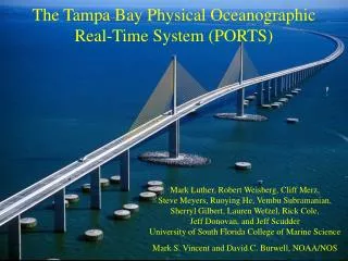
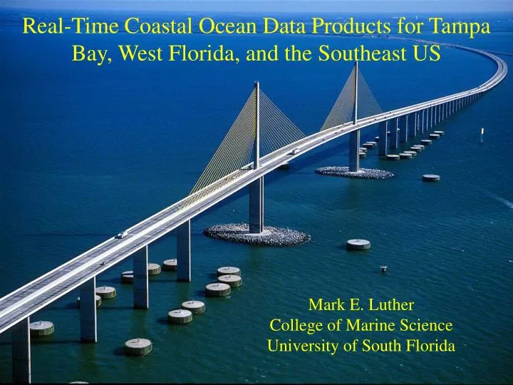
Real-Time Coastal Ocean Data Products for Tampa Bay, West Florida, and the Southeast US. Mark E. Luther College of Marine Science University of South Florida. Tampa Bay PORTS Physical Oceanographic Real-Time System.

E N D
Real-Time Coastal Ocean Data Products for Tampa Bay, West Florida, and the Southeast US Mark E. Luther College of Marine Science University of South Florida
Tampa Bay PORTSPhysical Oceanographic Real-Time System Operated in collaboration with NOAA/NOS/Center for Operational Ocean Products and Services (CO-OPS) and local maritime interests Funding for operations from State and County trust funds and local users Voice: 1-866-TB-PORTS www.co-ops.nos.noaa.gov or ompl.marine.usf.edu/PORTS
Uses/Users of PORTS Information • Safe and Efficient Navigation/Tampa Bay Pilots, Tampa Port Authority, Shipping Agents, USCG, Recreational Boating and Fishing • Hazardous Material Spill Response/FDEP, NOAA-HAZMAT, USCG, Private Sector • Environmental Protection&Management/FDEP, FWC, EPCHC, Dept. of Health • Storm Surge Prediction&Mitigation/County Emergency Managers, FDEM • Red Tide Studies&Prediction/FWC, FDEP • Fisheries Management/FWC, NMFS • Sediment Transport Studies & Mitigation/USGS, FDEP, USACOE
Pilot Carry-on Units Display Real-Time PORTS Data aboard ships as part of an operational Vessel Traffic Information System (VTIS) Since PORTS became operational in 1992, ship groundings have decreased by 60%
August 1993 Oil Spill Goal of PORTS and VTIS is to prevent this PORTS data and early version of model successfully used to predict spill trajectory – Now written into USCG Area Contingency Plan – NOAA/HAZMAT has special access to data and model products
Forecast Animation September 12, 2002 http://ompl.marine.usf.edu/TBmodel
Real-time observations are combined with a model of currents and water level to provide a predictive capability for storm surge, search and rescue, or hazardous material spills Sewage Spill Trajectory Phosphate Discharge Trajectory Desal Plant + + Piney Point Phosphate Plant
West Florida Coastal Ocean Monitoring and Prediction System (COMPS)Real-time data from buoys, coastal towers, HF radars merged with models and satellite observationsCOMPS observations are available thru NDBC http://comps.marine.usf.edu or http://ndbc.noaa.gov/Maps/Florida.shtml
Offshore COMPS buoys send information on currents, winds, temperature, and salinity by radio and satellite to shore-based computers and the Internet
Coastal sites send water levels and other oceanographic and meteorological data by satellite and radio Shell Point Cape Sable New Port Richey
Surface Current Mappers use radio waves to measure ocean currents over large areas off west Florida Indian Rocks Beach SCM antennas
The US Integrated Ocean Observing System • National System • Satellite remote sensing • Reference, Sentinel • Stations • Link to global module • Data standards & • exchange protocols • Regional Systems • Land-based inputs • State & Regional Priorities • Greater resolution • More variables
TB-PORTS and COMPS are building blocks of both the Southeast Atlantic Coastal Ocean Observing System (SEACOOS) and the Gulf of Mexico Coastal Ocean Observing System (GCOOS). SEACOOS and GCOOS are actively partnered with SeaGrant Extension Network to engage private sector collaborators/partners in both regions – see www.seacoos.org and www.gcoos.org SEACOOS
Ultimate goal of IOOS is to provide useful products for anyone who makes decisions in coastal regions of the US - see http://ocean.us