Download
1 / 41
410 likes | 425 Views
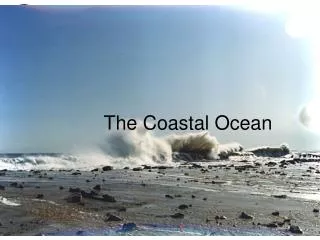
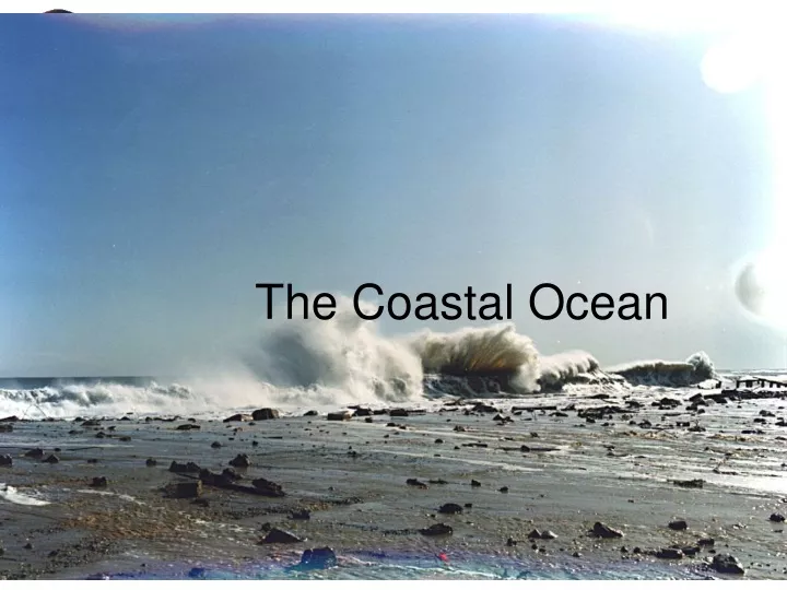
The Coastal Ocean. Learning Objectives. Students will be able to: Describe various definitions for the coastal zone Differentiate between pelagic and neritic processes Classify estuaries in multiple ways and explain estuarine sedimentation processes Articulate and describe beach processes

E N D
Learning Objectives • Students will be able to: • Describe various definitions for the coastal zone • Differentiate between pelagic and neritic processes • Classify estuaries in multiple ways and explain estuarine sedimentation processes • Articulate and describe beach processes • Describe the pros and cons to beach stabilization
Outline • Definitions • 3-D Ekman spiral • Estuaries • Estuarine Measurements • Habitat squeeze concept • Beaches and Shoreline Processes • Beach defense
Coastal waters • Relatively shallow areas that adjoin continents • Heavily used for commerce, recreation, fisheries, and waste disposal • Military purposes as well
The Coast • The land and waters extending inland for 1 km from high water mark on the foreshore and extending to the 30 m contour line including all beds, sediments, waters and land subject to the ebb and flow of the tide.
Definitions • A line extending 200 nm (370km) from the coast. • The 500 m isobath • A line a the foot of the continental slope • Territorial water- water adjacent to a coastal nation. Majority favor 3 miles, US wants 200.
EEZ • The exclusive economic zone- 200 mile fishing and mineral rights. • Legal-UN Convention on the Law of the Sea- the seabed and subsoil that extends to the edge of the continental margin or a distance of 200 nm.
How does the Coastal Ocean Differ from the deep ocean? Significant changes in Temperature, salinity and even pH. Very sensitive to environmental factors, like pollutants, contaminants, dissolved gases and nutrients. May or may not exhibit constant proportions. Bathymetry is a controlling factor in many physical processes.
How does the Coastal Ocean Differ from the deep ocean? • The pycnocline tends to follow the ______, Instead of the ________. Why? Friction can not be ignored this leads to 3-D Ekman system near the coast rather than the familiar 2-D one you know. Important implications for management issues. The shoaling effect is prominent here.
3-D Ekman • We have all seen the 2-D Ekman spiral. • But what happens when the depth of the sea floor is less than the theoretical Ekman depth? Where does this happen?
Quasi geostrophic Flow Pressure force friction coriolis
Depth variation of currents in the wind-generated Ekman layer shallow sea situation (constant eddy coefficient) for the northern hemisphere, assuming a southerly wind. light green curve is the Ekman spiral under deep sea conditions (H > 1.25 dE). red curves show Ekman spirals for successively shallower water (1/2, 1/4 and 1/10 of dE). White circles indicate the endpoints of the current vectors from the surface down in increments of 0.1 dE; the vector endpoints for z = 0 (the surface) and z = 0.5 dE are blue. Adapted from Neumann and Pierson (1966), based on Ekman (1905).
DE DB Flow at interior? Flow at bottom? z -x Overlap of bottom and surface Ekman layers Importance of shelf break depth Problems with Ekman theory – constant Az, constant wind, linear flow, steady state, infinite ocean, no pressure gradients
Estuaries • Estuaries are partially enclosed coastal bodies of water • Examples of estuaries include: • River mouths • Bays • Inlets • Gulfs • Sounds • Formed by a rise in sea level after the last Ice Age
Classifying estuaries by origin • Coastal plain • Fjord • Bar-built • Tectonic Figure 11-3
Classifying estuaries by water mixing • Vertically mixed • Slightly stratified • Highly stratified • Salt wedge Figure 11-5
Classification by Tides Amplitude Current Head Mouth Head Mouth Head Mouth Synchronous Convergence=Friction Hyposynchronous Convergence<Friction Hypersynchronous Convergence>Friction Friction is stronger and the tide diminishes along the estuary The tidal range & currents increase towards the head of the estuary until the convergence diminishes & friction reduces the tide The friction and convergence have equal and opposite effects on the tide
AN interesting problem • We all know that coastal lagoons tend to silt in. This seems to be a problem, because this occurs against the concentration gradient. • The Dutch were the first to recognize this in the Wadden Zee.
The silting in of harbors and lagoons • So why does it happen? • It turns out there are a number of dynamical processes all conspiring to create this effect. • 1- general estuarine circulation (salt wedge) • 2 - the time velocity asymmetry of the shallow tidal wave. • 3 - the settling lag effect
Landforms and terminology in coastal regions Figure 10-1
Movement of sand on the beach • Movement perpendicular (↕) to shoreline • Caused by breaking waves • Light wave activity moves sand up the beach face toward the berm • Heavy wave activity moves sand down the beach face to the longshore bars • Produces seasonal changes in the beach
Summertime and wintertime beach conditions Summertime beach Wintertime beach Figure 10-2
Movement of sand on the beach • Movement parallel (↔) to shoreline • Caused by wave refraction (bending) • Each wave transports sand either upcoast or downcoast • Huge volumes of sand are moved within the surf zone • The beach resembles a “river of sand”
Longshore current and longshore drift • Longshore current = zigzag movement of water in the surf zone • Longshore drift = movement of sediment caused by longshore current Figure 10-3b
Features of erosional shores • Headland • Wave-cut cliff • Sea cave • Sea arch • Sea stack • Marine terrace Figure 10-4
Features of depositional shores • Spit • Bay barrier • Tombolo • Barrier island • Delta Figure 10-7
Beach compartments in southern California • Beach compartments include: • Rivers • Beaches • Submarine canyons Figure 10-12
Evidence of emerging and submerging shorelines • Emergent features: • Marine terraces • Stranded beach deposits • Submergent features: • Drowned beaches • Submerged dune topography • Drowned river valleys Figure 10-13
Types of hard stabilization • Hard stabilization perpendicular to the coast within the surf zone: • Jetties—protect harbor entrances • Groins—designed to trap sand • Hard stabilization parallel to the coast: • Breakwaters—built beyond the surf zone • Seawalls—built to armor the coast
Jetties and Groins • Jetties are always in pairs • Groins can be singular or many (groin field) • Both trap sand upstream and cause erosion downstream Figure 10-21
Breakwater at Santa Barbara Harbor, California • Provides a boat anchorage • Causes deposition in harbor and erosion downstream • Sand must be dredged regularly Figure 10-22
Seawalls and beaches • Seawalls are built to reduce erosion on beaches • Seawalls can destroy recreational beaches • Seawalls are costly and eventually fail Figure 10-24
Alternatives to hard stabilization • Restrict the building of structures too close to the shore • Eliminate programs that encourage construction in unsafe locations • Relocate structures as erosion threatens them Relocation of the Cape Hatteras lighthouse, North Carolina Figure 10C