Download
1 / 31
310 likes | 413 Views
GEOSPATIAL WORLD FORUM 13-16 MAY 2013 BEURS-WORLD TRADE CENTRE, The NETHERLANDS Monetising Geospatial Value for Land Administration.

E N D
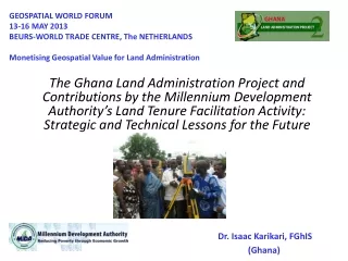
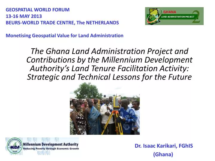
GEOSPATIAL WORLD FORUM 13-16 MAY 2013 BEURS-WORLD TRADE CENTRE, The NETHERLANDS Monetising Geospatial Value for Land Administration The Ghana Land Administration Project and Contributions by the Millennium Development Authority’s Land Tenure Facilitation Activity: Strategic and Technical Lessons for the Future Dr. Isaac Karikari, FGhIS (Ghana)
Outline The Ghana Land Administration Project Objective Ghana Millennium Challenge Account (MiDA) Programme Description Formalized Steps for Surveying Parcels (PNDCL 152) Establishment of CORS Station Delineating, Surveying and Pillaring the Awutu-Senya PRD and Section Boundaries Survey all Parcels Within the PRD Copy of Signed Parcel Plan Publication of Notices in Dailies Results Outcome Indicators Some Lessons Learnt Some Challenges with the Use of Technology Some Recommendations Conclusion in Pictures
GLAP Project Development Objectives • LAP-2: To consolidate and strengthen urban and rural land administration and management systems for efficient and transparent land service delivery, seeking to secure and complete the legal and institutional reforms started in LAP-1; building on the momentum underway to transform the Lands Commission, the Office of Administrator of Stool Lands (OASL) and Town and Country Planning Department (T&CPD) into modern and efficient service providers... LAP-1 (Revised): To undertake land policy and institutional reforms and key land administration pilots for laying the foundation for a sustainable, decentralized land administration system that is fair, efficient, and cost effective and ensures land tenure security.
REDUCTION OF POVERTY THROUGH ECONOMIC GROWTH LED BY AGRICULTURAL TRANSFORMATION • Increase production and productivity of high value cash and food crops in three selected areas of Ghana (Intervention Zones), spanning 30 Districts • Enhance the competitiveness of high value cash and food crops in local and international markets Ghana MCA Program Description PROGRAM GOAL STRATEGIC OBJECTIVES • Agriculture Project • ($241 million) • Increased Farmer & Enterprise Training in Commercial Agriculture • Increased Irrigation Development • Land Tenure Facilitation Activity • Improved Post-Harvest Handling and Value Chain Services • Improved Access to Credit On Farm and Value Chain Services. • Improved Linkages to Farmlands and Markets – Rehabilitation of Feeder Roads • Transportation Project • ($143 million) • Enhanced access to International Air and Sea Ports • (via Upgrade to N.1 - Highway) • Improved Trunk Road Network In Afram Basin • Improved Lake Volta Ferry Services • Rural Development Project • ($101 million) • Support for Community Services • Energy for Domestic and Commercial Uses • Water & Sanitation Facilities • Educational and Vocational Facilities • Strengthen Rural Financial Institutions • Strengthen Public Sector Procurement Capacity KEY PROJECTS
GHANA Savelugu Nanton Afram Plains Pilot Title Registration Districts Awutu-Senya
Land Component Adopted Outcome Indicators/Results Regulatory, Legal And Other Prep Work Regulatory, Legal And Other Prep Work Public Outreach Public Outreach Institutional Upgrading and Capacity Building Institutional Upgrading and Capacity Building Clarification and Formalization of Land Rights Clarification and Formalization of Land Rights Expected Outcomes (up to 20 years) Expected Outcomes Stakeholders Reached Buildings Built or Rehabilitated; Equipment Purchased; Stakeholders Trained Rural Hectares (Ha) Mapped/ Formalized; Effective Property Rights System Preparatory Studies Completed; Legal and Regulatory Reforms Adopted • 4 Studies conducted • 2 Reforms undertaken ›10,000 reached through sensitization and public education efforts • 3 Bldgs built • 72 trained in ADR • 100 Lands Commission Staff trained • 40 Judges trained in ICT, Land Law and ADR etc • ˃8,000 Rural Ha Mapped • Issued 1487 Title Certificates (approx. 403 Hectares formalized) • Travel Time/ • Transaction Costs Reduced • Tenure Security Increased
MiDA’s Land Tenure Facilitation Activities • MiDA’s Land Facilitation Activity (LFA), under its Agricultural Project, comprised four (4) components namely: • a pilot program for area-wide registration of rural lands; • improvement of the Court’s ability to process land disputes; • facilitation of land transactions through on-demand land services; and • capacity building for land administration agencies (public and private) and policy making. • Implementing Entity Agreement signed with MLFM on 18th December, 2007 – US$10,688,000 (was strategically reviewed to approx. US$4million)
The Two Reasons • Improve tenure security for existing land users (Local Farmers – nucleus and out-growers). • Facilitate expanding access to (higher value) agriculture land (attract foreign investors).
The Land Tenure Facilitation Pilot Approach • Purchase and Installation of Trimble CORS and Trimble Survey Equipment • Community sensitization • Study and incorporation of gender issues • Inventory of land rights, including gathering of legal documentation, conducting field interviews • Delineation and surveying parcels (using Trimble Products) and attribute data collection • Alternative Dispute Resolution Mechanisms • Preparation of (composite) plans showing parcels and land rights to the extent possible from the inventory • Demarcation of boundaries to the extent necessary to facilitate MiDA’s activities in the implementing districts • Processing and issuance of Title Certificates to Beneficiaries Community Sensitization Conversion from oral to written form ADR Session Survey Work
Formalized Steps for Surveying Parcels (PNDCL 152) • Step 1: Formal Declaration of the Registration District (Section 5 of PNDC Law 152) - 29 Communities, comprising mostly migrant farmers • Step 2: Reconnaissance and Demarcation of Pilot Land Registration District Boundary (Section 26, PNDCL 152) • Step 3: Development of Ownership Database 1-(Listing from Records) – Section 13(1a) of PNDCL 152, 1986 • Step 4: Development of Ownership Database 2 ( Field-based Parcel Inventory) • Step 5: Establishment of Survey Control in Registration District • Step6: Moulding of Standard Survey Beacons/Pillars • Step7: Pillaring of Framework (Boundary of PRD) • Step8: GPS Survey of the Framework (Boundary of PRD) • Step 9: GPS Survey of Individual Parcel Boundary Pillars • Step 10: GPS Survey Data Post Processing • Step 11: Creation of Spatial Database and linkage to Inventory Table (GIS) • Step 12: Development of Registry Map (Section 34, PNDCL 152) • Step 13: Development of Individual Parcel Plans
CORS Location Establishing Project Boundaries
Delineating the Awutu-Senya PRD • Using Features on the Topographic Sheet at the Scale of 1/50,000 • By Road network • Water course • Trimble GeoXH handheld GPS receiver Note: The use of Type A beacons with dimensions nine inches square and eighteen inches high (9” sq 18” high) meet survey requirements.
Survey of PRD and Section Boundaries • Using the CORS station as reference • Trimble R8 GNSS receiver as rover • Static observation • Post processing (Data via FTP to the office) Fieldwork: A thorough reconnaissance must be carried out on the framework and sections of the RD to identify possible locations of beacons. Suitable beacon locations, once identified, shall be marked on the ground with wooden pegs and flagged with red flagging tape.
Marking the PRD and Sub-division into Sections (Monumentation) • By Concrete TYPE ‘A’ Pillars • Each pillar given a unique serial number
Survey all Parcels Within the PRD • Using the CORS station as reference • Trimble R8 GNSS receiver as rover • Trimble S6 Robotic total station for detailing • Sections sub-divided into blocks • Each parcel given a unique parcel number (UPN)
Individual Parcel Pillaring • The process of pillaring a parcel has to take place in the presence of the prospective proprietor as well as a representative of the relevant traditional authority. In cases where controversies arise, an ADR team member should also be present to address and hopefully resolve issues of land disputes over boundaries and rights and conflicts between individuals and among groups. • Each parcel corner pillar is to be uniquely labelled with and identified by its Sectional Number, Block Number and a running Pillar Number. An example of this is S5/B/98; where S5 is denoted as Section 005; 02 is denoted Block B; and 98 is denoted Pillar number 98. Current Numbering system: Pillar Number
Suggested adoption of parcel corner pillar labelling where layouts or planning schemes exist Parcel 20 Schematic layout of adjacent parcels etched into top of pillar 20 Pillar 22 21 Parcel 21 Parcel 22
The Issue • The current pilot project is calculated to cost roughly US$165 per parcel for all work, including all Consultancies and Equipment/Infrastructure. Current rough estimates taking Survey Work (Consultant’s Fees inclusive of cost of monumentation) only are around US$43.60 per parcel. • While the per parcel cost would come down as more parcels are spread over the fixed costs of equipment, even in the US$100-150 per parcel range, a country-wide systematic title registration in rural areas would have significant budget issues for Ghana.
The Argument • Regarding land titling, the land titling unit cost per land parcel in this Pilot was far higher ($167) than for LAP-1 ($50), Thailand ($32) and Indonesia ($24) and Tanzania ($75). • Because the Pilot was to produce only 3,802 rural land titles (LAP-1, urban 8,000 titles), the MiDA’s pilot did not enjoy economies of scale. Because of the small volume of titles compared to, say, Thailand (more than 7 million titles), this MCA/MiDA-Ghana unit cost had to be higher by virtue of being a relatively small pilot. • When scaled up, the unit costs will fall very significantly to the level of about $20 to $30 per parcel, as happened in Thailand’s pioneer Land Titling Program where the first phase project had per parcel unit costs greater than $50 but declined from phase to phase to nearly $20 in the last phase as annual project outputs of land titles rose to 1 million. Compare to Indonesia’s $24 @ 1million titles. • Monumentation for defining boundaries is critical in many parts of Ghana. Should be at the cost of Individual Owners of Land; Not the Government; Not the Community; Not the Development Partners.
Some Challenges with the Use of Technology • Haphazard development not according to a planned layout in the villages impeded the smooth use of the Robotic Total station for parcel detailing. • Unavailability of RTK capability delayed the detailing as static observations were done and post processed. • Initial Power problems affected data collection process. • The consultant was faced with one major challenge from the latter part of August through to mid-September, 2009. This was due to the fact that another brand of GPS equipment (4 GPSs) owned by the consultant that was used to augment the Trimble GPS provided by the client (MiDA) faced a “Local Date Issue”. This made it impossible for communication between the GPS receivers and the Satellites. This was a global problem and it took the consultant close to a month to get the problem solved after series of communication between the consultant and the GPS equipment vendors.
Savings in Terms of Time and Money • The technology used was very adequate in the sense that a Licensed surveyor in Ghana would have ordinarily used a Total Station equipment for this assignment which would have resulted in challenges in terms of time, labour and cost, considering the fact that the job was time bound. • Establishing the CORS station solved the problem of always looking for a known reference point close to the site to set a reference GPS equipment for post processing and this also saved a lot of the survey time .
Some Recommendations • GoG to assist in the development of a systematic registration process that is replicable throughout Ghana at a REASONABLE COST and within an acceptable timeframe. • Gender awareness and the sensitization campaigns should be carried out simultaneously and at a high level of intensity. • Within the context of land registration programs Alternative Dispute Resolution’s relationship to the adjudication committees required by law also has to be clarified. ADR involvement needs to be integrated into all aspects of the rural registration program. • The Survey Consultants recommend that the project should in future include aerial survey, followed by the production of orthophoto maps of the PRD.
Final Note: The Future is Bright for Ghana - The Establishment of a National GRN in the Offing under LAP-2. • The Ghana Survey and Mapping Division (SMD) of the Lands Commission is currently in the process of modernizing the existing, outdated and inadequate National Survey Framework (which has been in existence since colonial times) by establishing a modern national Geodetic Reference Network (GRN) under LAP-2. • As a result it is establishing a nation-wide network of Global Navigation Satellite Systems (GNSS)-based CORS that will serve as the geodetic spatial reference frame for all ongoing national surveying and mapping activities in Ghana.
Conclusion in Pictures 2 1 3 5 6 4