Download
1 / 41
410 likes | 583 Views
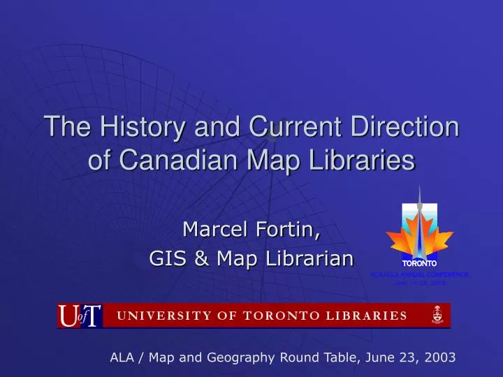
The History and Current Direction of Canadian Map Libraries. Marcel Fortin, GIS & Map Librarian. ALA / Map and Geography Round Table, June 23, 2003. Overview. History of Map Libraries in Canada Past Issues and Developments Current Challenges and Developments

E N D
The History and Current Direction of Canadian Map Libraries Marcel Fortin, GIS & Map Librarian ALA / Map and Geography Round Table, June 23, 2003
Overview • History of Map Libraries in Canada • Past Issues and Developments • Current Challenges and Developments • Future of Map Libraries in Canada Map Libraries in Canada
Map Libraries in Canada in 1954 • Canada 31 map collections* • United States 500 map collections * (Canadian population is always at about 10 % of American Population) * 8 Universities with 13 collections Why so few? - No strong depository agreements - No legal deposit - No startup collections from the US Army Map Service maps - Not many Universities Map Libraries in Canada
1960’s: Growth • 1967 45 Collections • 1969 87 Collections (562 in the US) WHY? • Canadian Centennial in 1967 • Mapping agencies at full force as Canada was exploring and developing in its quest for natural resources • Canadian studies / geography encouraged • Universities grew to accommodate the Baby Boomers • Depository system grew to accommodate the Universities • New map Libraries formed at new universities RESULT: • Growth - Association of Canadian Map Libraries formed in 1967 Map Libraries in Canada
Why ACML(A)? • Temporary organization • Librarians identified more with the subject than with other librarians • Membership was also from the archival and government fields • Was to eventually merge with a broader library association but never did • To tackle some of the big issues of the day Map Libraries in Canada
Early Issues in Map Librarianship in Canada • National Union Catalogue • Bibliographic Control • Computer Cataloguing • Depository system / Resources • Legal deposit • Education / Training of Map Librarians Map Libraries in Canada
Depository Services • Began in 1907 but to a select few • Depository agreement law in 1955 • Implementation in 1957 • Somewhat Standardized by the 1960’s • Still ironing out the details of agreements in 2003! Map Libraries in Canada
Legal Deposit • ACMLA has been lobbying the government since 1967 for a National Map Library • In 1969 officially requested the government to impose a law demanding legal deposit on maps • ACMLA letter in 2002 for legal deposit on cartographic material (digital and paper) • ACMLA about to send yet another letter in 2003 Map Libraries in Canada
Map Library Education • 1960’s Difficult to find trained librarians with “map sense” • 1970’s University of Toronto offered a course in map librarianship • 1990’s-2000’s Still an issue, especially with GIS Map Libraries in Canada
Map Library Growth Map Libraries in Canada
1970’s-1980’s: Growth 1980 111 Collections (684 in the US) 1986 122 Collections (716 in the US) ACML changed to ACMLA – 1987 Map Libraries in Canada
Why the growth? • 1970’s – 1980’s Period of expansion, depository system was at full force including USGS and other foreign government agreements • 1970, “Every Square Inch” of Canada was mapped at 1:250,000 • Government Objective: map Canada at 1:50,000 by 1995 • Continued expansion of Universities Map Libraries in Canada
Period of Decline • 1992 112 Collections (974 in the US) • 1999 91 Collections Map Libraries in Canada
Why the decline in 1990’s? • Budget Issues • Technology / GIS • Data Culture Map Libraries in Canada
Budgets CAUSES • Funding at the Government / University level drained • Budgets were strained by the economy EFFECTS • Depository Agreements changed / disappeared • USGS • NRCan (fewer maps made, fewer published, fewer distributed, Canada still not mapped completely at 1:50,000) • Mergers / Reorganizations (MadGIC effect) / Moves • Early Retirement Incentives offered to map library leaders RESULTS • Fewer map libraries and fewer map librarians Map Libraries in Canada
Technology / GIS • Discussion of GIS in libraries (1979); The demise of the library came along with it • Change from paper focus to digital focus in libraries affected all libraries • Libraries seen as passé Map Libraries in Canada
Map Library’s Perception • Perception of the Map Library changed because of technology / GIS • Seen as outdated • No longer a place for geographic education (many don’t know we exist) • Users shifted back to the geography department for data and help Map Libraries in Canada
Data Culture in Canada • Canada / United States: tremendous difference • Data costs prohibitive • Natural Resources Canada tiles at 1:50,000 on average cost $800.00 per sheet • Provincial Base Map Data at 1:20000 and 1:10000 $110.00 per sheet • Landsat images jumped from $0 - $5000 in the early 80’s • Attitude of Governments too protective and vendors caught in between Map Libraries in Canada
The Unexpected Still Occurred: GIS librarianship! • Most map libraries offer at least the most basic services in GIS • For many, GIS has become the modus operandi • Becoming the centre for data Map Libraries in Canada
How did this transformation Occur? Map Libraries in Canada
Reasons for Transformation • Map Librarians have worked hard at self-training and broadening their vision • Reclaiming the role as educators in geographic information • ACMLA has made things happen and kept the membership educated and informed
More Reasons for the Transformation: Mergers are not always bad! • Government Publications Librarians (dealt with changes to depository agreements) • Science Librarians (dealt with technical subjects) • Data Librarians (dealt with data issues well before GIS) Map Libraries in Canada
Data Librarians • Digital Census data and Satellite imagery in some University Data Libraries since the 1970’s • Canadian Association of Research Libraries Census Consortium (CARL) - (1988) • CARL – Census Consortium – (1991) Map Libraries in Canada
Data Landmarks • In 1995, Phase III of the ARL GIS Literacy Project 27 Canadian Universities and the National Library of Canada • Statistics Canada - Data Liberation Initiative (1996) replaces all data consortia for one yearly fee Map Libraries in Canada
More Landmarks • www.GeoConnections.org (1998) • KPMG Study on pricing (2001) • NRCan – National Topographic Database (2002) • www.DMTIspatial.com consortium • Provincial Agreements (OGDE for fee, Manitoba for free) • Municipal government agreements • ESRI Site licenses Map Libraries in Canada
Things are looking good but there are challenges and changes ahead • Funding – our success comes with a price • Data management – famine to feast • Administrative changes • Data and map legal deposit • Abandonment of map collections • Changing user base Map Libraries in Canada
How do we meet and beat these challenges? Map Libraries in Canada
On the Horizon • Funding Issues • Donations • Contracts • Cost Recovery • Data selling, storage, conversion • Teaching • Partnerships • Grant Proposals Map Libraries in Canada
On the Horizon Data management • Consortia • Collaborative projects for data distribution / management • Smartly hire good networking / web managers to help create Geography Network type applications Map Libraries in Canada
On the Horizon Administrative Issues • Retirements • Map Library Association membership dwindling • More moves and mergers • Librarians dealing with the geographic who have no geographic experience Map Libraries in Canada
On the Horizon Data and Map Legal deposit • Still no map and data legal deposit in Canada • National Library / National Archives merging in 2003 (ACMLA lobbying for new law for merger to include legal deposit) • Do you trust your government to preserve your data / history? Map Libraries in Canada
Do you trust your government? On the Horizon Source: topozone.com Map Libraries in Canada
Do you trust your government? On the Horizon 2nd edition 1st edition Source: NTS Sheet 32c01 Map Libraries in Canada
On the Horizon • Do we abandon the map and our history in our struggles for data? • No, the wise patrons and librarians know not to trust their governments • People are still using our map collections! Map Libraries in Canada
Users are asking for paper maps and GIS data! • About 55% of patrons of map libraries in North America walk away with both digital and paper maps for their research. (2000 survey*) * Published in Stone Muilenburg, J. “The changing role of GIS in the map room”, in The Map Library in the New Millennium. London: LAP, 2000 Map Libraries in Canada
On the Horizon – Expanding Base of Users • Geography but also … • Landscape Architecture • Geology • History • Environmental Science • Engineering • And more NOTE: All Ontario High School students are currently learning GIS as part of the curriculum Map Libraries in Canada
Map Library is regaining its status as the Centre for Geographic Information and Education • Software • Equipment • Skills • Building large data “libraries” • We’ve got the original GIS – the maps! Map Libraries in Canada
The future of Map Libraries may be in the past Map Libraries in Canada
Garrison Creek and Parcel Data Map Libraries in Canada
Creating new parcel data Map Libraries in Canada
Conclusion • Resurgence in the map library as a place for geographic education • But, we must educate and convince our administration why what we do is important • Alternatives to funding required to keep growing • Map Library Associations have to be ever more vigilant as advocates – must bond with other associations and data librarians • Protect and use our map collections until we get legal deposit • Remember that GIS is a tool for geographic information and that our maps are still just as important Map Libraries in Canada