Download
1 / 22
220 likes | 322 Views
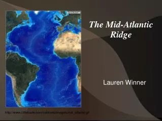
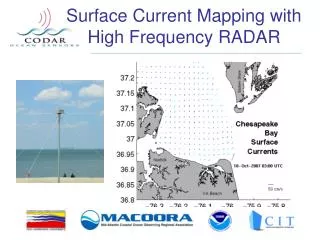
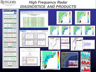
Cape Cod to Cape Hatteras: ~1000 km Coastline. Results from the Mid Atlantic High Frequency Radar Network. Hugh Roarty, Ethan Handel, Erick Rivera, Josh Kohut, Scott Glenn. Wendell Brown, Chris Jakubiak. Larry Atkinson, Teresa Garner. LONG RANGE NETWORK. 2003. 2003. 2003. 2001. 2000.

E N D
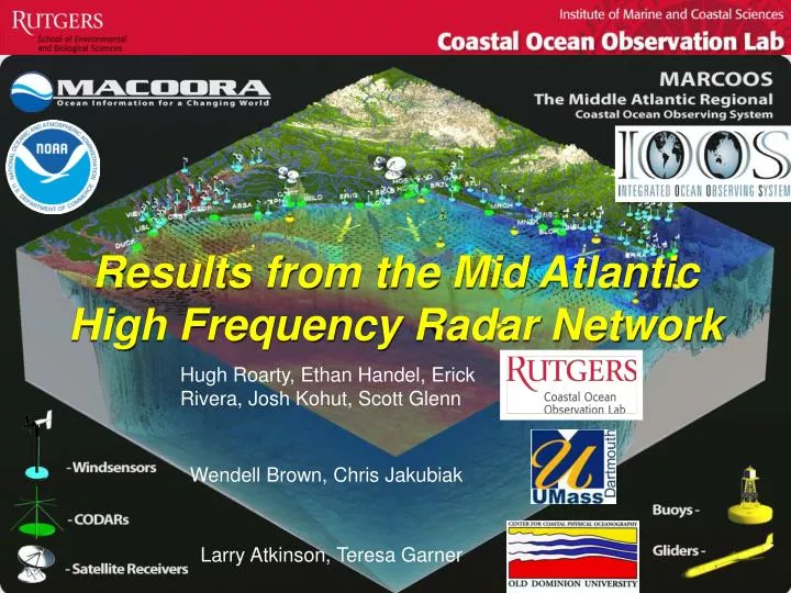
Cape Cod to Cape Hatteras: ~1000 km Coastline Results from the Mid Atlantic High Frequency Radar Network Hugh Roarty, Ethan Handel, Erick Rivera, Josh Kohut, Scott Glenn Wendell Brown, Chris Jakubiak Larry Atkinson, Teresa Garner
LONG RANGE NETWORK 2003 2003 2003 2001 2000 2007 2001 2001 2006 2006 2009 2003 2003
C:\Documents and Settings\hroarty\My Documents\COOL\01 CODAR\MARCOOS\Renewal
CEDAR ISLAND 2005 2009
BLOCK ISLAND 2009 2007
Radial Coverage Total Coverage
Radial Coverage Total Coverage
DEC 2008 to NOV 2009 Every Other Vector Shown for Plotting Purposes Temporal Coverage Greater than 50% Required for Plotting
MARCOOS Regional Theme 1: Maritime Safety, Search And Rescue Distribution: OPeNDAP/ THREDDS Data Format: NetCDF STPS, (UConn) MARCOOS Totals HF Radar Radials ROMS (Rutgers) EDS SAROPS NOAA National Network HOPS (SMAST) MARCOOS Year 1 & 2 NYHOPS (Stevens) Year 3
Validation of Optimal Interpolation Totals Feb 24-April 4, 200739 days
HF Radarand HYbrid Coordinate Ocean Model or (HYCOM)Currents in SAROPS • High Confidence (HF Radar) • sigma (1 std dev) = 0.22 knots • Tau (half life) = 264 minutes • Low Confidence (HYCOM) • sigma (1 std dev) = 0.37 knots • Tau (half life) = 264 minutes • Number of particles = 5000 • SLDMB 39029
24 Hours Into Search HYCOM Low Confidence HF Radar High Confidence
48 Hours Into Search HYCOM Low Confidence HF Radar High Confidence
Search Area After 96 Hours 154 km 100 km 232 km 123 km HF Radar 12,000 km2 3,500 nmi2 HYCOM 36,000 km2 10,500 nmi2
Spring Winter DEC ’08 – FEB ‘09 MARCH ’09 – MAY ‘09
Fall Summer JUNE ’09 – AUG ‘09 SEPT ’09 – NOV ‘09
Every Third Ellipse Shown for Plotting Purposes Temporal Coverage Greater than 50% Required for Plotting
Conclusions • Mid Atlantic Long Range HF Radar Network is celebrating its 10th anniversary • MARCOOS is delivering Quality Controlled Surface Current Data and Forecasts to the US Coast Guard for improved SAR • HF Radar Network is helping to describe the nature of the flow in the Mid Atlantic