Download
1 / 14
140 likes | 279 Views
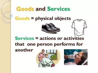
Measuring Ecosystem Goods and Services in Canada. Learning Centre on Experimental Ecosystem Accounting Art Ridgeway Statistics Canada. Project overview and objectives. Two-year project involving five federal departments 60 experts in various domains involved

E N D
Measuring Ecosystem Goods and Services in Canada Learning Centre on Experimental Ecosystem Accounting Art RidgewayStatistics Canada
Project overview and objectives • Two-year project involving five federal departments • 60 experts in various domains involved • Statistics Canada co-leading with Environment Canada • Objectives: • Create spatial standards and classifications • Standardize existing spatial data • Develop pilot ecosystem accounts for terrestrial, wetland and marine ecosystems • Investigate methods for valuation of ecosystem goods and services • Test methods in pilot accounts • Publish results in a research study (Fall 2013) Statistics Canada • Statistique Canada
Progress on standards and spatial data integration • An existing spatial unit (the “soil landscape unit”) has been chosen as the basic collection/organization unit for spatial data • 250 metre resolution satellite data for 2000-2011 have been acquired and processed • National shoreline, drainage region, road network, settlement, landcover, elevation maps, etc, have been integrated into a common GIS database • 2011 population and dwelling counts have been re-aggregated to soil landscape units Statistics Canada • Statistique Canada
Defining ecosystem statistical units • A nested hierarchy created from new and pre-existing spatial units: • Basic Statistical Units (many) • Landcover Ecosystem Units (many) • Soil Landscapes Units (12,924) • Ecodistricts (1021) • Ecoregions (194) • Ecoprovinces (53) • Ecozones(15) • The “Basic Statistical Unit” (BSU) is defined by the overlay of the 250 m satellite grid cells on the whole country • BSU’s are aggregated to create “Landcover Ecosystem Units” taking into account the land cover, the elevation, and terrain ruggedness within grid cells • LEU’s are the closest to what would normally be called an “ecosystem” Statistics Canada • Statistique Canada
Ecosystem Statistical Units: Spatial attributes Statistics Canada • Statistique Canada
Progress on pilot accounts - Terrestrial • Case study: Ecosystem goods and services in St. Lawrence Islands National Park • One of the smallest national parks in Canada, fragmented and discontinuous • Pilot account includes: • Descriptive information • Landcover • Maps of external pressures • Ecosystem socio-economic profile • Value of ecosystem goods and services Statistics Canada • Statistique Canada
Progress on pilot accounts - Marine • Marine ecosystem goods and services • First time that Canada’s coastal “ecumene” has been delineated • Pilot account includes: • Population employed and income generated • Landed catch and value data by fishing zone Statistics Canada • Statistique Canada
Total Biomass Extraction 2006 Department of Fisheries and Oceans, Zonal Interchange Format File (ZIFF) Catch and Effort Database. Statistics Canada • Statistique Canada
Population Employed in Fishing Industry – Distance from shore 2006 Percent Population Working in Fishing Industry of the Total Population Working in the Fishing Industry With Distance from Shoreline *Percent was calculated using population working in fishing industries within 100 km of shoreline. Statistics Canada • Statistique Canada
Progress on pilot accounts - Wetlands • Researching estimates for nutrient processing, carbon sequestration and surface water flow attenuation services • Estimating population pressures, population benefits and possible replacement costs associated with these services • Case study on the Assiniboine River drainage basin • Researching up-scaling, value transfer, meta-analysis, indicator values, biophysical estimation Statistics Canada • Statistique Canada
Progress on valuation • Prepared a geo-referenced version of Environment Canada’s existing Environmental Valuation Resource Inventory (EVRI) • Developing a benefits transfer process flow • Incorporates: • existing ecosystem goods and services studies from the EVRI and elsewhere (geo-referenced); • biophysical attributes of ecosystems (e.g. land cover) from the MEGS “common GIS database” • geo-referenced socio-economic data from census; • St. Lawrence Islands National Park case study area will provide a test case Statistics Canada •Statistique Canada
Geo-location of EVRI Studies St. Lawrence Islands National Park ecosystem boundary Statistics Canada • Statistique Canada
PathForward • Statistics Canada has allocatedsomefunds to produce a Freshwater Ecosystem Account over the nexttwoyears. • Statistics Canada has been invited by Environment Canada to contribute to the new Inter-Governmental Platform on Biodiversity and Ecological Services (IPBES) Statistics Canada • Statistique Canada