Download
1 / 16
180 likes | 301 Views
3D Environment Reconstruction. Using Modified Color ICP Algorithm by Fusion of a Camera and a 3D Laser Range Finder. The 2009 IEEE/RSJ International Conference on Intelligent Robots and Systems October 11-15, 2009 St. Louis, USA. 3D Reconstruction Background.

E N D
3D Environment Reconstruction Using Modified Color ICPAlgorithm by Fusion of a Camera and a 3D Laser Range Finder The 2009 IEEE/RSJ International Conference on Intelligent Robots and Systems October 11-15, 2009 St. Louis, USA
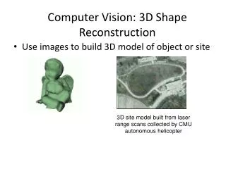
3D Reconstruction Background Building rich 3D maps of environments is an important task for mobile robotics, with applications in navigation, virtual reality, medical operation, and telepresence. Most 3D mapping systems contain three main components: the spatial alignment of continuous data frames; the detection of loop closures; the globally consistent alignment of the complete data sequence.
Concept explain • Scale-invariant feature transform(SIFT): • Detect and describe local features match in images. • Random Sample Consensus (RANSAC): • An iterative method to estimate parameters of a mathematical model from a set of observed data which contains outliers. • Iterative Closest Point (ICP): • employed to minimize the differences between two clouds of points. • K-D Tree • a space-partitioning data structure to organize points in a k-dimensional space for range searching and nearest neighbor searching
Processing of Color ICP Step of algorithm: SIFT RANSAC Color ICP
Processing of Color ICP, Cont. SIFT 1. Create image feature match Filtrate “Poisoned Point” and get motion Information Get low accurate position information for the initial estimation of ICP algorithm RANSAC Create 3D Environment Get Higher accurate position information Color ICP
Normal ICP algorithm Introduce • ICP mathematical expression • Euclidean distance
Normal ICP algorithm Introduce, Cont. • Get two sets of match and which include n matches from RANSAC algorithm. • Transfer the to by translation and rotation matrix equation. Build the KD-Treeand k = 0. • Select a point randomly in . Find the points which satisfy the distance constraints between and by using the nearest neighbor search algorithm. Then calculate translation and Rotation matrix. • Calculate the • If is smaller than previous minimum of match, update the translation and rotation matrix by using Least squares method. • k = k +1. Repeat 3) to 4) until search all points.
Color ICP Algorithm Improve Improve the normal ICP algorithm : • Transfer the RGB to YIQspace. Influence of luminance is decreased. • Build the IQ 2D histogram using I and Q channel for faster searching.
Color ICP Algorithm Improve, Cont. Improve the normal ICP algorithm : • Transfer the RGB to YIQspace. Influence of luminance is decreased. • Build the IQ 2D histogram using I and Q channel for faster searching. • Consider color distance in nearest neighbor search algorithm. • Color dynamic range can compress data size.
Higher Accuracy Location • Compare the rotation error graph of SIFT and Color ICP + SIFT algorithm • Compare the rotation error graph of ICP and Color ICP algorithm
Time Complexity • Comparison of searching time to find the closest points
UAV System Structure Position control Information Robust Controller Dynamics Model (Robot Operating System) Path Planning Attitude Information Motion Information Inertial Measurement Unitalgorithm Data Fusion Simultaneous localization and mapping(SLAM) Initial Motion Information Position and Environment Information Motion Information Lower LayerVision Algorithm Cloud Point Information second Layer 100 millisecond Layer 10 millisecond Layer High accuracy attitude information And low accuracy position information Higher accuracy position information
References • D.Lowe, "Distinctive Image Features from Scale-Invariant Keypoints", January 5, 2004 • T.Lindeberg, "Scale-space theory: A basic tool for analyzing structures at different scales" • Jon Louis Bentley, "Multidimensional Binary Search Trees Used for Associative Searching”, Stanford University 1975 ACM Student Award • P. Henry, M. Krainin, E. Herbst, X. Ren, and D. Fox. , ”RGB-D Mapping: Using Depth Cameras for Dense 3D Modeling of Indoor Environments“, Proc. of International Symposium on Experimental Robotics (ISER), 2010 • Lu F and Milios E “Globally consistent range scan alignment for environment mapping” ,Autonomous Robots 4: 333–349,1997
3D Environment Reconstruction Thank You!
Random Sample Consensus (RANSAC) • Build a equation between X image and X’ image in the projective coordinates • 1) Randomly selected 5 pairs of match from image and image to calculate H and K matrix. • 2) Calculate the distances between from another pairs of X image and image through the equation which does not include the set of 5 pairs points . If the distance is less than a threshold value, the point will be added to the “inliers” set. • 3) Repeat (1) and (2) step N times. Count the number of image feature points match for each time. Select the largest number of inliers point in that group. Use the least squares method to update the transformation matrix H.
KD-Tree Introduction x y x y Best-Bin-First(BBF) algorithm