Download
1 / 35
350 likes | 607 Views
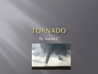
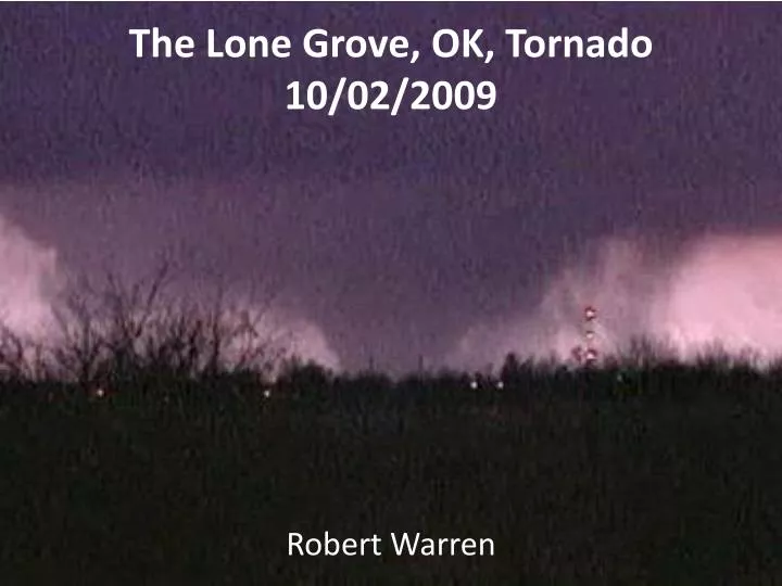
The Lone Grove, OK, Tornado 10/02/2009. Robert Warren. Case Study: The Lone Grove Tornado. February 10, 2009 – EF4 tornado passed through Lone Grove, OK 8 people killed; $3million worth of damage. Dallas. Oklahoma City. SPC forecasts.

E N D
The Lone Grove, OK, Tornado 10/02/2009 Robert Warren
Case Study: The Lone Grove Tornado • February 10, 2009 – EF4 tornado passed through Lone Grove, OK • 8 people killed; $3million worth of damage Dallas Oklahoma City
SPC forecasts • SPC Day 4–8 Convective outlook on Saturday, February 7th: “…INCREASING CONVECTIVE POTENTIAL…INCLUDING A CONSIDERABLE RISK FOR SEVERE STORMS. THIS MAY COMMENCE LATE TUESDAY AFTERNOON ACROSS PARTS OF THE SOUTHERN PLAINS…” • SPC Day 3 Convective outlook on Sunday, February 8th: “…LONG HODOGRAPHS WITH LARGE LOW-LEVEL CLOCKWISE CURVATURE WILL BE QUITE FAVORABLE FOR SUPERCELLS CAPABLE OF PRODUCING TORNADOES…”
SPC forecasts • SPC Day 1 Convective outlook on Tuesday, February 10th: “…GREATER SEVERE WEATHER THREAT IS EXPECTED TO DEVELOP ALONG THE DRY LINE IN CENTRAL OK TO CENTRAL TX BY LATE AFTERNOON… STRENGTHENING OF THE SLY LLJ /50+ KT/ FROM E TX/LA TO ERN KS/MO WILL RESULT IN LARGE CURVED HODOGRAPHS AND THE LIKELIHOOD FOR STRONG/SIGNIFICANT TORNADOES…”
Forecast update • SPC Day 1 Convective outlook on Tuesday, February 10th: “…THE STRONG LOW-LEVEL SHEAR AND MOIST LOW LEVELS WILL SUPPORT THE POSSIBILITY OF A FEW LONG-TRACK SUPERCELLS WITH STRONG TORNADOES LATE THIS AFTERNOON INTO EARLY TONIGHT ACROSS THE MDT RISK AREA…”
Tornadoes in central Oklahoma – 3:05pm Lone Grove Our location
Significant Weather Advisory – 6:20pm “THIS SIGNIFICANT WEATHER ADVISORY IS FOR JEFFERSON AND LOVE COUNTIES. A SEVERE THUNDERSTORM WAS LOCATED 16 MILES SOUTHWEST OF OSCAR AT 620 PM CST...MOVING NORTHEAST AT 40 MPH. THIS STORM HAS BECOME BETTER DEVELOPED OVER THE PAST 15 MINUTES. A TORNADO WARNING IS IN EFFECT FOR MONTAGUE COUNTY IN NORTH TEXAS. A SEVERE THUNDERSTORM WARNING WILL LIKELY BE REQUIRED AND POSSIBLE A TORNADO WARNING OVER THE NEXT 30 MINUTES.”
Hail Spike – 6:31pm • Indicative of large hail • 3-body scatter process • Portion of radar beam is scattered towards surface • Portion of this is scattered back into the cloud • Portion of this is scattered back to the radar • Delay in return signal → radar ‘sees’ target at a greater distance • Doppler velocity can be used to infer fall speeds of hail
Tornado Warning – 6:50pm “AT 650 PM CST...NATIONAL WEATHER SERVICE DOPPLER RADAR INDICATED A SEVERE THUNDERSTORM CAPABLE OF PRODUCING A TORNADO 7 MILES SOUTHEAST OF GRADY...MOVING NORTHEAST AT 40 MPH.”
Tornado Confirmed – 7:31pm “AT 731 PM CST… DOPPLER RADAR AND STORM SPOTTERS OBSERVED A TORNADO NEAR LONE GROVE… MOVING NORTHEAST AT 35 MPH…”
“Violent Tornado” – 7:38pm “AT 738 PM CST…A LARGE…VIOLENT TORNADOWAS LOCATED IN THE NORTHWEST PARTS OF ARDMORE…MOVING NORTHEAST AT 40 MPH…” • Velocity Aliasing (folding) on the Doppler radar. • Doppler Dilemma – trade-off between maximum Doppler velocity and maximum range
Tornado track • Lasted over an hour & travelled 35 miles • Reached peak intensity of EF4 just before it hit Lone Grove
MesonetMeteorgram • Mesonet– network of automated weather stations across OK • Newport site < 2 miles north of tornado track • As storm passed: • Sharp temperature and dewpoint drop • Northwesterly wind gust of 58 mph • Marked pressure drop • Heavy rain associated with storm core
Damage • 8 people killed (7 in Lone Grove, and one truck driver on I-35) • 14 seriously injured • 114 residences destroyed (including 2 trailer parks) • Cars and RVs overturned • Metal forced through trees • Double storey houses reduced to single storey • Loss of household possessions • $3million worth of damage
Response • National Guard sent to provide security • American Red Cross and Salvation Army shelters set up • Local charities, churches schools offer money, shelter, food and support to the victims • Help with the clean up from groups across the state • President Obama approved federal assistance on the 15th • FEMA set up a disaster recovery centre on the 20th
Why was the death toll so high? • Event was well forecast – risk identified several days early • Numerous watches, warnings, and advisories issued on the day • So why was the death toll so high? • Tornado sirens: Many people said they went off only a few seconds before it struck • Complacency: “I wasn’t worried. It was February. We don’t get tornadoes like this in February.” – Sherry Franks, Lone Grove survivor • After dark