Download
1 / 19
360 likes | 1.17k Views
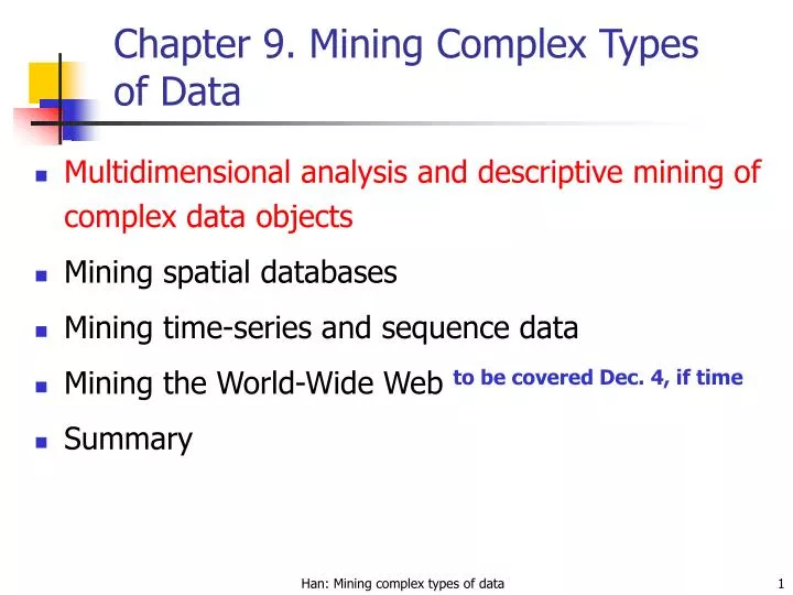
Chapter 9. Mining Complex Types of Data. Multidimensional analysis and descriptive mining of complex data objects Mining spatial databases Mining time-series and sequence data Mining the World-Wide Web to be covered Dec. 4, if time Summary.

E N D
Chapter 9. Mining Complex Types of Data • Multidimensional analysis and descriptive mining of complex data objects • Mining spatial databases • Mining time-series and sequence data • Mining the World-Wide Web to be covered Dec. 4, if time • Summary Han: Mining complex types of data
Mining Complex Data Objects: Generalization of Structured Data • Set-valued attribute • Generalization of each value in the set into its corresponding higher-level concepts • Derivation of the general behavior of the set, such as the number of elements in the set, the types or value ranges in the set, or the weighted average for numerical data • E.g., hobby = {tennis, hockey, chess, violin, nintendo_games} generalizes to {sports, music, video_games} • List-valued or a sequence-valued attribute • Same as set-valued attributes except that the order of the elements in the sequence should be observed in the generalization Han: Mining complex types of data
Generalizing Spatial and Multimedia Data • Spatial data: • Generalize detailed geographic points into clustered regions, such as business, residential, industrial, or agricultural areas, according to land usage • Require the merge of a set of geographic areas by spatial operations • Imagedata: • Extracted by aggregation and/or approximation • Size, color, shape, texture, orientation, and relative positions and structures of the contained objects or regions in the image • Music data: • Summarize its melody: based on the approximate patterns that repeatedly occur in the segment • Summarized its style: based on its tone, tempo, or the major musical instruments played Han: Mining complex types of data
An Example: Plan Mining by Divide and Conquer • Plan: a variable sequence of actions • E.g., Travel (flight): <traveler, departure, arrival, d-time, a-time, airline, price, seat> • Plan mining: extraction of important or significant generalized (sequential) patterns from a planbase (a large collection of plans) • E.g., Discover travel patterns in an air flight database, or • find significant patterns from the sequences of actions in the repair of automobiles • Method • Attribute-oriented induction on sequence data • A generalized travel plan: <small-big*-small> • Divide & conquer:Mine characteristics for each subsequence • E.g., big*: same airline, small-big: nearby region Han: Mining complex types of data
A Travel Database for Plan Mining • Example: Mining a travel planbase Travel plans table Airport info table Han: Mining complex types of data
Strategy Generalize the planbase in different directions Look for sequential patterns in the generalized plans Derive high-level plans Multidimensional Analysis A multi-D model for the planbase Han: Mining complex types of data
Multidimensional Generalization Multi-D generalization of the planbase Merging consecutive, identical actions in plans Han: Mining complex types of data
Generalization-Based Sequence Mining • Generalize planbase in multidimensional way using dimension tables • Use # of distinct values (cardinality) at each level to determine the right level of generalization (level-“planning”) • Use operators merge “+”, option “[]” to further generalize patterns • Retain patterns with significant support Han: Mining complex types of data
Generalized Sequence Patterns • AirportSize-sequence survives the min threshold (after applying merge operator): S-L+-S [35%], L+-S [30%], S-L+ [24.5%], L+ [9%] • After applying option operator: [S]-L+-[S] [98.5%] • Most of the time, people fly via large airports to get to final destination • Other plans: 1.5% of chances, there are other patterns: S-S, L-S-L Han: Mining complex types of data
Chapter 9. Mining Complex Types of Data • Multidimensional analysis and descriptive mining of complex data objects • Mining spatial databases • Mining multimedia databases • Mining time-series and sequence data • Mining text databases • Mining the World-Wide Web • Summary Han: Mining complex types of data
Spatial Data Warehousing • Spatial data warehouse: Integrated, subject-oriented, time-variant, and nonvolatile spatial data repository for data analysis and decision making • Spatial data integration: a big issue • Structure-specific formats (raster- vs. vector-based, OO vs. relational models, different storage and indexing, etc.) • Vendor-specific formats (ESRI, MapInfo, Integraph, etc.) • Spatial data cube: multidimensional spatial database • Both dimensions and measures may contain spatial components Han: Mining complex types of data
Dimension modeling nonspatial e.g. temperature: 25-30 degrees generalizes to hot spatial-to-nonspatial e.g. region “B.C.” generalizes to description “western provinces” spatial-to-spatial e.g. region “Burnaby” generalizes to region “Lower Mainland” Measures numerical distributive (e.g. count, sum) algebraic (e.g. average) holistic (e.g. median, rank) spatial collection of spatial pointers (e.g. pointers to all regions with 25-30 degrees in July) Dimensions and Measures in Spatial Data Warehouse Han: Mining complex types of data
Example: BC weather pattern analysis • Input • A map with about 3,000 weather probes scattered in B.C. • Daily data for temperature, precipitation, wind velocity, etc. • Concept hierarchies for all attributes • Output • A map that reveals patterns: merged (similar) regions • Goals • Interactive analysis (drill-down, slice, dice, pivot, roll-up) • Fast response time • Minimizing storage space used • Challenge • A merged region may contain hundreds of “primitive” regions (polygons) Han: Mining complex types of data
Star Schema of the BC Weather Warehouse • Spatial data warehouse • Dimensions • region_name • time • temperature • precipitation • Measurements • region_map • area • count Dimension table Fact table Han: Mining complex types of data
Spatial Merge • Precomputing all: too much storage space • On-line merge: very expensive Han: Mining complex types of data
Methods for Computation of Spatial Data Cube • On-line aggregation: collect and store pointers to spatial objects in a spatial data cube • expensive and slow, need efficient aggregation techniques • Precompute and store all the possible combinations • huge space overhead • Precompute and store rough approximations in a spatial data cube (e.g. use grids) • accuracy trade-off • Selective computation: only materialize those which will be accessed frequently • a reasonable choice Han: Mining complex types of data
Spatial Association Analysis • Spatial association rule: A B [s%, c%] • A and B are sets of spatial or nonspatial predicates • Topological relations: intersects, overlaps, disjoint, etc. • Spatial orientations: left_of, west_of, under, etc. • Distance information: close_to, within_distance, etc. • s% is the support and c% is the confidence of the rule • Examples is_a(x, large_town) ^ intersect(x, highway) ® adjacent_to(x, water) [7%, 85%] is_a(x, large_town) ^adjacent_to(x, georgia_strait) ® close_to(x, u.s.a.) [1%, 78%] Han: Mining complex types of data
Progressive Refinement Mining of Spatial Association Rules • Hierarchy of spatial relationship: • g_close_to: near_by, touch, intersect, contain, etc. • First search for rough relationship and then refine it • Two-step mining of spatial association: • Step 1: Rough spatial computation (as a filter) • Using MBR or R-tree for rough estimation • Step2: Detailed spatial algorithm (as refinement) • Apply only to those objects which have passed the rough spatial association test (no less than min_support) Han: Mining complex types of data
Spatial Classification and Spatial Trend Analysis • Spatial classification • Analyze spatial objects to derive classification schemes, such as decision trees in relevance to certain spatial properties (district, highway, river, etc.) • Example: Classify regions in a province into rich vs. poor according to the average family income • Spatial trend analysis • Detect changes and trends along a spatial dimension • Study the trend of nonspatial or spatial data changing with space • Example: Observe the trend of changes of the climate or vegetation with the increasing distance from an ocean Han: Mining complex types of data