Download
1 / 25
250 likes | 416 Views
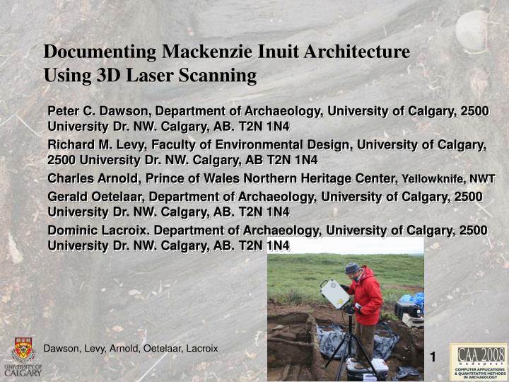
Documenting Mackenzie Inuit Architecture Using 3D Laser Scanning. Peter C. Dawson, Department of Archaeology, University of Calgary, 2500 University Dr. NW. Calgary, AB. T2N 1N4 Richard M. Levy, Faculty of Environmental Design, University of Calgary, 2500 University Dr. NW. Calgary, AB T2N 1N4

E N D
Documenting Mackenzie Inuit Architecture Using 3D Laser Scanning Peter C. Dawson, Department of Archaeology, University of Calgary, 2500 University Dr. NW. Calgary, AB. T2N 1N4 Richard M. Levy, Faculty of Environmental Design, University of Calgary, 2500 University Dr. NW. Calgary, AB T2N 1N4 Charles Arnold, Prince of Wales Northern Heritage Center, Yellowknife, NWT Gerald Oetelaar, Department of Archaeology, University of Calgary, 2500 University Dr. NW. Calgary, AB. T2N 1N4 Dominic Lacroix.Department of Archaeology, University of Calgary, 2500 University Dr. NW. Calgary, AB. T2N 1N4
Documenting Mackenzie Inuit Architecture Using 3D Laser Scanning Introduction Architectural variability often reflects social processes. The transition from single to double to triple platform houses in Mackenzie Delta may indicate changes in household organization. However, the study of the meaning behind these architectural transitions hindered by: Variation in how accuracy Inuvialuit architecture has been documented by archaeologists over the past 100 years. The destruction of house ruins by the erosion of archaeological sites on the Beaufort sea coast, and East channel of the Mackenzie River.
Documenting Mackenzie Inuit Architecture Using 3D Laser Scanning Goal Laser scanning provides a means of rapidly capturing architectural information at a levels of detail that may allow us to explore the relationship between house form and culture in Inuvialuit society. Demonstration: Laser scanning can be used for the reconstruction virtual 3D models of Inuit Sod Houses
Documenting Mackenzie Inuit Architecture Using 3D Laser Scanning Location Pond Site (NiTs-2). Several clusters of house depressions Cultural Affiliation Inuvialuit - regional groups of ancestral Inuvialuit Chronology Occupied since 1300 AD
Documenting Mackenzie Inuit Architecture Using 3D Laser Scanning Previous work Prince of Wales Northern Heritage Centre conducted excavations at two of the house depressions at the Pond Site in 1989 In 2002 the Prince of Wales Northern Heritage Centre returned briefly to the Pond site in order to test whether ground penetrating radar was effective in detecting subsurface archaeological features in permafrost environments.
Documenting Mackenzie Inuit Architecture Using 3D Laser Scanning • Previous Work • Summer of 2007, a laser scanner was used to record the excavation of two Inuit Sod houses located in the Mackenzie Delta, NWT NiTs-2 is located on the west shore of Richards Island at 69o 20.6’N and 134o 03.3’W Towards the mouth of the East Channel of the Mackenzie River
Documenting Mackenzie Inuit Architecture Using 3D Laser Scanning • Why use a laser scanner to capture data • Challenges • Expense • Logistics • Cost of processing • Opportunities • Complete record • Baseline for 3D construction in a CAD environment
Documenting Mackenzie Inuit Architecture Using 3D Laser Scanning • Laser Scanner Selection • Pulse – Time of Flight • Resolution 6 -10 mm • Point accuracy vs model space • Range • 50 to 400 m. • Field of View • 360 horizontal • 270 vertical • Pts. per second • 5000 to 500,000 • Cost • $100,000 US + HDS6000 CYRAX2500
Documenting Mackenzie Inuit Architecture Using 3D Laser Scanning • Issues: • Laser Scanner Selection • Modulating Light • Resolution – 3mm at 20 m • Range – .6 to 20 m • Field of View • 360 horizontal • 320 vertical • Pts. per second - 120,000pts • Color – 24 bit • Cost – $100,000 US
Documenting Mackenzie Inuit Architecture Using 3D Laser Scanning • Laser Scanner Selection • Phase • Resolution - .03 mm (Z) • Range - .6 to 2.5 m • Field of View: Lens dependent • Telephoto Lens: 111 x 84 x 40mm to 460 x 350 x 130 mm • Mid Lens:196 x 153 x 70 mm to 830 x 622 x 220 mm • Wide Lens:355 x 266 x 92 mm to 1200 x 903 x 400 mm • Pts. per second – 300,000 • Color - 24 bit 640x480 • Cost - $40,000+
Documenting Mackenzie Inuit Architecture Using 3D Laser Scanning • Choice of Scanner • Two Scanners vs. One • General Survey vs. High Level of Detail • Decision: Minolta Vivid 910 • Point accuracy vs. Model accuracy • .03 mm vs. Time of flight +/- .6mm • Acquisition time- 300,000 pts/sec • Weight 25 lbs • Price – used unit within budget
Documenting Mackenzie Inuit Architecture Using 3D Laser Scanning • Issues: • Logistics • Transport • Helicopter and quad • Weather • Temperature and humidity • 10 to 40 C • 65% or less • Lighting conditions • Electric Power • Generator and UPS • Time Constraints • One day per site
Documenting Mackenzie Inuit Architecture Using 3D Laser Scanning • Data Collection: Laser Scanning • Occlusion House 4
Documenting Mackenzie Inuit Architecture Using 3D Laser Scanning • Data Collection: Laser Scanning • Overlap • Targets • Orphaned Polyfaces House 3
Documenting Mackenzie Inuit Architecture Using 3D Laser Scanning • Data Collection: Laser Scanning • Field of View House 3
Documenting Mackenzie Inuit Architecture Using 3D Laser Scanning • Data Collection: Laser Scanning • Field of View • Setup Time House 3
Documenting Mackenzie Inuit Architecture Using 3D Laser Scanning • Data Collection: Color • From digital imagery vs. scanner • Issues • Light levels • Reflectance • Soil moisture • Resolution • Color Depth
Documenting Mackenzie Inuit Architecture Using 3D Laser Scanning • Data Collection: Color • From digital imagery vs. scanner • Issues • Light levels • Reflectance • Soil moisture • Resolution • Color Depth
Documenting Mackenzie Inuit Architecture Using 3D Laser Scanning • Data Processing • Polyworks 10.1 • Point Cloud • 90,000,000 points in two days • Mesh files • From points to polyfaces
Documenting Mackenzie Inuit Architecture Using 3D Laser Scanning Laser Scanning I Output formats: CDM Polytrans Input Format: OBJ Output Forma: 3DS Media Products: AVI, MOV, QTVR,Tif,JPG 3d Studio Input Format: OBJ Output Format: MAX VR: Virtools Media/ VR
Documenting Mackenzie Inuit Architecture Using 3D Laser Scanning Laser Scanning I Output formats: CDM Polytrans Input Format: OBJ Output Forma: 3DS Media Products: AVI, MOV, QTVR,Tif,JPG 3d Studio Input Format: OBJ Output Format: MAX VR: Virtools Media/ VR
Documenting Mackenzie Inuit Architecture Using 3D Laser Scanning Recommendations Two scanners General survey work – Time of flight for general survey work Detail scanning – Triangulation scanner (Minolta Vivid 910) Registration Targets - Improve the legibility of the 3D targets with less reflective targets
Documenting Mackenzie Inuit Architecture Using 3D Laser Scanning Recommendations Control light levels Portable Structure Increase lighting levels with daylight flouresent Control the distance from scanner to object Rail system for mounting the scanner Maintain constant distance to object
Documenting Mackenzie Inuit Architecture Using 3D Laser Scanning Conclusions Laser scanning offers a means of rapidly documenting Inuvialuit architecture at high levels of resolution, and in a standardized fashion. Our research indicates that the use of laser scanning technology is possible in remote environments like the Canadian Arctic. Documenting Inuvialuit sod houses at high resolutions will enable archaeologists to examine the possible social and ideological significance of variability in circumpolar architecture
Documenting Mackenzie Inuit Architecture Using 3D Laser Scanning Peter C. Dawson, Department of Archaeology, University of Calgary, 2500 University Dr. NW. Calgary, AB. T2N 1N4 Richard M. Levy, Faculty of Environmental Design, University of Calgary, 2500 University Dr. NW. Calgary, AB T2N 1N4 Charles Arnold, Prince of Wales Northern Heritage Center, Yellowknife, NWT Gerald Oetelaar, Department of Archaeology, University of Calgary, 2500 University Dr. NW. Calgary, AB. T2N 1N4 Dominic Lacroix.Department of Archaeology, University of Calgary, 2500 University Dr. NW. Calgary, AB. T2N 1N4 House 4