Download
1 / 20
210 likes | 408 Views
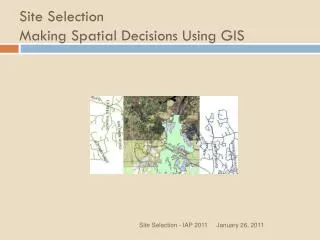
Riparian Wetland Restoration Site Selection Using GIS. Dave Cour SSC 570 December 2, 2003. overview. Introduction Materials Identifying Suitable Restoration Areas Advanced Processes Conclusions . introduction.

E N D
Riparian Wetland Restoration Site Selection Using GIS Dave Cour SSC 570 December 2, 2003
overview • Introduction • Materials • Identifying Suitable Restoration Areas • Advanced Processes • Conclusions
introduction • Recognition of wetland values (flood abatement, improving water quality, supporting biodiversity, etc.) has stimulated interest in protecting these ecosystems from further losses. • Choosing the site is important because the conditions needed to form wetlands are complex and failure to meet wetland conditions is common.
introduction • To try and minimize the time and expense required for fieldwork, geographic information systems (GIS) can be used to select and prioritize candidate restoration sites. • The case study used as an example is in the lower Neuse River watershed in eastern North Carolina.
materials Soils data: This dataset should contain the hydric status of the soils. An “A” indicates primary hydric classification by the NRCS while a “B” denotes secondary hydric status. CGIA: Soils, Detailed County Surveys - North Carolina Center for Geographic Information & Analysis. Var dates. Hydrography: Riparian areas require a nearby channel. CGIA: Hydrography (1:24,000) - North Carolina Center for Geographic Information & Analysis. 1999. Hydrologic Units: We will need to delineate the watershed we are interested in. For maximum flexibility, this dataset should include watershed delineations at HUC-8, HUC-11 and HUC-14 levels. CGIA: Hydrologic Units: Subbasins - North Carolina Center for Geographic Information & Analysis. 1994. Land use/ Landcover (LULC): Restoration projects take place on impacted landscapes. We will identify potential project areas by looking at how land is utilized within the watershed. EPA BASINS: Landuse/Landcover Spatial Data of CONUS - U.S. Environmental Protection Agency. 1998.
identifying restoration areas 1. Select Area – Determine the extent of your search.
identifying restoration areas 2. Clip layers to area– Make sure all layers are set to the same extent. • Select the GeoProcessing Wizard from the Tools menu. • Clip Function • Your input layer is the soils, hydrography or LULC layer you want to clip and the clip layer is boundary of your study area from step 1.
identifying restoration areas 3. Create a buffer around hyrdrography
identifying restoration areas 4. Create a hydric soil layer and impacted land use layer
identifying restoration areas 5. Select LULC that Intersect Buffer
identifying restoration areas 6. Convert Shapefiles to Rasterfiles and Classify Layers
identifying restoration areas 7. Combine Layers
identifying restoration areas 8. Calculate Area and Convert to Acres
identifying restoration areas 9. Delete Areas Less than Ten Acres
advanced processes Simple Method provides a mechanism to differentiate between subcatchments using LULC data L = (R)(C)(2.72) or L = [(P)(Pj)(Rv)/12](C)(2.72)A
advanced processes Simple Method
advanced processes Simple Method
conclusions • Site selection is a vital step in the early planning process. • The process outlined above does not eliminate the need for field data collection. • This method provides the means for completing the analyses quickly and succinctly. • The major limiting factor affecting the results will be the resolution of the data.
References Mitsch, W.J. and J.G. Gosselink. 2000 Wetlands: Third Edition. John Wiley and Sons, Inc. New YorK, NY. North Carolina Department of Environment & Natural Resources, Division of Water Quality. 2001. Neuse River Basin Basinwide Assessment Report. Raleigh, NC. Zedler, J. B. 2003. Wetlands at your service: Reducing impacts of agriculture at the watershed scale. Frontiers in Ecology and Environment.