Download
1 / 19
190 likes | 253 Views
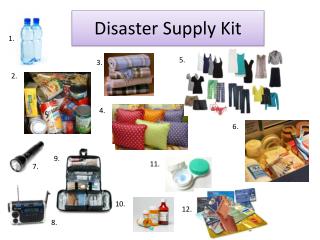
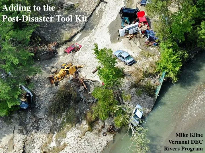
Adding to the Post-Disaster Tool Kit. Mike Kline Vermont DEC Rivers Program. Identify Hazards and Assess Risks Since 1927 Vermont has experienced a large-scale disastrous floods once every 14 years.

E N D
Adding to the Post-Disaster Tool Kit Mike Kline Vermont DEC Rivers Program
Identify Hazards and Assess Risks Since 1927 Vermont has experienced a large-scale disastrous floods once every 14 years. From 1973-2011, Vermont has suffered approximately 25 disastrous floods of regional-scale as depicted on this map. Data Source: VT DEC Rivers Program
Identifying Hazards / Risk Analysis: Inundation Hazards
Vulnerability Assessment • 200+ years of Channel, Floodplain and Watershed Modifications: • Deforestation • Snagging and ditching • Encroachments, i.e., villages, farms, roads and rails • Dams and diversions • Gravel removal • Straightening - berming • Undersized Culverts • Stormwater Not in a Mapped SFHA Channel evolution confounds flood mapping and results in the under-estimation of risk in Vermont.
I II III IV-V • Vulnerability Assessment • 1/3 to 1/2 of VT streams historically straightened • 75% currently incised
Escalating Costs, Risks, and Ecosystem Degradation Floods and Property Damage Encroachment Dredge, Berm and Armor
Growing Consensus in VT Trying to contain flows.. ..is a recipe for erosion.
River Corridor Planning Watershed-Scale Strategies: Drainage and Stormwater Management Gully and Erosion Control Buffer Establishment and Protection Removal of Structural Encroachments River Corridor Easements River and Floodplain Restorations Reach-specific Projects: Protect Sensitive River Corridors Plant Stream Buffers Stabilize Stream Banks Arrest head cuts and nick points Remove Berms and other constraints to flood and sediment load attenuation Remove/Replace Structures (e.g. undersized culverts, low dams) Restore Incised Reaches Restore Aggraded Reaches
Functioning floodplains and river corridors create an intersection for the protection of public values Ecological Integrity and Fish & Wildlife Resource Public Safety and Property Protection Avoidance Strategies to Protect Floodplains & Stream Equilibrium Water Quality and Quantity
Literally and Figuratively Picking up the pieces • Mitigation Constraints • Public Safety and imminent threats to property and infrastructure • Limited authority during emergency operations • Limited time to act before the conflict becomes worse • Limited funding to support the desired alternative • Effectiveness and longevity of various solutions • Limited time available to the River Management Engineer • Logistics • Irreconcilable conflicts • Lack of public understanding about how rivers work • Social pressures
Establish technical standards and rules for conducting instream work and emergency protective measures.
Maximize public assistance funding for flood hazard mitigation. • Adopt codes and standards to ensure eligibility. • Update hazard mitigation plans for FEMA approval • Establish Municipal Incentives
Establish a three-tiered river management training programand integrate ANR emergency operations with other agencies.
Enhance State and municipal floodplain regulation andcreate tools and incentives for river corridors protection.
Winooski River Otter Creek Irene flood flow data showing the protection of downstream communities when attenuation assets are in place and functioning.