Download
1 / 46
580 likes | 1.39k Views
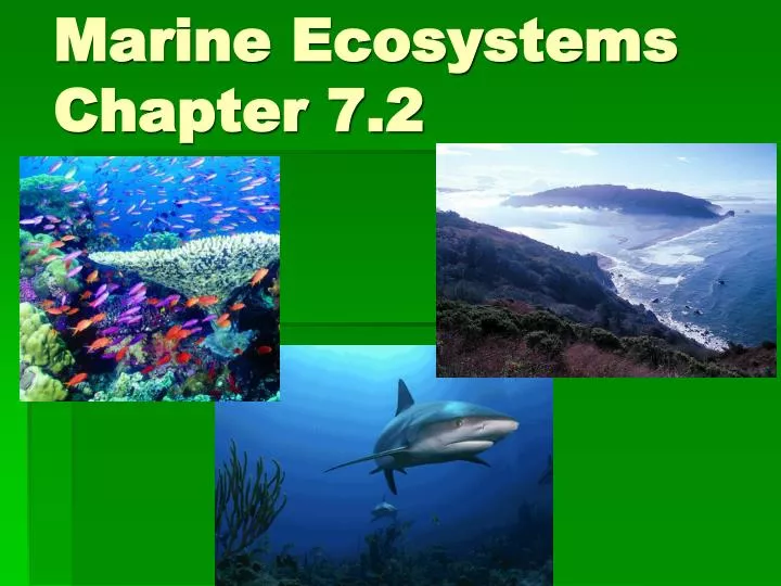
Marine Ecosystems Chapter 7.2. Natural Capital. © 2004 Brooks/Cole – Thomson Learning. Marine Ecosystems. Ecological Services. Economic Services. Climate moderation CO 2 absorption Nutrient cycling Waste treatment and dilution Reduced storm impact (mangrove, barrier islands,

E N D
Natural Capital © 2004 Brooks/Cole – Thomson Learning Marine Ecosystems EcologicalServices EconomicServices Climate moderation CO2 absorption Nutrient cycling Waste treatment and dilution Reduced storm impact (mangrove, barrier islands, coastal wetlands) Habitats and nursery areas for marine and terrestrial species Genetic resources and biodiversity Scientific information Food Animal and pet feed (fish meal) Pharmaceuticals Harbors and transportation routes Coastal habitats for humans Recreation Employment Offshore oil and natural gas Minerals Building materials
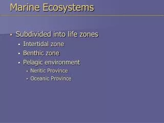
Categories of marine ecosystems 1. Coastal ecosystems – includes: estuaries, salt marshes, mangrove swamps, rocky and sandy shores 2. Coral reefs 3. Oceans
Estuaries Definition: an area in which fresh water from a river mixes with salt water from the ocean; a transition area from the land to the ocean Other names: bay, sound, lagoon, harbor, bayou The Ocean Area where fresh and salt water mix River bringing freshwater to the sea
Characteristics of Estuaries Water is brackish: a mixture of freshwater and saltwater There is a gradient (gradual change) in the salinity • near the input from the river: 0-5 ppt • in the middle of the estuary: 5-25ppt • at the ocean: >25 ppt (ppt = parts per thousand, a unit for salinity)
Mobile Bay – one of the largest estuaries in the U.S. Tensaw River What is the approximate salinity in ppt for these locations? Mobile River Mobile Bay Gulf of Mexico Dauphin Island
Characteristics of Estuaries Very nutrient rich ecosystems leads to high productivity and high biodiversity Fast-moving rivers and waves carry nutrient-rich particles Sediment settles out in the estuary when the water slows down It accumulates on the bottom (benthic zone) Great place for plants to grow!
Important functions of estuaries: for living things1. habitat2. nursery3. fisheries4. recreation
Important functions of estuaries: related to water 5. Water purification 6. Flood control (from upstream) 7. Buffer land from hurricanes, absorb storm surge Loss of coastal wetlands in Louisiana made Hurricane Katrina’s effect worse than it would have been
Estuary plants Plants must be adapted to salty habitat eelgrass cordgrass glasswort – a succulent
Estuary plants Narrow leaved cattail
Estuary animals Huge variety! Including… horseshoe crabs Mosquito…
Estuary animals oysters lobster
Estuary animals Flounder Striped Bass
Estuary animals Many, many birds! Common tern Great White Egret
Estuary animals Manatee
Estuary animals Sea lions at Pier 39 in San Francisco Bay
Salt Marshes Definition: a low area that is subject to regular, but gentle, tides Dominated by grasses (Remember, marshes do not have trees or shrubs) Location: Gulf of Mexico and Atlantic coast Texas salt marsh
Alabama salt marsh Dauphin Island, AL
Mangrove Swamps Definition: coastal wetlands located in tropical and subtropical zones; characterized by salt-tolerant trees and shrubs, such as mangrove trees
Mangroves Different species – include red mangrove… with tangled roots that reach above the water line, form an important habitat for many animals
Rocky shores Also called rocky intertidal zone – many places to live in this habitat, means high biodiversity Organisms must be adapted to wave action, changing tide levels Some examples of rocky shores organisms are at the Monterey Bay Aquarium website below: http://www.montereybayaquarium.org/efc/efc_rocky/rocky_cam.asp#
Rocky Shores At low tides, there are often tide pools left behind where you can see starfish, anemones, crabs, octopus
Sea star Hermit crab Shore crab Rocky Shore Beach High tide Periwinkle Sea urchin Anemone Mussel Low tide Sculpin Barnacles Kelp Sea lettuce Monterey flatworm Nudibranch
Sandy shores “The Beach!”
Sandy Shores Not as much biodiversity as rocky shores – Why? • not much habitat diversity • sand dries out at low tide some small things can live in the sand, food for shorebirds
Barrier Islands Narrow islands made of sand that provide a buffer for the mainland from the sea Constantly shifting, especially with storms Ex: Dauphin Island, Alabama
Barrier beach Beach flea Peanut worm Tiger beetle Blue crab Clam Dwarf olive High tide Ghost shrimp Sandpiper Silversides Mole shrimp Low tide White sand macoma Sand dollar Moon snail
Barrier Islands Ocean Beach Intensive recreation, no building Primary Dune No direct passage or building Trough Limited recreation and walkways Secondary Dune No direct passage or building Back Dune Most suitable for development Bay or Lagoon Intensive recreation Bay shore No filling Grasses or shrubs Taller shrubs Taller shrubs and trees Think about ecological succession as you move away from the ocean. What is the “disturbance” in this ecosystem?
Notice the beach erosion. Barrier islands are constantly changing.
This picture was taken from Dauphin Island, AL. Notice the offshore platforms for drilling natural gas in the Gulf of Mexico. Interestingly, Florida does not allow offshore drilling. Why?
Coral Reefs • Structures in the shallow oceans that are built by animals called corals; serve a habitat for many diverse organisms • Require two things: warm temperatures and sunlight • Found between 30°N and 30°S of the equator
Coral Reefs Corals are animals that belong to the phylum Cnidaria, the stinging-celled animals such as jellyfish and hydra Coral polyps resemble small sea anemones with tentacles that can sting and paralyze prey
Coral Reefs They build limestone houses around themselves and stay in one spot (sessile) Over many generations, the limestone builds up to form a large reef (takes a long time) Polyps in limestone skeleton Elkhorn coral
Coral Reefs Corals live in a symbiotic relationship with algae called zooxanthellae; the algae are photosynthetic and give the coral food and oxygen; the algae get carbon dioxide and nutrients from the nitrogenous wastes of the coral
Coral Reefs There are many different kinds of corals: Soft corals Hard corals
Coral Reefs Growing on the reef with the corals are other animals, such as sponges, worms, shrimps, crabs, mollusks Living in and around the reef are fish, sea turtles, sea snakes, marine mammals
Coral Reef Destruction 1. Coral bleaching – when temperatures go above normal, the zooxanthellae (algae) in the coral can be rejected, the coral turns a whitish color and dies Natural causes: El Nino Manmade causes: Global warming
Coral Reef Destruction 2. Physical damage Ships, anchors, tourist divers Dynamite fishing - reefs are damaged by physical destruction that may occur when people collect fish
Coral Reef Destruction • Land development and pollution – loss of mangrove forests means more nutrients and sediments flow out to the sea; coral may die from sediment or algal blooms • Fish and coral trade • Increased exposure to UV due to ozone depletion
Ocean: Deep and Wide Defining characteristics: light and depth of water Varying surface of ocean floor: continental shelf, slope, trenches (deepest is Mariana Trench at about 35,000 feet below sea level), plains, geologic features (hydrothermal vents, volcanoes, fault lines that produce earthquakes and tsunamis)
Depth in meters High tide Sun Low tide Coastal Zone Open Sea Sea level 0 50 Euphotic Zone Photosynthesis 100 Estuarine Zone Continental shelf 200 500 Twilight Bathyal Zone 1,000 1,500 2,000 Euphotic zone – full sunlight, phytoplankton (the producers), zooplankton, nekton Bathyal zone – the twilight zone Abyssal zone – cold, dark, pressure high, specialized “weird” organisms live here Benthic zone – all along the ocean bottom, benthos are organisms that live on the bottom of the ocean, filter feeders, scavengers, decomposers 3,000 Abyssal Zone Darkness 4,000 5,000 10,000 © 2004 Brooks/Cole – Thomson Learning
Deep ocean Characteristics: dark, cold, high pressure How can anything live there? What is the base of the food chain? Two ways: 1. marine snow – organic particles that settle down from above 2. hydrothermal vents - cracks in the earth that allow hot gases to escape, certain bacteria can make food in these conditions (chemosynthesis) Will see both of these in the Planet Earth video….
Biodiversity in marine ecosystems Why do coral reefs have more biodiversity than the open ocean or the deep ocean? More sunlight and more habitat support greater diversity of species
Natural Capital Degradation Marine Ecosystems Half of coastal wetlands lost to agriculture and urban development Over one-third of mangrove forests lost since 1980 to agriculture, development, and aquaculture shrimp farms About 10% of world’s beaches eroding because of coastal development and rising sea level Ocean bottom habitats degraded by dredging and trawler fishing boats Over 25% of coral reefs severely damaged and 11% have been destroyed