Download
1 / 31
320 likes | 485 Views
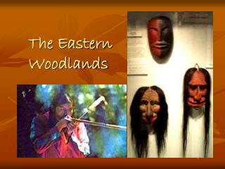
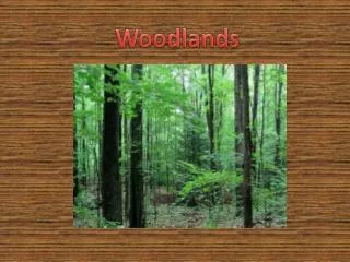
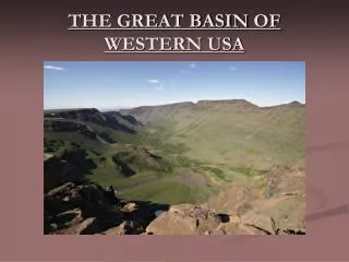
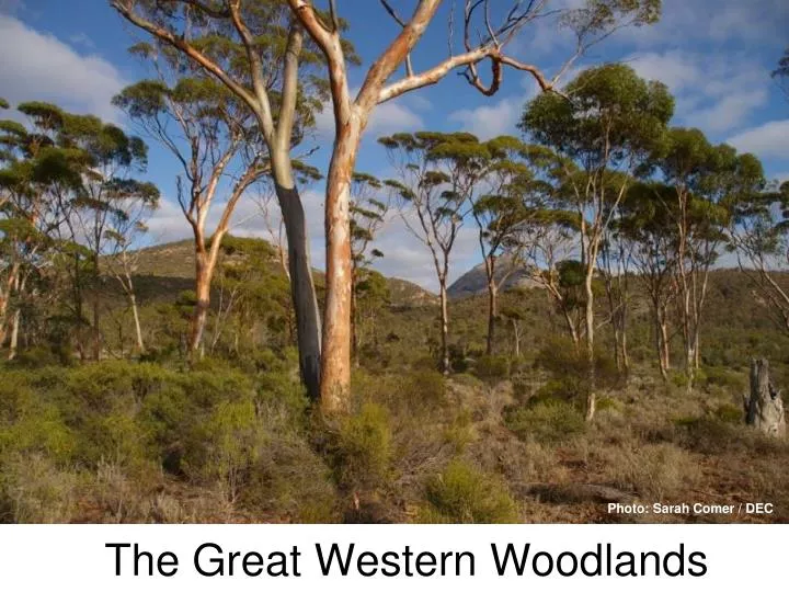
The Great Western Woodlands. Photo: Sarah Comer / DEC. Where are they?.

E N D
The Great Western Woodlands Photo: Sarah Comer / DEC
Where are they? “The world's largest and healthiest temperate woodlands is right here in WA. The Great Western Woodlands are in the area between Hyden and Norseman and between Kalgoorlie and Esperance.” (Barbara Madden - The Wilderness Society)
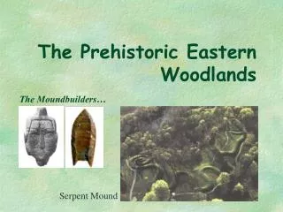
Lake Johnston, west of Norseman in the Great Western Woodlands. Photo: Aminya Ennis / DEC
What is the longitudinal extent of the GWW? 117oE 130oE
Australian Supersite Network Describe the location of the GWW by referring to the names of settlements , distance and direction.
The largest remaining intact temperate woodland on Earth • What is a woodland? • What does temperate mean? • Why is this woodland special? Photo: Aminya Ennis / DEC
What do you think a woodland is? Check out the Department of Conservation website http://www.dec.wa.gov.au
What is a Woodland? “When I look up between the trees I can see more between 30% and 70% sky.” “Widely spaced trees with their crowns not touching.” (Richard Hobbs)
Did you know? • WA is home to the largest, healthiest temperate woodland left on the planet. • The GWW are under threat from uncontrolled bushfire and feral animals such as cats, dogs and foxes. • The GWW has over 300 species of trees • The biosphere of the GWW region has been the same for the last 10,000 years. Photo: Ian Herford / DEC
What are the threats to the GWW? Weeds Fires Reduced Biodiversity
Fires Photo: Graeme Keals / DEC
Looking at Climate Graphs • What is the seasonal temperature range for Kalgoorlie/Boulder? • In which season does Kalgoorlie/Boulder have the most rain? • How much rain do they have in the wettest season?
ISOHYETS • What is an isohyet? • Between which two isohyets does GWW lie? • What affect does the rainfall in the GWW have on the vegetation?
Let’s do some investigating Photo: Dr Suzanne Prober / CSIRO
Investigate a woodland near you • Mark out an area of woodland - 20 square metres plot and place markers at the corners. • Use a Compass App. on a mobile phone to locate your position. • Record the latitude and longitude of your plot. • Sketch the location of each tree in your plot and allocate a number to each tree. Record this on a grid. • Measure the girth of each tree by measuring around the trunk of each tree at about 1.3 metres above ground level. • Estimate the height of each tree by standing someone beside the trunk and moving away. How many people of about 1.5 metres height could you stack up the trunk? • Describe each tree in your sample plot. • Compare your plot to another one from another location. Photo: Ian Herford / DEC
Researching the Great Western Woodlands • What do you now know about the GWW? • Design a topic for investigating more about the Great Western Woodlands. • Write 5 questions that you would like to find out more about. • Now create your own powerpoint. Try to use some hyperlinks to make it more interesting. Photo: Sarah Comer / DEC
Gondwana Link Gondwana Link Project is a landscape-scale conservation project in the ecologically significant south west corner of Western Australia. The aim of the Gondwana Link project is to reconnect fragmented ecosystems, and to protect, restore and maintain the fundamental ecological processes that underpin these ecosystems.
Watch this YouTube and then consider the stakeholders that are interested in the GWW. https://www.youtube.com/watch?v=wW3FyEk27IM&feature=player_embedded The Great Western Woodlands Scoping Study
Stakeholder Groups Dept. of Environment & Conservation Bushwalkers & recreational users Scientific community: researchers Developing a land use plan for the GWW Mining sector managers Gondwana Link Project Property owners Pastoralists Timber industry
DEVELOPING A LANDUSE PLAN • Summarise the interest of each of the stakeholder groups. • Identify some other government groups that could have an interest in the management of the GWW. • How are each of the sub-regions different? • What data gathering and online projects could be developed?
End notes Designed to support teachers of Stage 1A and 2B Geography