Download
1 / 45
450 likes | 599 Views
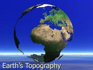
Mapping Earth’s Surface. UNIT 2. What types of landforms are around here?. Homework check Homework review Homework quiz What is the land like around BFS? Use your smart phones to research one city outside of Korea. Use each vocabulary term to describe what the city’s land is like.

E N D
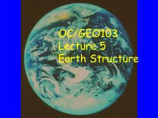
Mapping Earth’s Surface UNIT 2
What types of landforms are around here? • Homework check • Homework review • Homework quiz • What is the land like around BFS? • Use your smart phones to research one city outside of Korea. Use each vocabulary term to describe what the city’s land is like. • Topography • Elevation • Landform • Plain • Mountain
Bellwork Quiz A landform that has high elevation but a mostly flat surface is a • Plain • Mountain • Mountain range • Plateau
BFS environment • Draw a small square to represent BFS. • Choose a word a word that describes the type of land near your school (flat, hilly, mountainous) and write it next to the square. • Use a compass to determine which direction is north. Assume north is the top of your paper. • Draw a picture of what the land is like 5 km in each direction. Describe in words what you drew using terms like flat, hilly etc. • -Scale and Key Practice
Why do we use maps? • Homework check/homework review • Homework quiz • Share landforms from our chosen countries • Glue in map to your notebook and follow the instructions! • If time get started on the history of maps reading.
Map Analysis Questions • Color the water light blue, color the mountains purple, color the land light green, and color the key yellow. • What is the name of the largest island? • What is the name of the ocean in the map? • Which island is farthest west? • Which island is farthest south? • About how many miles is it from Hilo to Captain Cook? • What direction would you travel to go from Hilo to Mauna Kea?
What is the history of maps? • Read about different historical maps with a partner • Make your map foldable
Bellwork Quiz • Over time map technology has allowed us to see the world more accurately. Which maps were improved by the printing press? • Early Maps • Medieval Maps • Renaissance Maps • Modern Maps
Bellwork Quiz The equator divides the Earth into two equal halves called: • Globes • Hemispheres • Degrees • Pixels
History of Maps Foldable Step 1: Title the page “History of Maps” Step 2: Make your foldable and glue it on the page Step 3: The flaps should be labeled: Early Maps, Medieval maps, Renaissance maps, and Modern maps (leave room for pictures!) Step 4: Draw a sample map from each era on the front flap. Step 5: The inside flap should describe the type of map in your OWN WORDS. Step 6: On the bottom of the foldable you should answer the question: How has map technology influenced our view of the Earth?
How do we use latitude and longitutude? • Latitude and Longitude notes • Latitude and longitude practice game in pairs • Paste globe into journal: Label • North Pole • South Pole • Equator • Prime Meridian • Western Hemisphere • Eastern Hemisphere • Northern Hemisphere • Southern Hemisphere • longitude • latitude
Unnderstanding Longitude & Latitude
Typical Graph • This is an example of a typical graph we are all familiar with. • The graph is made up of different “points” with lines that connect the points.
Typical Graph Y axis • Each point has two values: • The “X” value that runs along the horizontal “X” axis • The “Y” value that runs along the vertical “Y” axis X axis
Typical Graph • X value is always stated first • Followed by the Y value • The “origin” is the point where the 2 axes intersect with a value of (0,0) Y (3,8) (9,5) X (0,0)
Typical Graph • A point can also have negative (-) values • Negative X values are to the left of the origin (0,0) • Negative Y values are below the origin Y (-X,+Y) (+X,+Y) (0,0) X (-X,-Y) (+X,-Y)
East West, North South on The Earth • Let the X axis be the Equator. • Let the Y axis be the Prime Meridian that runs through Greenwich outside of London. • Latitude and Longitude are the 2 grid points by which you can locate any point on earth. Y X
East West, North South on the Earth N • Let each of the four quarters then be designated by North or South and East or West. W E S
East West, North South on the Earth • The N tells us we’re north of the Equator • The S tells us we’re south of the Equator. • The E tells us that we’re east of the Prime Meridian. • The W tells us that we’re west of the Prime Meridian. (N, W) (N, E) (S, W) (S, E)
East West, North South on the Earth • That means all points in North America will have a North latitude and a West longitude because it is North of the Equator and West of the Prime Meridian. (N, W) Prime Meridian
East West, North South on the Earth • What would be the latitude and longitude directions in Australia? ? Prime Meridian If you said South and East , you’re right!
What is Latitude? • Latitude is the distance from theequator along the Y axis. • All points along the equator have a value of 0 degrees latitude. • North pole = 90°N • South pole = 90°S • Values are expressed in terms of degrees. 90°N Y X 90°S
What is Longitude? • Longitude is the distance from the prime meridian along the X axis. • All points along the prime meridian have a value of 0 degrees longitude. • The earth is divided into two parts, or hemispheres, of east and west longitude. Y X 180°W 180°E
What is Longitude? • The earth is divided into 360 equal slices (meridians) • 180 west and 180 east of the prime meridian Y X 180°W 180°E
So Where is (0,0)? • The origin point (0,0) is where the equator intersects the prime meridian. • (0,0) is off the western coast of Africa in the Atlantic Ocean.
See If You Can Tell In Which Quarter These Longitude and Latitudes Are Located • 1. 41°N, 21°E • 2. 37°N, 76°W • 3. 72°S, 141°W • 4. 7°S, 23°W • 5. 15°N, 29°E • 6. 34°S, 151°E A B D C
Let's See How You Did! • 1. B • 2. A • 3. C • 4. C • 5. B • 6. D
Practice game with your partner! • Which continent is: • 20 degrees S, 60 degree W • 40 degrees N, 100 degrees E • 60 degrees N, 120 degrees W • 50 degrees N, 20 degrees E • 20 degrees S, 0 degrees • 80 degrees S, 60 degrees E
Answers • South America • Asia • North America • Europe • Africa • Antarctica
Bellwork quiz The distance in degrees east or west of the prime meridian is called: • Hemisphere • Equator • Latitude • Longitude
How were the borders of the United States decided? • Review board • United States boundary case study p.20 • Analysis questions #s 1-4 • Get notebooks set up for homework
Welcome back! • In your notebook answer the following question: • If you were in charge of deciding where the state borders would be for an area of land, HOW WOULD YOU DECIDE WHAT THEY WOULD BE?
Reading Check/Prediction… • Reading check page 26 • What information does a topographic map give you? • Reading check page 27 • How do you think steep slopes are represented on a topographic map? • Reading check page 30 • What are some uses for a topographic map?
How can we read topographic maps? • Analyze topographic map #1 • Page 29 questions 1-6, EXCEPT 5 • Analyze topographic map #2 • Next slide • Vocabulary Word Game
Bellwork Quiz • How can you tell if there is a STEEP mountain on a topographic map? • A. The contour lines are CLOSE together • B. The contour lines are FAR apart • C. There are different color lines for steepness • D. There is no way to tell!
-What do close contour lines mean? -What do spread out contour lines mean? -What information can you conclude from this map? -How tall is Mr. Passaconway peak?
How can you MAKE a topographic map? • Collect your mountain • Make a topographic map! (page 31) • Analysis questions: • Compare your map with the clay landforms. How are they alike? How are they different? • Looking at your topographic map, how can you tell which parts of your model have a steep slope? A gentle slope? • How can you tell from the map which point on the hill is the highest? • How could you improve your map as a model of the landform?
Time to create! • Make a clay model of your topographic map. • Study the picture • Make a sketch • Make your model • Describe in words • Review for quiz!
Review • Page 33 #s 1,2, 3, 6, 7, 8, 9, • Page 34 #s 12, 14, 16, 17, 20, 22, • Page 35 #s 1, 2, 3, 4, 5, • Name 4 important technological advances for MAPPING.
Nightly Reading: Chapter 1 • A: Pages 6-10 • B: Pages 11-15 • C: Pages 16-17 • D: Pages 27-30
Vocabulary • Elevation • Relief • Plain • Mountain • Plateau • Map • Globe • Scale • Equator • Hemisphere • Prime Meridian • Latitude • Longitutde • Topographic map • Countour line