Download
1 / 15
150 likes | 154 Views
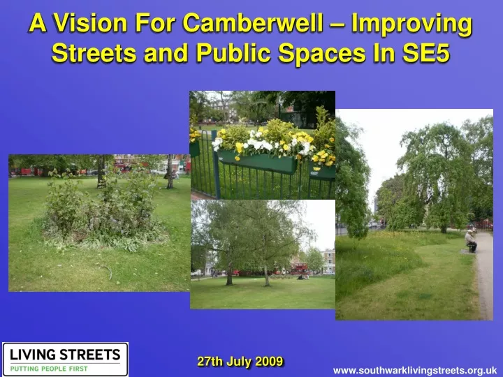
This document outlines a vision for improving the streets and public spaces in Camberwell, SE5. It includes proposed improvements such as creating green corridors, reducing vehicle capacity, and enhancing pedestrian safety. The goal is to create a more pleasant, safe, and accessible environment for residents and visitors.

E N D
A Vision For Camberwell – Improving Streets and Public Spaces In SE5 27th July 2009 www.southwarklivingstreets.org.uk
Vision for Camberwell – Jan 2008 Impetus given by Area-Based Scheme Other new initiatives likely in SE5 in the next 5 to 10 years Background. • Draws together work and ideas from…
All Collisions Pedestrian Collisions Pedal Cycle Collisions Key Driver - Reducing Danger From Motor Vehicles. • The road casualty data that accompanied the recent Southwark Council Road Safety Plan Review shows the high levels of road traffic danger on Camberwell’s main roads.
Long complex crossings - the mouth of Denmark Hill Crowded pavements - Camberwell Church St. Crowded pavements - Denmark Hill – west side. Improving Camberwell Town Centre – The Issues. • Focus is on: • Increasing space for pedestrians. • Making crossings safer and more direct; removing the guard-railing. • Reducing the speed limit to a maximum of 20mph. • Improving the town centre environment by planting trees, improving the lighting and providing more seating. • Creating pleasant public spaces where people can sit and spend time.
Wider pavements needed on: • Camberwell New Road (along to Camberwell Station Rd). • Camberwell Church Street • Denmark Hill (key walking route to the Hospitals) • Junction improvements and easier crossing needed at: • Camberwell Green • Coldharbour Lane • Champion Park Improving Camberwell Town Centre – Proposed Improvements. 20mph speed limit within the town centre area.
The Northern Gateway – Camberwell Rd The Southern Gateway – Denmark Hill The Gateway Roads Into Camberwell. • Both roads suffer from excess road capacity (Camberwell Rd is at least 6 lanes wide!). • This creates high speeds and high levels of casualties. • The proposed approach is to create attractive boulevards with: • Reduced capacity for vehicles. • Tree planting along the centre of the road and on the pavements. • Protected cycle lanes. • Enforcement of speed limits through average speed cameras.
The Southern Gateway – Denmark Hill from Red Post Hill to Champion Park.
The Northern Gateway – Camberwell Road from Albany Rd to Camberwell Green.
Linking Up Green Spaces – The Opportunities. • Developments north of Camberwell to create a criss-cross of “Green Links” or “Green Corridors” throughout the areas of East Walworth and Borough & Bankside. • Goals of: • increasing physical activity through walking and cycling • creating safe environments for adults and children to move around their area and improving the local environment • increasing bio-diversity. • Ideal is to create pleasant, quick, direct and safe routes right up to the river.
A formal and safe crossing is needed between Lomond Rd to Burgess Park. • At present access is poor from Myatts Fields to the town centre and to the north to owing to : • Lack of pleasant and direct routes. • Severance for pedestrians and cyclists from the Knatchbull Rd mini-roundabout. • Lack of safe crossings and attractive environment on Camberwell New Rd. ? • Green links and corridors could be created to connect: • Brunswick Park and Burgess Park via Edmund St and Benhill Rd. • Burgess Park and Camberwell Green via Lomond Grove. • Between Brunswick Park and Camberwell Green. ? Linking Up Green Spaces – The Proposed Improvements.
Wasted space around the Green. Camberwell Road – unused capacity Wren Rd. Daneville Rd - pocket park. Regenerating and Improving Public Spaces.
Artichoke Place is a VERY poor entrance to the Leisure Centre. Kimpton Rd Regenerating and Improving Public Spaces. Creating a piazza by the Leisure Centre.
Southampton Way. Camberwell New Road – Clarendon Terrace. Crossthwaite Avenue. Vestry Road. Encouraging Local Shopping Centres.
Datchelor Place - important entrance to the D’Eynsford Estate. Valmar Rd Orpheus St Planted road closure (with cycle access) between main road and residential street in Wimbledon. Pedestrian route into Kings from the west. Problem Places & Opportunities.
Summary Map Of Improvements. Map Of Proposed Improvements Proposed Improvements By Location • Camberwell Rd – create boulevard. • Burgess Park to Camberwell Green – green corridor. • Brunswick Park to Burgess Park – green corridor. • Brunswick Park to Camberwell Green – green corridor • East side of the Green – remove tarmac; greening. • Artichoke Place – remove car park and fence. • Kimpton Rd – close junction with Camberwell Church St. • Camberwell Church St – widen pavements (esp by bus stops), improve crossings, lower vehicle speeds. • Wren Rd – green/walking link to Butterfly Walk. • Daneville Rd – pocket park. • Orpheus Rd – Remove blank walls; integrate into town centre. • Camberwell Green Junction – narrow and make all crossings safer. • Denmark Hill – widen pavements; make crossing safer right up to Champion Park. • Myatts Fields – remove mini-roundabout; improve links to town centre and north. • Valmar Rd – close to through traffic. • Love Walk – formal crossing over Denmark Hill to bus stops. • Coldharbour Lane junction – improve crossing. • Improve pedestrian access to KCH from the west. • Denmark Hill (by KCH and Maudsley) improve crossing throughout this stretch. • Champion Park junction with Denmark Hill – crossing improvements. • Denmark Hill towards Herne Hill – create boulevard. • Southampton Way – range of improvements to promote local economy and improve the environment. • Camberwell New Rd – safeguarding and promoting access to the shops by Councillor St. • Crossthwaite Avenue. Improved signage for local shops. • Datchelor Place – Remove from red route; create attractive space 22 1 3 2 23 4 5 6 7 14 25 12 8 9 13 10 11 17 16 15 19 18 20 21 24