Download
1 / 15
150 likes | 287 Views
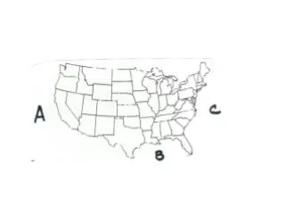
Ocean Currents of the Eastern Gulf of Mexico Robert H. Weisberg Professor, Physical Oceanography College of Marine Science University of South Florida St. Petersburg, FL 33701 http://ocgweb.marine.usf.edu http://comps.marine.usf.edu http://www.seacoos.org http://efsis.rsmas.miami.edu

E N D
Ocean Currents of the Eastern Gulf of Mexico Robert H. Weisberg Professor, Physical Oceanography College of Marine Science University of South Florida St. Petersburg, FL 33701 http://ocgweb.marine.usf.edu http://comps.marine.usf.edu http://www.seacoos.org http://efsis.rsmas.miami.edu 4/3/06
Physical Oceanography • The study of the ocean circulation, how the water moves and how the ocean and atmosphere interact. • Large-scale, Deep-Ocean Circulation • The Gulf of Mexico Loop Current, Florida Current, Gulf Stream system. • West Florida Continental Shelf Circulation • The local, shallow water circulation driven by winds and surface heating/cooling.
The large-scale, deep-ocean circulation (red arrows) around Florida.
Methods Analyses from satellite data Simulations using models Direct observations
Sea surface currents (arrows) superimposed on sea surface height (with red indicating high and blue low). The height is obtained by satellite altimetry, and the currents are calculated using the geostrophic approximation, wherein the currents tend to flow along lines of constant pressure (height).
Particle Trajectories for Multiple Launch Sites Superimposed on a Sea Surface Temperature Analysis A one week hindcast and a one week forecast are updated weekly, in this case for 1/11-1/25/06 and calculated on 1/18/06. We use geostrophic currents analyzed from SSH integrated in time and apace.
Particle Trajectories for Multiple Launch Sites Superimposed on a Sea Surface Temperature Analysis A one week hindcast and a one week forecast are updated weekly, in this case for 2/15-3/1/06 and calculated on 2/22/06. We use geostrophic currents analyzed from SSH integrated in time and apace.
Model simulation of the eastern GofM circulation driven by both the LC/FC/GS system and local winds and heat flux. Shown are surface V superimposed on SST.
Nowcast/Forecast Model Updated daily, we run a one day hindcast followed by a 3.5 day forecast. Results at different levels may be retrieved and plotted interactively. http://ocgweb.marine.usf.edu
WFS In-situ Observations http://comps.marine.usf.edu http://ocgweb.marine.usf.edu
Seasonal Circulation Patterns on the WFS “Climatological (3-yr) currents” superimposed on climatological (5-yr) SST reveals upwelling in fall through spring and downwelling in summer.
The WFS currents are fully three-dimensional: Particle trajectories at the surface are much different from those near the bottom.
Cold, nutrient-rich water upwells onto the shelf by the combined effects of local and LC forcing. 18º (A) Bottom Ekman layer currents transport these waters to the coast. (B)
Summary • 1. The eastern G of M deep-ocean circulation consists of the LC/FC/GS system, which is always present. Materials entrained in the LC can quickly flow through the Florida Straits with proximity to the Florida Keys and the east coast. • 2. The West Florida Shelf circulation is driven mainly by winds and surface heating. The currents vary seasonally and are fully three-dimensional, with the near bottom circulation accounting for the across shelf transport of nutrients from the deep-ocean. • 3. An understanding the shelf ecology must begin with an understanding on how the currents distribute water properties (nutrients, fish larvae, pollutants, etc.). • 4. Given the shelf width and the nature of the currents, arbitrary distances from land are not in themselves sufficient indicators of environmental safety.