Download
1 / 34
340 likes | 346 Views
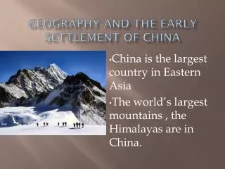
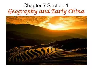
Geography and Early China. Section 1: Geography and Early China. How does China’s geography affect the culture?. Continents of the World. Label the continents. Where is China located?. Where is China located?. In your groups, begin filling out your KW charts.

E N D
Section 1: Geographyand Early China How does China’s geography affect the culture?
Continents of the World Label the continents. Where is China located?
In your groups, begin filling out your KW charts. Use your knowledge of China’s geographical location to help you to come up with questions about this civilization. Use your knowledge of other ancient lands that we have learned about thus far to spark some questions.
China Guessing Game • US Population: • China Population: • In the United States, how many cities are there with over a million people? • In China, how many cities are there with over a million people? 311,067,033 1,331,460,000 9 160
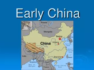
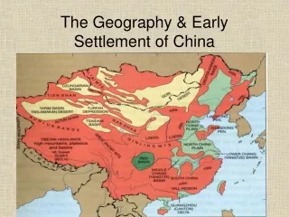
Physical Map: China What geographical features do we notice? How might these geographical features affect Chinese culture?
Section 1: Geographyand Early China Read pages 160-161. How does China’s geography affect the culture?
Geographical Features of China: • Islands: • Deltas: • Deserts: • Mountains: • Rivers: • Peninsulas: • Plateaus: • Plains:
Geographical Features of China: • Islands: A land mass completely surrounded by water. • Deltas: An area of land formed by deposits of silt as a river empties into the sea. A delta often has fertile land which is good for farming. • Deserts: A dry, barren region that can support little or no vegetation. • Mountains: A natural elevation of the earth’s surface higher than a hill. • Rivers: A relatively large natural stream of water. • Peninsulas: A long, narrow piece of land that projects into water from a larger land mass. • Plateaus: A leveled expanse of elevated land. • Plains: An extensive region of level, treeless land.
Chinese Rivers The Chinese civilization first began in northern China in the valley of Huang He (hwang huh), or the Yellow River. How do you think the river got its name?
Huang He (Yellow River) • What would be some reasons as to why the Chinese Civilization began in the valley of the Huang He?
Huang He (hwanhng huh) Yellow River Why do you think the Chinese civilization first arose in northern China in the valley of the Yellow River? (Think about Egypt and the Nile). How do you think the Yellow River got its name?
Huang He (Yellow River) • 3,000 miles long in northern China • Floods and leaves behind silt • Floods can be very dangerous and sometimes the river is called the “China’s Sorrows.”
Chang Jiang or Yangzi • River in central China • Longest river in Asia • These two rivers helped increase contact between different parts of the country.
Chinese Mountains • Changbai Mountain
Mountain Ranges • To the west are mountain ranges (the Himalayas) that protect China from western invasions. • There are other smaller mountain ranges within the country, one being the QinlingShandi which separates the north from the south.
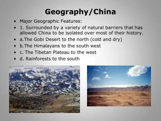
Physical Map: China Why do you think that early Chinese civilization was isolated from the rest of the world?
Chinese Plateau Leoss Plateau
Gobi Desert • A harsh desert • Provides a barrier between China and its neighbors to the north • Helps to protect China from invasions from the north
Eastern Plains • These plains are “one of the world’s largest farming regions.” • Allowed for a farming economy to begin in China • The Pacific Ocean provides a natural barrier along the east.
Farming: • Farming begins as a result of China’s climate and the fertile soil along the banks of rivers. • The Chinese grew rice, as well as millet and wheat. • People also fished and hunted to supplement their diet. • They also had domesticated animals. • Food surplus and variation =population growth. • Over time Chinese civilization developed and became more advanced.
Weather and Climate • The climate of China is very varied across the continent. • Some areas are very dry, others are well suited for crops, and some are very wet due to monsoons.
Begin filling out your study guide. Be sure to list the page number as to where you find your information. • Why is the Huang He (Yellow River) called China’s sorrow? • What kinds of crops are grown in China?