Download
1 / 13
150 likes | 231 Views
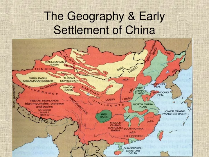
The Geography & Early Settlement of China. Outer China. - includes western & northern parts (Tibet-Qinhai Plateau, two deserts, & low hills/plains in the northeast) Inner China - includes southeastern part of China (North China Plain & Chang Jiang Basins) . Tibet-Qinghai Plateau.

E N D
Outer China - includes western & northern parts (Tibet-Qinhai Plateau, two deserts, & low hills/plains in the northeast) Inner China - includes southeastern part of China (North China Plain & Chang Jiang Basins)
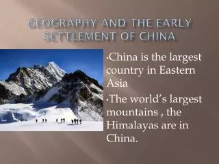
Tibet-Qinghai Plateau • Rocky land surrounded by towering mountains – average elevation is 2 miles above sea level • Climate is very cold – air is thin & dry • China’s major rivers begin in this area - Huang He (Yellow River) - Chang Jiang (Yangtze River) • Difficult to live here because of bad climate & challenging terrain
Northwestern Deserts • Harsh places to live & difficult to travel • Summers are sizzling hot while winters are below freezing • Only places to grow crops or raise animals are near oases (where water is found) Talamakan Desert – 105,000 sq. miles - very dangerous because of shifting sand dunes & sandstorms Gobi Desert – 500,000 sq. miles - has few sand dunes, most of desert is stony
Natural Barriers for China Above - Tibetan-Qinghai Plateau Right – Gobi Desert Above – Taklamakan Desert
Northeastern Plain • Land of low hills & plains • Vegetation is mostly prairie grass • Two main rivers 1. Liao – shallow river 2. Sungari – deeper • Short/warm summers & cold/dry winters • In south, a narrow plain links this area to rest of China – invaders used this to get to Inner China
North China Plain • Flat region of grassland in Inner China • “Land of Yellow Earth” – ground covered by yellow limestone silt • Huang He (Yellow River) is one of the longest rivers in the world – also very muddy • River has been good & bad for Chinese Good – silt fertilizes the land for farming Bad – flooding causes much damage & loss of life
Chang Jiang Basins • Low, wet coastal plains located along Chang Jiang River • River is longer than Huang He with many tributaries(streams that feed into rivers) • River is good for: - trading - farming
China’s Famous Rivers Chang Jiang River/Yangtze River Also known as the “Long River” Huang He/Yellow River
Early Settlement & China’s Isolation • Remains of the first inhabitants were found in northeastern China in the 1920s • When Chinese began farming, they settled mostly on North China Plain in Inner China • China’s geography kept it very isolated - mountains, rocky plateau, & cold weather in southwest - deserts in northwest - only narrow coastal plain linked northeastern China to Inner China
Life in Outer China • People living in Tibetan Plateau, the Northwestern Deserts, & the Northeastern Plains were mostly nomadic • Raised livestock like yaks, sheep, goats, cattle, & horses • Grew some crops like cotton, winter wheat, & maize (a type of corn)
Life in Inner China • People grew wheat & millet (type of grain) • Raised cattle, sheep, oxen, pigs, & chickens – also herded water buffalo & horses • People built permanent homes • Rice thrived in the warm, wet areas of the Chang Jiang Basins