Download
1 / 54
550 likes | 745 Views
Working Group on Nowcasting Research Report. Paul Joe WWRP JSC 21-24 Feb 2011 Geneva. Outline. CAS XV/Gaps Committee Symposia Advancing the Science - FDP/RDP’s Capacity Building Related Projects Specialty Meetings New Initiatives Lake Victoria South East Asia INCA – CE

E N D
Working Group on Nowcasting Research Report Paul Joe WWRP JSC 21-24 Feb 2011 Geneva
Outline • CAS XV/Gaps • Committee • Symposia • Advancing the Science - FDP/RDP’s • Capacity Building • Related Projects • Specialty Meetings • New Initiatives • Lake Victoria • South East Asia • INCA – CE • Regional Training Center for Nowcasting (Brazil)
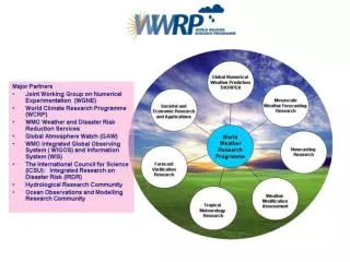
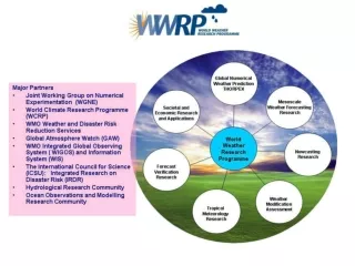
Gaps and CAS XV Decisions • “Advise, promote, advance, publish, convene, capacity build” • Advancing the Science • Expanding the accuracy, precision, predictability/blending, heuristic, data assimilation and high resolution models • Applications: Convective weather/initiation, multi-element, winter, complex terrain, hydrology, aviation • Observational science, measurement errors for nowcasting (in situ, remote sensing – radar QC and QPE), • Understanding (conceptual models; complex terrain, etc) • Hydrology Links - MAP-D Phase (coupling) and INCA-CE FDP? • Integrated Nowcasting: Satellite rainfall and nowcasting, lightning nowcasting (particularly related to developing countries), • Forecast systems: decision making and system design in the nowcast process; links to PWS and operations, system design, seamless (links to aviation, hydrology, etc) • OPERA Radar Data Exchange (Nowcasting Requirements) • Technology and knowledge demonstration
Committee Membership Ttom Keenan Steve Goodman Thomas Haiden Ted Nakazawa Augusto Pereira Paul Joe Slobodan Nickovic Alan Seed Jenny Sun Marianne Koenig Jian Jie Wang Peter Li Jim Wilson(a)
Convene Nowcasting Symposia WSN05 Toulouse, France, Meteo-France, Stephane Senesi WSN09 Environment Canada, Whistler, BC, George Isaac/Paul Joe QPE/QPF 3, Nanjing, China, Oct 2010, Brown/Lu WSN12 Rio de Janiero, INPE/USP, Augusto Pereira 20-24 August 2012
Promote, Advance, Capacity Build FDP / RDP’s Initiatives Sydney 2000 1999-2002 To demonstrate the capability of modern forecast systems and to quantify the associated benefits in the delivery of very short term weather forecasts Mesoscale Alpine Programme (MAP) Demonstration of Probabilistic Hydrological and Atmospheric Simulation of flood Events in the Alpine region entire forecasting chain ranging from limited-area ensemble forecasting, high-resolution atmospheric modelling (km-scale), hydrological modelling, and nowcasting to decision making by the end users, i.e., an end-to-end forecasting system MAP D 2005-2008 Implement advanced high impact weather and precipitation nowcast systems providing an enhance weather service for B08 with demonstration of impact Beijing 2008 2005-2009 Capacity Building Workshop - early 2012 Initiative to drive journal publications.
2010 Nowcasting Initiatives Shanghai World EXPO 2010Nowcasting Service Demonstration Project (WENS)2008-2011 In the context of the multi-hazard early warning systems (MHEWS), to demonstrate how nowcasting applications can enhance short-range forecasts of high-impact weather using the opportunity afforded by the World EXPO 2010 SNOW-V10 RDP 2009-2011 Focus is to improve our ability to produce short term or Nowcasts (within 6h) of high impact winter weather over complex terrain in association with the Vancouver 2010 Olympic and Paralympic Winter Games. Sochi2014 RDP/FDP ? WENS Capacity Building Nov 2011 SNOW-V10 Final Seminar 2012?
Warm start reduces the cross-over point in blended systems! B08: Too low to be useful for “call to action” decisions Benjamin et al, WSN09
Predictability is a function of scale! Alan Seed
Capacity Building Workshops Sydney 2000 Australia Brazilia, Brazil 2003 Palm Cove, 2006 Asia-Pacific Region Pretoria, 2005 South African Weather Service
Other Related Projects WENS • Joint Nowcasting, Applications and Service (JONAS) • CBS/PWS • WWRP co-chair • Test Beds • Service • Commission of Instruments, Methods and Observations • Radar Quality Control and Quantitative Precipitation Estimation Inter-comparison Project • 14-15 April 2011, Exeter • RQQI pronounced Rickey Non-QC QC Perfect Radar
Forecast SystemsScience, Process, Production and Service • Forecasting Systems and End User Requirements-Definition of outputs and functionality • nowcasting • short-medium term • hydrology • advanced user needs and capacity building; • Requirements for Forecast Process and Decision Support for Forecasts and warnings • Using Guidance and Observations, NWP, EPS Use, MOS Direct Model output • Conceptual models • Integration of Decision support in meteorological Process • Visualisation • Verification • Training with emphasis on process use of applications and systems • Man Machine Mix Issues- • Optimising Role of human in forecast process and potential of NWP/Automation • Approaches to Forecast System development • (manual, matrix, object grid etc) • digital forecast databases, user interaction etc • Forecast Sub-Systems and Applications • Automatic Text generation • Graphical product • Dissemination and communication techniques • Potential contributors to the meeting should be decided upon by CAS and CBS. • In principle agreement was obtained at the 8th WWRP SSC (2005) to conduct a technical forum of invited experts to facilitate the development of a position paper on Forecasting Systems. • Little progress, priority and funding • How to progress this?
JONAS MissionCBS/PWS + WWRP Increase the capacity of NMHS’s to deliver reliable nowcasts to enable informed decision-making in mitigating the effects of high impact weather and weather-related disasters. Links for legacy of WGNR
Specialty MeetingsClosing the Gap /Advancing the Science • Mesoscale-Nowcasting Working Group Specialty Meeting • Meeting approved • Boulder, Colorado • Dates 2011 TBD • Jenny Sun and Dale Barker • High Resolution, Spin up, Parameterizations, Data Assimilation • 2nd Heuristic Nowcasting • Meeting approved by WGNR • Montreal, Canada • Dates TBD 2012 • Alan Seed and Isztar Zawadzki • Probabilistic/Ensemble Nowcasting • Blending • Phase and Intensity
Lake Victoria Project • Executive Council approves recomendation to develop research project • Basin dynamics • Generation of HIW • How to save lives • Dr. Samwei Marigi/Dr. Dave Parsons • Fisherman have no radios, dissemination an major issue -> cell phones • Need for Conceptual Model • Data Sparse • Option 1: • SERVIR • Option 2 • Radar deployment to demonstrate benefits (forecast skill and user benefits) • Related Projects • Severe Weather Forecast Demonstration Project (SWFDP) in implementation phase • Mobile Weather Alert (MWA) Pilot • Many more… (project overload) • Radar status unclear (Uganda, Tazania) • Severe weather Service Gaps • Knowledge • Observation • Understanding (Nocturnal thunderstorms • Technology (Lake surface temperature; CASA, OTG) • Piggy back on SWFDP (later than sooner) • JONAS or WWRP (WGNR, WGMW, SERA) to fill understanding gap first • Expert Team Visit required • Fisherman • Deaths (5000 deaths/yr) • Warning Service?
Lake Victoria Events • In May 1996, a passenger ferry M.V. Bukoba capsized while on its way to Mwanza in Tanzania killing around 800 people • MV Kabelega sunk on 8th May 2005 and though no life was lost, consumer produce in the tune of 800 tons was lost. • Grounding of M.V. Thor at Ghana island on 24th March 2006 loaded with 300,000 litres of petroleum products • Capsizement and sinking of M. V. Nyamageni on 21st April 2006 • In 22nd July 2010.Passenger boat capsized on Ugandan side of the lake and 50 people are feared dead. Survivors tale of strong waves that hit the vessel, shattering it into pieces. • 200,000 fisherman and 5000 deaths per year Samwei Marigi
Lightning due to thunderstorms in weak forcing situations (Lake Breeze) Daytime Nocturnal Albrecht, Goodman
Mobile Weather Alert Project Objective: Utilise mobile phone technology to develop a sustainable warning service that reduces the vulnerability of communities in the Lake Victoria Region to weather hazards. Tom Butcher Mobile Weather Alert: Community weather information via mobile technology
(1) Integrated Observations (2) Severe Weather Forecasting (3) Communication via mobile phone (4) Stakeholder Engagement (5) Socio-economic benefits analysis Key Outcomes • Drawing upon Severe Weather Forecasting Demonstration Project and other initiatives, clearly defined processes for the delivery of pilot warnings and forecasts established and implemented. Q: Any existing “call to action” warning service? Q: Knowledge of localize severe weather? Technology? Radar? Need to assess capabilities, service, knowledge, modes of collaboration! Tom Butcher Mobile Weather Alert: Community weather information via mobile technology
Discussion CASA: Off The Grid Radar (UPR) “solar” Low Cost Low infrastructure Low Maintenance ??? • WGNR providing support to the MWA to demonstrate how/which satellite products could be used (already EUMETSAT training done) • Need to assess situation on options (Sat-Lightning demonstration; Understanding field/forecast project). • Piggyback and extend on SWFDP and MWA projects; WWRP join next science/planning meeting? • Note – many projects in the area! Sandra Cruz-Pol, UPR Need feedback. KMD waiting for WMO/WWRP response
South East Asia Cairns, 2007 • Contact by staff member of VHMS (HP Lam) to conduct a FDP in Vietnam • Weather Radar Modernization • Email/Phone discussions • Finnish Met Institute is providing aid to Vietnam • SWFDP in formulation stage • NWG piggyback and fill gap of SWFDP (0-12) • MWG piggyback and fill gap of SWFDP (6-12) • Many unknowns • culture gap, • technology gap • Service gap • knowledge gaps • JONAS Activity • Expert Team Visit 2010-2020 Existing Proposed
> 100 Thunderstorm Days > 100 days in all regions of Vietnam NCHMF – no tools for nowcasting (TITAN/TIFS)
Suggestion for Next Steps • FMI did a good review and assess about current status of VHMS nowcasting system • FMI is going to do some training courses of radar using and interpreting in 2011 • What should be done next? • More training with real events of Vietnam after modernization project (when radars, AWS, automatic raingauge and NWP products… are available) • Improve nowcasting system in Vietnam from National to Regional and even Provincial levels by setting up a easy-to-use system. • Radar data sharing between neighbour countries. CBS/PWS initiating a SWFDP in this area Joint SWFDP/WWRP with Nowcasting component under JONAS umbrella? Need to assess the warning, knowledge, technology, etc
INCA -CE Explore possibility to be WWRP FDP? Yong Wang
Brazil: RTC-N/Test BedAverage of 20 floods per year in Sao Paolo 800-1000 deaths Serrana Jan 2011
Regional Training Centre - Nowcasting • Request made several years ago (Augusto Pereira/USP) • Envision an advance course/post basic training on nowcasting - severe weather, urban, hydrology • Housed at U of Sao Paolo • Classrooms, radar facilities • Target – South America • Invite “S2K/B08” systems and experts • Opportunity: FDP or Test Bed for nowcasting systems ?? – focus on urban, hydrology HIW Detailed project concept and implementation plan being prepared.
Radar Modernization Support by Ministry of Science and Technology. Interested in FDP/Testbed in Rio de Janiero and Sao Paolo. Pilot FDP using CARDS. Visit Canada in March. RTC-N -> Nowcasting (Verification, SERA) Test Bed Feedback from JSC?
Discussion • Forecast Systems Workshop • Lake Victoria • South East Asia • South America Regional Training Centre – Nowcasting / FDP / Testbed
Nowcasts leads to a “call to action” Met. Information VSRF (Anal+NWP) >caution Nowcast (Anal) >warning SRF(NWP) >Outlook Cancel warning Local Government Action for disaster prevention Action for recovery Ready to take action Stand by Back to normal (recovery) Citizen Keep in mind evacuation preparation 1-2 days before 3-6 hours before 1 hour before Is the skill of our forecast fulfilling their needs? disaster (Flood/Landslide) Precip. Intensity Courtesy, Shingo Yamada JMA
Mandate of WGWWRP Strategic Plan • Advise • Promote Nowcasting • Advance the Science • Publish and Convene • Capacity Build and Technology Transfer
Variational Doppler Radar Analysis System Temperature Perturbation, Winds, 35 dBZ Echo Nowcast Jenny Sun
Impact of Radar Data on NWP HRRR reflectivity verification Skill vs. forecast length All HRRR forecasts Radar CSI No Radar Forecast Length 30 dBZ reflectivity on HRRR 3-km grid Verification period 23 June – 25 Aug 2008 Weygandt et al WSN09 WSN09 Evaluation of the High Resolution Rapid Refresh (HRRR): an hourly updated convection resolving model utilizing radar reflectivity assimilation from the RUC/RR Steve Weygandt, Stan Benjamin, Tanya Smirnova, Curtis Alexander, Doug Koch, John Brown, Kevin Brundage, Barry Schwartz, Ming Hu, Susan Sahm, Brian Jamison NOAA ESRL
Impact of Radar Data on NWP ECMWF 1d+4dVAR 12h Window T511 L60 20May-20 June 2005 Hourly RR 4 km NCEP grid Rain-1d VAR, moisture increments vertically integrated for pseudo TCWV-assim-with 4DVAR New-CNTRL 4dVAR TCWV analyses Well structured drying and moistening Forecasts: Clear improvement over NA first 3 days Improvement over Europe days 7-8
Current Use of Radar in DA Partial list of international research efforts into the use of radar data in operational NWP systems
Proposed SWFDP – Eastern Africa (status/progress) WMO • Project develop in progress • Focus on: • Strong winds • Heavy precipitation • Hazardous waves (Indian Ocean and Lake Victoria) • Users: general public, agriculture and fishery communities • Domains: (TBC) • 5E – 55E; 30N – 25S (for monitoring, analyzing, predicting and verifying the various severe weather events) • 31E – 36E; 2N – 4S (for the Lake Victoria) • Global Centres: ECMWF, UKMO, NOAA/NCEP (NWP guidance material) • Regional Centre: RSMC Nairobi, supported by TMA, UKMO and DWD • National Met. Centres:Kenya, Tanzania, Uganda, Burundi, Rwanda and Ethiopia • Possible start-up 2011 Provides “outlook” Peter Chen
SWFDP – improving forecasts and warnings • Severe weather: heavy rain, strong winds • Forecast range: up to day-5 (increased lead-time) • Forecasting (GDPFS), warning services (PWS), Agriculture (incl. Fishery-Lake Victoria, AgM) • High-impact focus (flash-flooding, wind damage, dry-spells) • Forecast Verification • Other developments (phased-in) • Technological gaps: • Tropical convection, rapid on-set, localized events • Lack of forecasting tools in the very-short-range (< 12h) • Little or no radar coverage, few real-time observations
Understand the weather dynamics over the lake Flash Flood Guidance MH-EWS Dissemination of Weather Information WWRP HWR General Public, nearshore vessels, Media and Disaster Management PWS + HWR Global NWP/EPS Global Centres (ECMWF, Met Office (UK), US African Desk, DWD) National Met Centres (Kenya, Tanzania, Uganda, Rwanda, Burundi, Ethiopia) Guidance Products RSMC Nairobi Farmers and fishermen PWS AgM LAM, Ver. DWD, UKMO, TMA MMO + AeM Navigation and Rescue AgM GDPFS WMO SP Tailored forecasting products for farmers and fishermen (e.g. statistical downscaling) Satellite Imagery and Tools Proposed SWFDP – Eastern Africa
Satellite Detection 12 12 Radar Detection 9 9 6 6 Height (km) 3 3 Time CI Forecast without satellite CI Forecast with satellite Lightning Initiation: Conceptual Idea What is the current LI forecast lead time? Up to ~60 min added lead time for LI using GOES Lead time increases with slower growing cumulus clouds (i.e. low CAPE environments) 30-45 min to 75 min LI Forecast? 42 John Mecikalski/ UAH
World Wide Lightning Location Network (WWLLN) Operated by U. Wash. 50 + sites worldwide Potential for site in Kenya 43 Bob Holzworth
SERVIR Collaboration between NASA and USAID to enable the use of earth observations and models for timely decision making to benefit society • Data and Models • Online Maps • Visualizations • Decision Support • Training • Partnerships Training and Capacity Building Flood Forecasting in Africa Mapping Fires in Guatemala Mexico A. Limaye/D. Irwin MSFC
SERVIR Hydrologic Modeling Nzoia River in the Lake Victoria Basin Modeled Evapotranspiration CREST model Spatially distributed hydrologic model CREST, developed by University of Oklahoma Based on Variable Infiltration Capacity (VIC) model Spatial resolution ~1km Uses near real-time satellite rainfall estimates from TRMM to produce soil moisture, evapotranspiration and streamflow SERVIR-east Africa makes real time model outputs for a watershed in Lake Victoria basin A. Limaye/D. Irwin MSFC
SERVIR Hydrologic Forecasting • Work in underway to expand the spatial extent of CREST runs to Kenya Meteorological Department (KMD) domain (~2000 x 2300 km) • Spatial resolution: 1km • KMD rainfall and temperature forecasts, available hourly at 1/8 spatial resolution, to provide boundary conditions. • Forecasted soil moisture, evapotranspiration and streamflow will enable KMD to issue early flood warning, especially in the flood prone watersheds in western Kenya. • KMD intends to use the modeled fields to initialize the next model run A. Limaye/D. Irwin MSFC
Nowcasting in Vietnam • July 2010, Hanoi – Thunderstorm and Heavy Rain • Data: • Satellite images (MTSAT, FY2): about 15 minutes/image • 3 reflectivity radars: Việt Trì, Phủ Liễn, Nội Bài • synoptic observations (every 3 hours or telephone (if required)) • 15 automatic rain-gauges (since Oct 2010) • Information Transmission to Public: • NCHMF Website • Radio channel (Voice of Vietnam – VOV) (live interview)