Download
1 / 49
490 likes | 613 Views
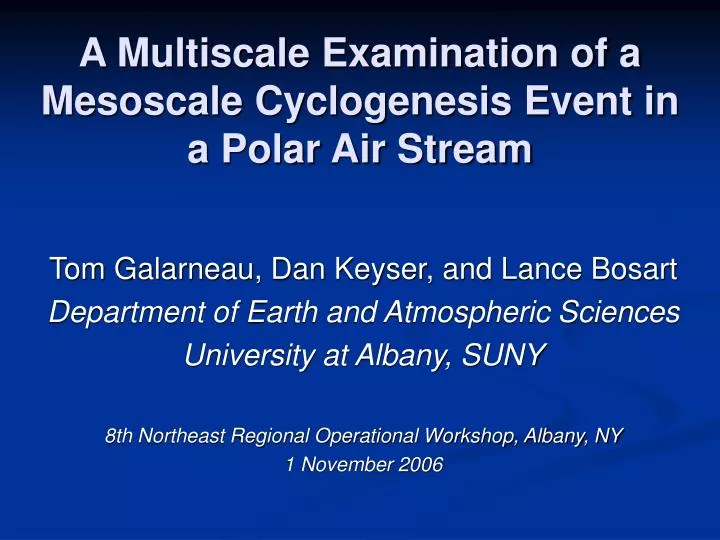
A Multiscale Examination of a Mesoscale Cyclogenesis Event in a Polar Air Stream. Tom Galarneau, Dan Keyser, and Lance Bosart Department of Earth and Atmospheric Sciences University at Albany, SUNY 8th Northeast Regional Operational Workshop, Albany, NY 1 November 2006. Motivation.

E N D
A Multiscale Examination of a Mesoscale Cyclogenesis Event in a Polar Air Stream Tom Galarneau, Dan Keyser, and Lance Bosart Department of Earth and Atmospheric Sciences University at Albany, SUNY 8th Northeast Regional Operational Workshop, Albany, NY 1 November 2006
Motivation • Heavy snow with thunder reported across eastern PA, NJ, and LI on 5 April 2006 • Review during “Friday Map Discussion” revealed two comma-cloud structures and led to arguments on whether these were true polar lows • Investigation in graduate “Extratropical Cyclones” class (spring 2006) indicated the involvement of a coherent tropopause disturbance (CTD) in the evolution of the polar lows
Storm Tracks 00Z/25 X CTD Polar Low 1 Polar Low 2 06Z/05
CTD Structure Fig. 11a from Hakim (2000) Fig. 10c from Hakim (2000) DT (K) DT anomaly (K) Ertel PV (PVU) (K)
CTD Example 300 hPa Height, Temp, DT , Wind, 850 hPa Hakim (2000)
The Polar Low Spectrum Rasmussen and Turner (2003) Reed (1979) Trough system Boundary-layer front Comma cloud Cold low Reverse shear Orographic Forward shear Adapted from Rasmussen and Turner (2003); originally suggested by Emanuel in 1986
Polar Low Timeline Instability lows near Norway Cold air depressions near British Isles Satellite studies of comma clouds Baroclinic instability suggested mechanism 1950 1960 1975 High latitude TC-like lows Instability lows obtain fronts 1st comprehensive observational study using sfc/upper air Lows occur in cold unstable air mass over warm ocean Conditional Instability of Second Kind (CISK) suggested mechanism Polar lows in NPAC, Sea of Japan, SH Idealized simulations Aircraft obs of Antarctic polar low 1976 1990 2000+ Comma clouds vs. ‘real’ polar lows Norwegian Polar Lows Project 1983–85 -Aircraft obs; climo; modeling Polar low Classification (1985–96) Studies using Scatterometer data WISHE processes CTDs Intense polar lows dubbed “Arctic hurricanes”
Polar Low Timeline Instability lows near Norway Cold air depressions near British Isles Satellite studies of comma clouds Baroclinic instability suggested mechanism 1950 1960 1975 High latitude TC-like lows Instability lows obtain fronts 1st comprehensive observational study using sfc/upper air Lows occur in cold unstable air mass over warm ocean Conditional Instability of Second Kind (CISK) suggested mechanism Pre-CTD Polar lows in NPAC, Sea of Japan, SH Idealized simulations Aircraft obs of Antarctic polar low 1976 1990 2000+ Comma clouds vs. ‘real’ polar lows Norwegian Polar Lows Project 1983–85 -Aircraft obs; climo; modeling Polar low Classification (1985–96) Studies using Scatterometer data WISHE processes CTDs Intense polar lows dubbed “Arctic hurricanes”
Businger and Reed (1989) Classification • Short-wave/jet streak type (baroclinic) • Form in polar air mass in wake of synoptic-scale cyclone in region of cyclonic vorticity advection • Comma-cloud structure • Arctic front type (baroclinic) • Form along continental arctic-maritime polar air mass boundaries • Comma-cloud structure • Cold low type (warm core) • Form in arctic air masses over warm oceans • Spiral-cloud structure
Goals • Examine large-scale environment • Document evolution of CTD and two polar lows • Relate to classification scheme in polar low spectrum
Data Sources • 1.0 GFS analyses • 32 km North American Regional Reanalysis • UAlbany surface/upper-air archive • GIBBS and RAL satellite archive • NCDC WSR-88D Level-II radar archive • National Lightning Detection Network • Dynamic tropopause (DT) defined as 1.5 PVU
1445Z/05 GOES-12 Visible 2 1
1745Z/05 GOES-12 Visible 2 1
2045Z/05 GOES-12 Visible 2 1
1145Z VIS
1445Z VIS
1845Z VIS
X 00Z/25 CTD Track Map X X 80 70 X 60 50 X 40 30 X X 00Z/04 X X X X 00Z/30 00Z/03 340 K isotherm on DT DT (K) and wind (kts) at 0000 UTC 5 April 2006
Large-Scale Summary • CTD extracted from high latitudes via two ridging episodes • Ridging near 160W on 30 March • Ridging over Intermountain West on 2-4 April • Two polar lows developed in association with CTD on 5 April in wake of synoptic-scale surface cyclone
00Z/05 DT (K), Wind (kts), 850 hPa (10-5 s-1)
03Z/05 DT (K), Wind (kts), 850 hPa (10-5 s-1)
06Z/05 DT (K), Wind (kts), 850 hPa (10-5 s-1)
09Z/05 DT (K), Wind (kts), 850 hPa (10-5 s-1)
12Z/05 DT (K), Wind (kts), 850 hPa (10-5 s-1)
15Z/05 DT (K), Wind (kts), 850 hPa (10-5 s-1)
18Z/05 DT (K), Wind (kts), 850 hPa (10-5 s-1)
21Z/05 DT (K), Wind (kts), 850 hPa (10-5 s-1)
00Z/06 DT (K), Wind (kts), 850 hPa (10-5 s-1)
00Z/05 1 925 hPa e (K), 925–500 hPa wind shear (kts), 850–500 hPa lapse rate (C km-1), cloud-to-ground lightning
03Z/05 1 925 hPa e (K), 925–500 hPa wind shear (kts), 850–500 hPa lapse rate (C km-1), cloud-to-ground lightning
06Z/05 2 1 925 hPa e (K), 925–500 hPa wind shear (kts), 850–500 hPa lapse rate (C km-1), cloud-to-ground lightning
09Z/05 2 1 925 hPa e (K), 925–500 hPa wind shear (kts), 850–500 hPa lapse rate (C km-1), cloud-to-ground lightning
12Z/05 1 2 925 hPa e (K), 925–500 hPa wind shear (kts), 850–500 hPa lapse rate (C km-1), cloud-to-ground lightning
100 100 200 200 OBS 0.5 GFS 300 300 500 500 700 700 ALB OKX 850 850 1000 1000 -30 -20 -10 0 10 20 30 50 40 -30 -20 -10 0 10 20 30 50 40 925 hPa e (K), 925–500 hPa wind shear (kts), 850–500 hPa lapse rate (C km-1), cloud-to-ground lightning 1 2 12Z/05
15Z/05 1 2 925 hPa e (K), 925–500 hPa wind shear (kts), 850–500 hPa lapse rate (C km-1), cloud-to-ground lightning
18Z/05 1 2 925 hPa e (K), 925–500 hPa wind shear (kts), 850–500 hPa lapse rate (C km-1), cloud-to-ground lightning
21Z/05 1 2 925 hPa e (K), 925–500 hPa wind shear (kts), 850–500 hPa lapse rate (C km-1), cloud-to-ground lightning
00Z/06 1 2 925 hPa e (K), 925–500 hPa wind shear (kts), 850–500 hPa lapse rate (C km-1), cloud-to-ground lightning
98 00 -2 02 -2 0 04 2 2 06 06 4 06 1 8 6 08 10 10 12 12 12 10 14 SLP (hPa) (C) 06Z/05
06Z/05 1 2
1145Z 02 0 -2 04 0 06 4 2 08 04 2 1 6 10 8 10 14 12 10 12 12Z/05 14 SLP (hPa) 12 (C)
12Z/05 1 2 1
1445Z 6 4 2 04 2 06 2 2 4 08 1 12 10 2 2 6 04 8 10 16 12 14 14 10 SLP (hPa) (C) 16 15Z/05
15Z/05 2 2
1845Z 6 8 2 04 4 4 4 2 6 2 1 12 02 10 8 2 10 06 04 6 14 12 08 06 14 16 16 SLP (hPa) 22 18 (C) 20 18Z/05
18Z/05 2
4 10 06 2 04 4 4 2 02 6 2 10 6 8 12 08 16 10 12 20 SLP (hPa) (C) 21Z/05
Summary • Two polar lows developed in wake of synoptic-scale surface cyclone • Formed downstream of CTD • Formed in surface baroclinic region • Formed in moist-adiabatic environment • Surface frontal structure developed during polar low evolution • Surface pressure minima formed beneath comma heads during polar low evolution
Concluding Remarks • The two polar lows exhibit characteristics of short-wave/jet streak type described in Businger and Reed (1989). • Are short waves discussed in previous polar low literature possibly CTDs? • Are moist-adiabatic environments associated with CTDs over land analogous to those resulting from flow of arctic air over warm ocean? • Can strong CTDs induce low-level vertical motion maxima and thus contribute to robust surface cyclogenesis via enhanced vortex stretching?