Download
1 / 23
240 likes | 493 Views
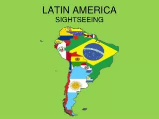
LATIN AMERICA. THE PHYSICAL GEOGRAPHY OF LATIN AMERICA. LATIN AMERICA: WHAT MAKES IT A REGION?. STRONG SPANISH AND PORTUGUESE INFLUENCE ON LANGUAGE AND CULTURE BLEND OF NATIVE AMERICAN, AFRICAN, AND EUROPEAN HERITAGE MOSTLY TROPICAL AND SUBTROPICAL CLIMATE

E N D
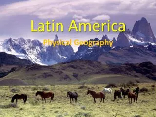
LATIN AMERICA THE PHYSICAL GEOGRAPHY OF LATIN AMERICA
LATIN AMERICA: WHAT MAKES IT A REGION? STRONG SPANISH AND PORTUGUESE INFLUENCE ON LANGUAGE AND CULTURE BLEND OF NATIVE AMERICAN, AFRICAN, AND EUROPEAN HERITAGE MOSTLY TROPICAL AND SUBTROPICAL CLIMATE WORLD’S LARGEST AREA OF TROPICAL RAINFOREST
LATIN AMERICA: THE LAND • KEY TERMS: • CORDILLERA • ALTIPLANO • ESCARPMENT • LLANO • PAMPA • HYDROELECTRIC POWER
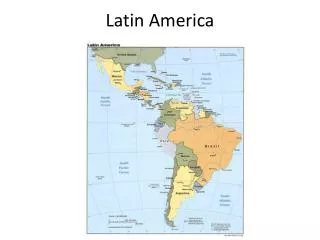
THE LAND • Western Hemisphere, South of the U.S. • 8 million sq.mi. • 16% of Earth’s surface • Middle America (Mexico to Panama) • Caribbean • South America- largest landmass in Latin America
MOUNTAINS AND PLATEAUS • Extension of the Rockies • Mexico- Sierra Maestra • Central and South America- Andes • Location on the Ring of Fire • Earthquakes and Volcanoes still affect the area • Why did people move there? • Cooler climates • Natural resources- water, volcanic soil, timber, and minerals • Rugged terrain = isolated communities
MIDDLE AMERICA AND THE CARIBBEAN • Sierra Maestra- Mexico, on the Mexican Plateau • The Carribean Islands • Are mainly volcanic peaks • Andes Mountains • 4,500 miles long covering the West Coast of S.A. • Longest and highest mountain range • Some peaks over 20,000 ft • Is a cordillera system- separate mountain ranges that run parallel to each other • In Peru • Andes encircle the altiplano, or high plain
THE BRAZILIAN HIGHLANDS • Eastern S.A.- broad plateaus and valleys • Ex: MatoGrosso Plateau • Brazil, Bolivia, Peru • Ex: Brazilian Highlands • Warm climate • Good for raising cattle • Ends in an escarpment- steep slope plunging into the Atlantic Ocean
LOWLANDS AND PLAINS • Brazil has the longest strip of coastal plain • Northeastern Brazil to Uruguay • Escarpment forces the Brazilian people to live on the coast • Llanos- inland grassland • Colombia and Venezuela • Pampas- in Argentina and Uruguay • Grazing land for cattle and livestock • Fertile soil- wheat and corn production
WATER SYSTEMS • Transportation of goods and people • Mostly in South America • Amazon River • Headwaters in the Peruvian Andes • Empties into the Atlantic • Over 4,000 miles long • Carries 10x the amount of water volume than the Mississippi • Paraná Paraguay and Uruguay Rivers • 2nd longest river system in Latin America
WATER SYSTEMS (cont) • Used for hydroelectric power • Rio Grande • Largest river in Middle America • A.K.A.- Rio Bravo del Norte • Panama Canal • Man made on the Isthmus of Panama • Used to get from the Atlantic to the Pacific • Lakes • Titicaca- Peru and Bolivia • Maracaibo- Venezuela (Oil fields)
NATURAL RESOURCES • Oil- Gulf of Mexico and Caribbean Sea • Orinoco River- (Venezuela)- Gold • Peru and Mexico- Silver • Colombia- Emeralds • Chile- Copper • Jamaica- Bauxite = aluminum
CLIMATE AND VEGETATION • KEY TERMS: • Tierra Helada • Puna • Tierra Fria • Tierra Templada • Tierra caliente • Canopy
ELEVATION AND CLIMATE • Climate affected more by elevation than location relative the Equator • Have vertical climate zones • Tierra Helada-Andes Mts • Puna- cold zone w/grass; cattle graze here • Tierra Fria • Potatoes and Barley • America’s highest climate zones • Tierra Templada • Coffee and corn main crops • Tierra Caliente • Bananas, sugar, rice, cacao
CLIMATE AND VEGETATION REGIONS • Most of L.A. is tropical w/lush vegetation • Tropical wet • Dominates most of the region • Rainfall from the prevailing winds = moisture from the Atlantic • Mostly lands in the Amazon Basin • Rainforests • Trees grow close to one another forming a canopy • Dense layers of leaves • Sunlight does not reach the floor • Many species live here
Tropical Dry • Southwestern Mexico, Caribbean Islands, and North Central South America • High temperatures, rainfall, drought • Soils not too fertile but flooding has helped move sediments
Humid Sub-Tropical • Southeastern South America • Short winters • Heavy rain during Summer • Short grasses • Today: Alfalfa, corn, and cotton
DRY CLIMATES • Northern Mexico, Peru, Chile, and Southeastern Argentina • Desert climate and vegetation • Ex: Atcama desert • In some places here rainfall has never been recorded • Vegetation • Cacti- due to lomas (dense sea fog) that comes over the area • Steppe • N. Mexico, N. Brazil, South Central S.A. • Hot Summer, cool Winter, grassy