Download
1 / 15
150 likes | 158 Views
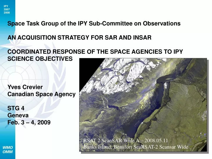
Space Task Group of the IPY Sub-Committee on Observations AN ACQUISITION STRATEGY FOR SAR AND INSAR COORDINATED RESPONSE OF THE SPACE AGENCIES TO IPY SCIENCE OBJECTIVES Yves Crevier Canadian Space Agency STG 4 Geneva Feb. 3 – 4, 2009.

E N D
Space Task Group of the IPY Sub-Committee on Observations AN ACQUISITION STRATEGY FOR SAR AND INSAR COORDINATED RESPONSE OF THE SPACE AGENCIES TO IPY SCIENCE OBJECTIVESYves CrevierCanadian Space Agency STG 4GenevaFeb. 3 – 4, 2009 RSAT 2 ScanSAR Wide A – 2008.05.11Banks Island, Beaufort SeaRSAT-2 Scansar Wide
Contributors • SAR Space Agencies • Agenzia Spaziale Italiana – Fabrizio Battazza • Canadian Space Agency – Yves Crevier, Robert Saint-Jean • DLR, Germand Aerospace Center – Manfred Gottwald, Dana Floricioiu, et al. • European Space Agency – Henri Laur • JAXA – Masanobu Shimada • NASA – Craig Dobson • STG members • Mark Drinkwater • Ken Jezek, Katy Farness • Private sector and International organisations • MDA, ASF, KSAT, GIIPSY, WMO JC
SAR Agency IPY Portfolios • http://bprc.osu.edu/rsl/GIIPSY/
September 2007 • In response to an action: • STG2 – A9 - Action on CSA - to set up an inter-agency meeting of SAR mission managers to optimise SAR coverage - in order to address top level scientific objectives/requirements stated in the GIIPSY User requirements document. • Objectives: • Develop an acquisition strategy for SAR and InSAR data that achieves the maximum number of IPY science objectives • Distribute the acquisition load across the different agencies ENVISAT ASAR Mosaic
Path Towards SAR Coordination • Assessment of SAR system capacity vs IPY science objectives – meeting 1 • SAR acquisition plan consolidation exercise – meeting 2 • SAR processing strategy • Data dissemination - sustainability
Assessment of SAR system capacity vs IPY science objectives • Review existing GIIPSY science requirements (the Global Inter-agency IPY Polar Snapshot Year (GIIPSY) Strategy Document) • Review the Agencies strategic priorities in line with IPY science activities. • Review current acquisition plans focused on IPY. • Review the satellite and ground segment operators system capabilities and constraints related to the acquisition of data in support to IPY. • Agree on priorities
SAR Coordination MeetingMarch 08 • 13 organisations were represented at this meeting • 6 Space Agencies • 3 Ground Segment Operators • 4 end-user and research organizations • Presentation material available on the GIIPSY website
Meeting Outcomes • Agreement to focus the acquisition strategy on: • Solving important science problem (in line with STG objectives) • Filling a gap in planned coverage for IPY (build from existing agencies’ imaging activities) • Involve interagency collaboration (no-single agency can do it all)
Derived Contribution From SAR • C-Band coverage (3-day snapshots) for the Arctic Ocean during the remainder of IPY (background missions, operation data acquisitions, etc.). • Winter Pole to Coast InSAR coverage of the Antarctic in high-resolution mode (3-4 consecutive cycles in ascending and descending). • Greenland and Major Canadian Icefields of InSAR acquisition over 3-4 consecutive cycles of high-resolution in winter. • Supersites (where possible using what exists already): determine acquisition parameters (frequency, resolution, etc.) for multi-polarisation and polarimetry data collection.
SAR acquisition plan consolidation exercise • Avoid Gaps and Overlaps – optimize resources • Consolidate the current SAR planning and imaging activities occurring under the auspices of IPY/STG (i.e. thematic / instrument matrix, common planning tool, etc.) • Distribute imaging load according to Agencies’ capacities and priorities, and develop acquisition plans • Look at a short/med/long term planning approach to continue the acquisitions (if at all possible)
SAR processing strategy and data dissemination • Definition of priorities • A Data Processing Strategy for Satellite Data Collected During the IPY – K. Jezek, GIIPSY • Develop a processing strategy that will use the existing agency resources (from signal to data archive) • Coordinate funding opportunities for science initiative and private sector involvement for the development of derived products TerraSAR X Strip Map Dual Pol East Greenland, 12-12-07
Dissemination • Development of an outreach strategy to demonstrate the leverage of coordination under STG. • Joint technical paper • Presentation of compiled results in selected forums • Compile links of data nodes and portfolio description for space agencies • Promote our joint / integrated products • GIIPSY