Download
1 / 16
160 likes | 287 Views
USGS Perspective on The Ele -Hydro Concept. Adapted from a presentation by Jeff Simley USGS National Hydrography Data Manager. Erosion and Resistance. Integration and registration. Heads-up Digitizing. Contours integrated with Hydro.

E N D
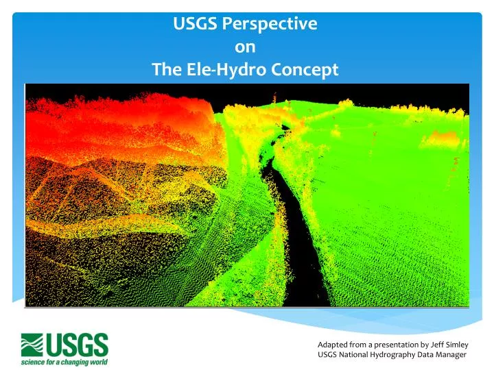
USGS Perspective on The Ele-Hydro Concept Adapted from a presentation by Jeff Simley USGS National Hydrography Data Manager
Heads-up Digitizing Contours integrated with Hydro http://letters-sal.blogspot.com/2011/05/digitizing-wacom-way.html
How we think and collect now. . . Separate funding mechanisms $$$ Indiana LiDAR $3.3million Indiana Hydro $2.6million Managed separately Hydro Elevation Stovepiped Empires Turfs • National Hydro Data • 100k • 24k • Local Data • Watersheds • Vector National Elevation Data PointCloud DEM Raster Separate data standards Data housed separately (raster vsvector) Separate collection methods
Indiana’s National Hydrography Data Update Project Illinois - Indiana
Hydro Drainage features Wetlands DEM Hydro-Flatten Hydro-Enforced Watershed Boundaries LiDAR Point Cloud Catchments Subbasins Floodplains Infra- structure Building footprints Utilities Roof analysis Transportation signage Veg Forest Canopy Forest Health Crop Health Grasslands Soils
How we think now - Some integration occurring. . . Hydro USGS Apps: StreamStats NHDPlus U.S. Topo Combined Elevation Forcing integration by “burning” the Hydro data into the Elevation data
Packaging the Data NHD Wetlands Catchments Landcover Vegetation Elevation
Integration – What does it mean? Alignmentof elevation and hydrography such that streams flow in channels Interoperabilitysuch that a levee can be connected to a river Data Modelthat links elements and features Synthesissuch that streamflow can be estimated Derivativessuch that gradient, channel dimensions, etc. can be calculated Programwhere a DEM and Hydro can be jointly produced and funded Synchronizationso that data are temporally coincident Productin a way that both elevation and hydro can be packaged together Deliveryof data to be accessed in unison
Integration – Why? Reduce cost Provide improved credibility Produce accurate data Increase the value of the data Empower science-based decisions Challenge and drive research
An Integrated Landscape “All geospatial software is moving to 3D. It is now an expectation.” Steve Snow, ESRI Imagingnotes.com, http://www.imagingnotes.com/go/article_freeJ.php?mp_id=292