Download
1 / 22
240 likes | 429 Views
Introduction to ArcView. ArcView_module_2 May 12, 10:40 AM. Outline. How ArcView is organized? What ArcView does? Data. How organized?. Project. One project contains five types of components (called documents ): Views, Tables, Charts, Layouts, and Scripts. How organized?. Documents.

E N D
Introduction to ArcView ArcView_module_2 May 12, 10:40 AM
Outline • How ArcView is organized? • What ArcView does? • Data
How organized? Project • One project contains five types of components (called documents): Views, Tables, Charts, Layouts, and Scripts
How organized? Documents • work with a theme in Views • manage a table in Tables • create charts from a theme or a table in Charts • create a high-quality map by putting together graphic elements in Layouts • customize in Scripts
How organized? Views View Document (View Window) With One Theme Table of Content
How organized? Tables Table Document (Table Window)
How organized? “Proj5” Project With One Chart Document Charts Chart Document (Chart Window)
How organized? Layouts Layout Document (Layout Window)
How organized? Documents • Each document displays data differently; each has its own related menus, buttons, and tools organized in a unique interface • They are dynamically linked
How organized? Project files “.apr” • allows all the works (e.g. creating maps, joining tables, making charts) to be saved in one file. • saves only descriptive information about the work (i.e. doesn’t save the actual data).
What it does? ArcView functionalities • ArcView divides functionalities into the core program and extensions. • Core program – generic capabilities e.g. menu/button/tool supported in the documents when no extensions are loaded • Extensions – additional capabilities loaded onto the core program e.g. Spatial Analyst, Network Analyst, 3D Analyst, Geoprocessing, Digitizer, Image Support # We are going to learn the core program
What it does? View • displaying spatial data • identifying features attributes • selecting features • thematic mapping (e.g., choropleth map, dot density map, chart map) • measuring distance/area • analyzing spatial relationships • geocoding
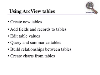
What it does? Table • displaying tables • selecting records by mouse /queries • editing tables • summarizing attributes of selected records • getting a statistics of selected records • Joining/linking tables
What it does? Chart • creating a chart • modifying a chart element • identifying features/records on the chart
What it does? Layout • adding a frame • manipulating a frame • adding a text • drawing graphics • exporting a layout to a image file
What it does? Scripts • compiling/running scripts • debugging scripts
Data Geographic Data • Geographic data stores the geometric location of particular features, along with attribute information describing what these features represent
Geographic Data Spatial Data Descriptive Data (Tabular data) Feature data (vector) Image data (raster) Data Geographic Data
Data Spatial data • Georeferenced to known locations on the Earth's surface (i.e. employs a specific coordinate system, unit of measurement and map projection) • primarily feature based (e.g. topology) • organized thematically into different layers, or themes (e.g. streams, landuse, elevation, and buildings )
Data Feature data • Coordinate-based representation of map features (i.e. A point is stored as a single x, y coordinate, a line as a pair of x, y coordinates, and a polygon as a set of x, y coordinates) • Good to represent discrete entities (e.g. school, event location, lake) • Supported format in Arcview includes ArcView shapefiles, Arc/Info coverages, SDE layers, VPF, and so on
Data Image data • Cell-based representation of map features (e.g. satellite imagery, aerial photo) • Good to represent continuous entities (e.g., temperature, elevation, toxic level) • Supported format in ArcView includes TIFF, JPEG, MrSID, Arc/Info GRID, BMP, BIL and so on
Data Tabular data • stored in a table • ArcView supports data from database servers such as Oracle, Ingres, Sybase, Informix, etc, dBASE files, Arc/Info INFO tables, text files with fields separated by tabs or commas.