Download
1 / 13
140 likes | 692 Views
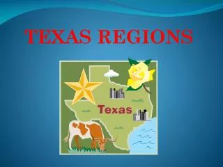
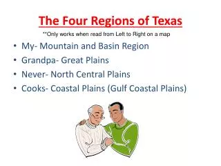
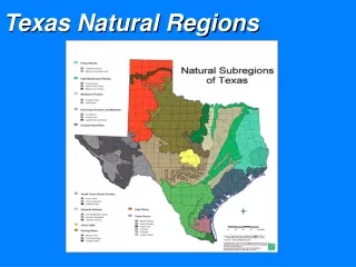
Texas's Different Regions. 1. The Central Plains2. The Great Plains3. The Coastal Plains4. The Mountains and Basins . The Central Plains. It has The Grand Plains, The Cross Timbers, and The Rolling Plains.Crops:Cotton, Corn, and other Grains.Animals:Beef cattle, sheep, goats, hogs, chickens, turkeys, and dairy cattle..

E N D
1. Texas�s Four Regions By
Rush Hemphill
2. Texas�s Different Regions 1. The Central Plains
2. The Great Plains
3. The Coastal Plains
4. The Mountains and Basins
3. The Central Plains It has The Grand Plains, The Cross Timbers, and The Rolling Plains.
Crops:
Cotton, Corn, and other Grains.
Animals:
Beef cattle, sheep, goats, hogs, chickens, turkeys, and dairy cattle.
4. The Central plains Grow:
Peaches, hay, peanuts, wheat, and sorghum.
Resources:
Oil, Limestone, Sand, Gravel, Grass, and Clay.
5. The Great Plains 1. The Cap rock Escarpment separates the Great Plains and the Central Plains.
2. The Great Plains Region is a high flat grassland. 3. The High Plains area is mainly in Panhandle.
Resources:
Petroleum, Natural Gas, and Rich Soil.
Produce:
Wheat, Cotton, and Sorghum.
6. The Great Plains Industry:
Cattle, Ranching, and Mohair.
4. The Edwards Plateau lies just south of the High Plains.
5. Mohair comes from this area. Mohair is the hair of angora goats. It is spun into fine hair.
7. Oil is produced in the Permian Basin.
8. The Llano Basin is on the eastern edge of the Edwards Plato.
7. The Great Plains 9. The Palo Duro Canyon, second Biggest Canyon in the U.S.A. Greater than 100 miles long, 6 miles wide, and 800 feet deep.
10. The Palo Duro means �Hard Wood�. Shrubs and trees grow in the Canyon. 11. It became Palo Duro State Park.
Major Cites:
Amarillo-means yellow soil.
Lubbock-the hub of the Plains, Texas Tech University, farmers.
Sister Cities:
Midland-Odessa, large oil and gas industries.
8. The Coastal Plains The largest of the Four Regions is one-third of the State.
It runs along the Gulf of Mexico.
Reaches Inland away from the coast, about 250 miles long
9. The Coastal Plains 4. It�s made up of 5 smaller Regions:
Piney Woods,
Gulf Coastal Plains,
South Texas Plains,
Post Oak Belt, and
Blackland Prairie.
Piney Woods:
1. Part of a large forest that stretches from the Atlantic Ocean to Texas.
2. Large number industry and oil industry.
3. Cattle Ranching, fruit and vegetables.
4. The Big Thicket is a protected area.
10. The Coastal Plains Gulf Coastal Plains:
Stretches from Port Arthur to Corpus Christi.
2. Most of Texas�s major rivers empty into the Gulf here.
3. There are slow moving streams.
-Oil industry
-fishing industry
-cotton and sorghum South Texas Plains:
Reaches from San Antonio to Brownsville and from the Rio Grande to the Gulf.
-dry with thorny brush
-oil industry
-family ranching
-The famous King Ranch is here
-lots of citrus fruits
11. The Coastal Plains Post Oak Belt:
Stretches from San Antonio to the NE corner of the state.
2. Rolling hills and prairie
3. Cotton, corn, and sorghum.
4. Oil, gas, and lignite [soft soil].
Blackland Prairie:
West of the Post Oak Belt.
2. Rich dark soil.
3. Grains and cotton.
4. Oil, gas, limestone, gravel.
Major Cites:
Houston-major port city.
San Antonio-major tourist industry.
Dallas-major business center.
Austin-State Capital
12. Mountains and Basins 1.Towering Peaks, Rocky Canyons, and flowering Cacti.
2. Guadalupe Peak is the highest point in Texas.-8,749 feet.
3. Dry Rocky soil.
4. Places, Big Ben National Park, Guadalupe Mountains National Park, McDonald Observatory, and The Davis Mountains.
13. Mountains and Basins 5. Animals:
Mountain Lions, Peregrine Falcons, Rattlesnakes, and Deer.
6. El Paso is the only Major City in a different Time Zone.
7. El Capitan is a Natural Land Mark.
I hoped you liked the information I got and my report.
Rush Hemphill