Download
1 / 22
220 likes | 347 Views
South Carolina Geographic Alliance Field Trip GPS Navigation. Mark Musselman Audubon Center at Francis Beidler Forest Harleyville, South Carolina. Field Trip GPS Navigation. After completing GPS training on a practice course at school, students will be ready for field trip navigation.

E N D
South Carolina Geographic AllianceField Trip GPS Navigation Mark Musselman Audubon Center at Francis Beidler Forest Harleyville, South Carolina
Field Trip GPS Navigation After completing GPS training on a practice course at school, students will be ready for field trip navigation.
Anderson Field Example Here we will explore downtown Anderson, SC and the students will be the guides and instructors.
Anderson Field Example How can a teacher determine the coordinates for a destination like the Anderson County Arts Council?
Finding Coordinates Type the address in the Google Earth search field. The location will be highlighted.
Finding Coordinates Place the cursor over the target.
Finding Coordinates …and read the coordinates at the bottom left of the image.
Entering waypoints in advance Just as the name can be changed, so too can the location (coordinates). Toggle down until the location field is highlighted. Press the center of the thumb stick to reveal a number keypad for editing. Waypoints
Entering waypoints in advance Waypoints can be downloaded directly from a computer using free software such as EasyGPS at http://www.easygps.com. For example, all 280 waypoints (including trailheads, camp sites, etc.) of the Foothills Trail in SC can be downloaded at http://www.travelbygps.com Waypoints
Navigation Navigating to your waypoint If you already have waypoints loaded to your unit, press the bottom button on the left side to reveal the options. Select “Waypoints”. Waypoints may be displayed by name or by the nearest to your current position.
Navigation Navigating to your waypoint If you have a waypoint already displayed, simply toggle to the Goto button and press the center of the thumb stick.
Anderson Field Example The student that navigated to this point would also be responsible for providing the educational content to the group. Anderson County Arts Council
Anderson Field Example Repeat the previously described procedures for the next address.
Anderson Field Example It would be a short walk from the Arts Council to the “man statue”.
Anderson Field Example The student that navigated to this point would also be responsible for providing the educational content to the group.
Anderson Field Example This memorial could be another historical destination. A student navigating to this spot would provide the group with a brief lesson.
Anderson Field Example Cultural aspects of the community can be highlighted. Do the paintings on the fish tell us what the community deems important?
Anderson Field Example Art and public areas also provide rich opportunities to explore the geography of a place.
Anderson Field Example Total trip less than 0.6 miles! All of the waypoints were determined from 160 miles away!
Trip Documentation Collected waypoints can be converted to Google Earth (kml) files to document a field experience.
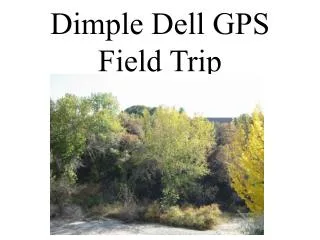
boardwalk canoe trail hiking trails Trip Documentation Example The Audubon Center at the Francis Beidler Forest in Four Holes Swamp
Conclusion It’s easy to incorporate geography and global positioning systems (GPS) technology into any field trip experience. A field trip route can be set up prior to the trip without physically visiting the destination. Using navigation technology that can be easily taught and mastered, students of all ages can enjoy success studying any theme or subject.