Download
1 / 17
170 likes | 302 Views
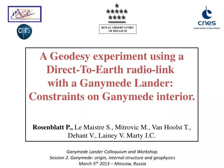
ROYAL OBSERVATORY OF BELGIUM. A G eodesy experiment using a Direct-To- Earth radio- link with a Ganymede Lander: Constraints on Ganymede interior . Rosenblatt P., Le Maistre S., Mitrovic M., Van Hoolst T., Dehant V., Lainey V. Marty J.C.

E N D
ROYAL OBSERVATORYOF BELGIUM A Geodesyexperimentusing aDirect-To-Earth radio-linkwith a Ganymede Lander: Constraints on Ganymedeinterior. Rosenblatt P., Le MaistreS., Mitrovic M., Van Hoolst T.,Dehant V., Lainey V. Marty J.C. Ganymede Lander Colloquium and Workshop.Session 2. Ganymede: origin, internal structure and geophysics March 5th 2013 – Moscow, Russia
Overview • Why a Geodesy experiment at the surface of Ganymede?Scientific rationale:Ganymede’ interiorissue: Depth of the liquidwater ocean Thickness of the iceshellExperiment: Precisemeasurements of the rotational variations (libration) and tidal vertical displacementInstrument:Designed for Lander X-band coherenttransponder: LaRa (Lander Radioscience) developed by Belgium
Ganymede’sinterior issue • Internalliquidocean (Kivelson et al., 2002) • Whichthickness? Whichiceshellthickness? • Needs to know Ganymede’sinternal structure to reconstructitsinteriorevolution, sounderstandingits surface geologicalhistory
In the absence of seismicdata, geodesybringspreciousinformation on deepinterior of terrestrialplanets and of theirmoons Measurements oftides and rotation variations mantle crust outer core (radius 3480 km) inner core (radius 1221 km) ProbingEarth’sinterior
Ganymede: Tidal surface displacements Surface deformation (in meters) Equatorial band withmaximumtidal signal Latitude fromsouth pole (in radians) Longitude (in radians) • Pattern of tidal vertical displacementsat the surface of Ganymede: up to 2.5 meters in equatorialregion in the presence of a internalliquidocean. • Best Signal-To-Noise ratio near Equatorial Lander
Ganymede: Tidal vertical displacements Maximum surface displacement(in meters) h2 • h2measurementbetterthan ~0.01 isrequired Moore and Schubert, 2003 • Tidal displacementsexpressed as the tide vertical Love numberh2 • It depends on : internalliquidoceanthicknessand iceshellthickness, rigidityand viscosity • as small as 0.01 (lessthan 10 cm of displacement if no ocean and high icerigidity) • as large as 1.6 (almost 4 meters of displacementif thickoceanand lowicerigidity)
Ganymede: Libration and interior Baland and Van Hoolst, 2010 • Layeredinterior model of Ganymede: Liquid-solidlayers. • ‘Decoupling’ betweenlayers: iceshell (surface layer) and liquidocean Increase of libration amplitude w.r.t. rigidGanymede.It depends on thickness and physicalproperties of layers.
Rotation variations (libration) of Ganymede Densitydifferencebetween Ocean and Ice Shell (in kg/m3) • Amplitudes are about 2 to a few 10 times larger than for models without ocean (10m) • Observations of libration amplitude can be used to • confirm the existence of a subsurface ocean • constrain the ice shell: thickness and density • Required accuracy: • 10 meters or better Baland and Van Hoolst, 2010 Libration amplitude (in metersatequator) Iceshellthickness (in km) The thinnest the ice shell (the shallowest the ocean), the greater the libration amplitude Assumption: rigid layers.
Geodesyfromorbit (tides) Tide vertical Love number: h2 From Laser altimeter (GaLa):Cross-over data-pointsVertical precision: 1 meter(Δh2=0.01 )Lateralprecision: (10 meters) Tidal potential Love number: k2 Tracking of orbiter (3GM):Gravity fieldPrecision: Δk2=0.01 ProbingGanymedefromGeodesy JUICE Geodesy from the surface • Surface tidal vertical displacement: h2 (cross-check with orbiter) • Surface lateraldisplacement: Libration amplitudea precisionbetterthan 10 meters (orbiter precision) wouldbringadditional information about the interior (iceshellthickness).
Geodesy experiment: instrumentation JUICE spacecraft GanymedeLander X-band radio-link Uplink in [7.145,7.190] GHz LaRaelectronic box Downlink in [8.400,8.450] GHz Coherent transponder maser • Direct-To-Earth (DTE) radio-link: Two components • Coherenttransponder (LaRa) initiallydesigned by Belgium for Martian Lander (> TRL-5) • Trackingstations on Earth: (DSN, ESTRACK) and VLBI (like PRIDE experiment on JUICE) • X-band 2-way Doppler shift measurements. • Monitoring of the rotational and orbital motion of Ganymede
LaRa: Specially designed for Lander Electronic box + patch antennas Main characteristics • X-band coherenttransponder: Allan deviation10-13s-1 @ 60sec. • Designed for Mars, but for Ganymede …
‘Re-sizing’ LaRa for Ganymede Martian case: Average distance: 1.5 AU Uplink: 34 m. Earthantenna Downlink: 20 W (power to Radio-Freq. 3W) 34 m.Earth’santenna to get 5dB receivedatEarth’s station Doppler instrumental noise: 0.04 mm/s @ 60sec Doppler count time Ganymede case: Average distance : 5 AU Uplink: 34 m. Earthantenna Downlink: 25 W (power to Radio-Freq. 5W) 70 m.Earth’santenna (or 34 m. network) to get 5 dB ReceivedatEarth’s station Doppler instrumental noise: 0.04 mm/s @ 60sec Doppler count time • LaRacanprovide Doppler signal fromGanymede’ssurface with ‘minor’ technicaladjustment.
Simulation Processusing GINSsoftware Simulation of Doppler tracking data: Duration : up to 2 yearsGanymede Lander at equatorial areaDeep space ground stations: 1 hour per week or 1 hour per day Libration + vertical tides ( h2 ) Simulated Doppler data (60sec sampling time) with white noise at 0.04 mm/s. Simulation of least-squares fit on the noisy simulated tracking data of: Fitted parameter: Libration amplitude: cosine and sine amplitudes at different periods (among them the orbital period)h2 vertical tide Love numberQuality of the fit:Formal uncertainty (least squares fit quality) and accuracy (discrepancy between retrieved and nominal value) as a function of the mission duration and tracking coverage. GINS: Géodésie par Intégrations Numériques Simultanées developed by CNES and furtheradapated to planetarygeodesyappliccations by ROB
Simulations: Measurement of the vertical tide Love numberh2 Ocean: 200 km 20 km Lines: precision Dots: accuracy No ocean.Shell rigidity: 109Pa 1010 Pa • Case withocean : Detectionafter 20 weeks and ~10% of errorafter 2 years • Case withoutocean: Detectionafter 20 weeks for lowicerigidity • onlydetectionafter 2 years for high icerigidity.
Simulations: Measurement of the libration amplitudes Lines: precision Dots: accuracy • Precision: using 1 hour of trackingper week. 10-4degrees (~4.5 meters) after40 weeks of mission 10-5degreesafter 2 years (betterthan 1 meter !), • Precisionbetterthan 1 meterafteronly 20 weeks of mission using1 hour of tracking per day. • But the error on Ganymede’sephemeris (50-100 km) not takenintoaccount. • LaRa Doppler data to beused for global inversion: libration+tide+ephemeris(part of a tidal instrument suite) Further simulations are in progress. • Also, spacecraft to Lander radio-link to overcome the ephemeriserrorproblem.
CONCLUSION & PERSPECTIVES • Radio-transponderLaRadesigned for Martian Lander canbeaccomodated to a Ganymede Lander • It allows us to measure libration amplitudes with a sub-meterprecisionafter 20 weeks of mission (1 hour of tracking per day). • It permits to confirm (again) the presence of an internaloceanand to constrain the iceshellthickness, and rheology. • Improvement of Ganymede’sorbit: UsingLaRa as a radio-beaconOrbital evolution - Interior structure • Radio-science instrument part of the ‘core package’ to probe in-situ the bulkinteriorstructure of solar system bodies.
Acknowledgements This work was financially supported by the Belgian PRODEX program managed by the European Space Agency in collaboration with the Belgian Federal Science Policy Office.