Download
1 / 32
330 likes | 439 Views
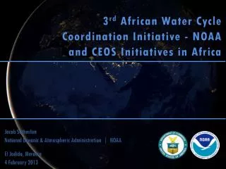
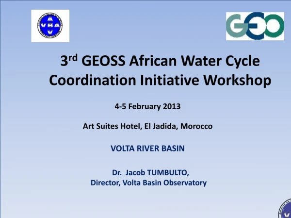
3 rd GEOSS African Water Cycle Coordination Initiative Workshop. 4-5 February 2013 Art Suites Hotel, El Jadida , Morocco VOLTA RIVER BASIN Dr. Jacob TUMBULTO, Director , Volta Basin Observatory. Presentation Plan. 1. Volta River Basin

E N D
3rd GEOSS African Water Cycle Coordination Initiative Workshop 4-5 February 2013 Art Suites Hotel, El Jadida, Morocco VOLTA RIVER BASIN Dr. Jacob TUMBULTO, Director, Volta Basin Observatory
Presentation Plan 1. Volta River Basin 2. Water Resources management and use issues in basin 3. Urgent needs in Basin 4. Planned actions
Riparian Countries Volta basin
Catchment Area: About 400 000 km2 Transboundary basin shared by 6 countries: Benin, Burkina, Côte d’Ivoire, Ghana, Mali &Togo 85 % of the area of the basin is shared between BF and Ghana 3 main sub-basins: Black Volta (Mouhoun ): 150 000 km2 White Volta (Nakambé):105000 km2 Oti: 70 000 km2 Basic Information on the Volta Basin
Surface water monitoring sites
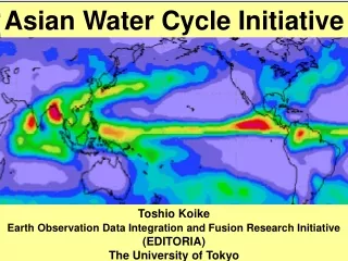
Rainfall and Agro-Ecological Zones i. Spatial variability - south-north gradient; ii. Medium-term variability - alternating dry & wet periods basin-wide; iii. Strong spatial and short-term variability within a given season • The Sudano-Sahelian Zone: 500-900 mm – BF and MA • The Sudanian Zone: 900-1,100 mm – northern GH, CI, BE & TG • The Guinean Zone: >1,100m; bimodal rainfall; southern GH
Population • Basin population 18.6 million in 2000; • Projected to reach 33.9 million in 2025; • Rural pop. 70% ; • Live on natural resources
Economic Profile HDI of Volta Basin Countries and Other Areas • Export of primary commodities; • 2009 HDI <0.5
2. Water Resources Management and use Issues • Current Challenges in Basin • UNEP/GEF Volta TDA -8 priority transboundary concerns: • Changes in water quantity and seasonality of flows • Degradation of Aquatic Ecosystems • Degradation of Surface Water Quality/Pollution • Invasive Aquatic Species • Land Degradation/ Loss of Vegetative Cover • Loss of Biodiversity • Water related diseases • Coastal Erosion
2. Water Resources Management Issues • Other challenges include: • Insufficient political support, • Lack of financial resources, • Gaps in information, • Insufficient stakeholder participation and • Poor institutional coordination and collaboration.
MANDATE OF VBA 1.Promote permanent consultation tools among the parties for the development of the basin; 2.Promote implementation of IWRM and equitable distribution of the benefits resulting their utilization; 3. Authorize the development of infrastructure and projectsplanned by the stakeholders, which could have substantial impact on water resources; 4.Develop joint projects and works; 5. Contribute to poverty alleviation, sustainable development in the Volta basin, and for better socioeconomic integration in the sub-region.
Water Demand • Consumptive uses: domestic water supply, crop irrigation and livestock; • Non-consumptive: hydropower generation, fisheries, recreation and tourism. • Water demand projected to increase > 1000% 2000 - 2025. WEAP model Projections: • Ouagadougou to experience shortages in dry months, from 2013; • By 2030 only 42% of Bagre irrigation demand will be met; • The conditions will worsen in very dry years.
Agricultural Production Systems • Agricultural production about 40% of basin economic output; • Most cultivation still rain-fed; • Production increases largely due to expansion of agric. land; • Cropping systems distributed in the agro-climatic regions; • Livestock - important upstream water use; • Fisheries in large reservoirs; Specific negative impacts • Forests over-exploitation and degradation: for firewood, charcoal and lumber, cash crops, over-grazing; • Loss of top soil, erosion and salinisation; • Over-exploitation of fisheries Irrigated agriculture relatively developed in BF
MITIGATING FLOOD IMPACT • SONABEL VRA collaborative meeting & data sharing • Sub-regional level - Regional Study on Transnational Flood Impacts and Preparedness Mechanisms • Millennium Challenge Account Project in Burkina Faso is collaborating with the GEF Volta • Planned training in Hydrological Modeling and Flood Forecasting
Climate Change Adaptation • Some Adaptation to Climate Change • Introduction of new crop varieties e.g., early maturing and drought-resistant species; • Land management to improve water soil moisture needed for optimal crop growth, e.g., rain harvesting (Challenge Program on Water and Food Phase-CPWF 2) • Prediction of the onset of the rainy season through the use of empirical models. • Reservoirs for water storage and use in the dry season
Climate Change Adaptation • WASCAL Programme
PRELIMINARY RESULTS FROM COLLABORATIVE WORK- UNIV OF TOKYO /VOLTA BASIN
Upper: Simulation of the seasonal change in vegetation in West Africa and validation by using the satellite data. Climate Change Impacts on Vegetation Right: Impact of climate change on vegetation dynamics in the river basin of West Africa by using the selected GCM outputs after the bias correction.
Urgent needs in basin • It is necessary to focus on the prevention and integrated risk management of disasters in response to increased intensity and frequency of natural disasters (floods and droughts) which reduce the resilience of communities in the basin; • To move from subsistence to growth agriculture so as to improve upon food security in the basin.
Urgent needs in basin • Hence, the need for climate smart agriculture, attention on rain-fed agriculture, and greater focus on risk management.
Urgent needs • Climate Change impacts negatively on economic growth and erodes the gains from the countries development. • strengthen climatic database and information systems • promoting the use of climatology and meteorology in multi-sectoral planning
Urgent needs • Setup early warning systems • Promote an integrated approach on environmental issues in particular articulating climate change adaptation as well as disaster risk reduction efforts.
1. Developing Integrated Monitoring Systems • Near-real time observing systems by coupling satellite and in-situ measurements • Linkage of meteorological, hydrological and agricultural observations • Long-term and comprehensive climate observational data
2. Developing Integrated Early Warning Systems • Weather and seasonal prediction coupled with hydrological and agricultural prediction. • Optimization systems for reducing disaster risks and increasing societal benefits
3. Assessing Climate Change Impacts for Adaptation • Effective use of climate model projection including multi-model analyses, bias correction and downscaling. • Assessment system of the climate water food nexus
Actions continued 4. Developing Data and Information Integration and Sharing Systems 5. Promoting Capacity Building Programs SCHEDULE • Two (2) years of integrated research-oriented feasibility study • Three (3) years operational program