Download
1 / 10
100 likes | 232 Views
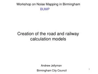
Creation of the road and railway calculation models. Andrew Jellyman Birmingham City Council. To calculate noise maps it is necessary to have some or all of the following data: A terrain map e.g. ground height data Ground cover data e.g. areas of hard and soft ground

E N D
Creation of the road and railway calculation models Andrew Jellyman Birmingham City Council
To calculate noise maps it is necessary to have some or all of the following data: • A terrain map e.g. ground height data • Ground cover data e.g. areas of hard and soft ground • The location and dimensions of cuttings and embankments • Building locations and heights • Barrier locations • Bridge locations • The location & intensity of noise sources to be mapped
Each type of data can be considered as a ‘layer’ from which the calculation model is built up • Data may be too complex or detailed for noise mapping. Too much detail slows down the calculation and may exceed the capability of the noise mapping software to handle the data • For this reason some simplification may be needed before calculations can take place. • For example, for BUMP: • Only buildings larger than 25m2 were included • Areas of soft ground less than 500m2 were excluded
The maximum size of calculation model is limited by, amongst other things, the amount of memory in the computer and the software itself Even after simplification, it is unlikely that noise mapping software would be able to calculate very large areas in one go For this reason, it may be necessary to ‘tile’ or cut up the data into more manageable areas. Alternatively, the noise mapping software may do it for you automatically We originally used 1 x 1 km tiles for BUMP, but following recent changes to the noise mapping software we are intending to increase this to 5 x 5 km
Where data is not available it will be necessary to ‘assume’ certain values • For example, in the first BUMP calculation runs: • Building heights were based on the surface area of the building • Road surface texture depths were assumed to be 2mm • Road traffic vehicle flows were assumed to be 50 vehicles per hour if no other data was available • It is very important to keep records of all assumptions made
All of the model data used in BUMP is held on a GIS (ArcMap) Some processing of the data, for example, removing buildings of less than 25 m2 was done in GIS To use the data for noise mapping, it was then converted from GIS ‘Shape file’ format into a format suitable for the noise mapping software using the import filters in Lima Lima was then used to cut the area up into tiles of 1 x 1 km using locally generated ‘batch files’ to automate the process
Layers of data loaded into Lima Height contour Soft ground Buildings Road source line
Once the data is tiled, the calculation programme set-up files can be produced • These files tell the programme which model files to load and contain the calculation parameters • These parameters include: • How far to look for a noise source relative to the receiver • How many reflections to consider • What calculation height to use, etc.
SEITUM -1 1 1 /* side diffraction: Art max. width max. number of screens ARTDBM 0 MASS 1000.00 /* Scale of plot-output RLSSTG+ /* determine addition of gradient SRC-NAME * /* calculation of emitters with substring E-VALUE L10D L10N Q KOMBINAT * " A B " TRL-BACK 1 A B CALCEMIS+ /* recalculate emission when starting calculation MODERR 0 GEBNZ 1 IGBCHK+ RASTINT 0 15 2 3 /* special options BEW LDEN genein Z:\ground\gSP0685.bna Z:\ground\gSP0686.bna Z:\ground\gSP0687.bna Z:\ground\gSP0688.bna Z:\ground\gSP0689.bna Z:\ground\gSP0785.bna Z:\ground\gSP0786.bna Z:\ground\gSP0787.bna Z:\ground\gSP0788.bna Z:\ground\gSP0789.bna Z:\ground\gSP0885.bna Z:\ground\gSP0886.bna This is a small section of a Lima setup file showing some of the parameters and part of the list of files to be loaded
And finally……. With large model areas, all of this can take a long time!