Download
1 / 45
500 likes | 1.07k Views
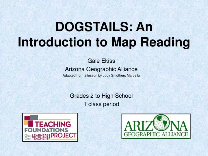
DOGSTAILS: An Introduction to Map Reading. Gale Ekiss Arizona Geographic Alliance Adapted from a lesson by Jody Smothers Marcello Grades 2 to High School 1 class period. National Geography ELEMENT ONE: THE WORLD IN SPATIAL TERMS

E N D
DOGSTAILS: An Introduction to Map Reading Gale Ekiss Arizona Geographic Alliance Adapted from a lesson by Jody Smothers Marcello Grades 2 to High School 1 class period
National Geography ELEMENTONE: THE WORLD IN SPATIAL TERMS 1. How to use maps and other geographic representations, tools, and technologies to acquire, process, and report information from a spatial perspective. Arizona Grade 2 Strand 4 Geography Concept 1 The World in Spatial Terms PO 2 Interpret political and physical maps using the following elements: a.alpha numeric grids b.title c.compass rose - cardinal directions d.key (legend) e.symbols Standards
Reading Informational Text Key Ideas and Details 2.RI.1 Ask and answer such questions as who, what, where, when, why, and howto demonstrateunderstanding of key details in a text. 3.RI.1 Ask and answer questions to demonstrate understanding of a text, referring explicitly to the text as the basis for the answers. Craft and Structure 2.RI.4 Determine the meaning of words and phrases in a text relevant to a grade 2 topic or subject area. 3.RI.4 Determine the meaning of general academic and domain-specific words and phrases in a text relevant to a grade 3 topic or subject area. 2.RI.5 Know and use various text features (e.g., captions, bold print, subheadings, glossaries, indexes, electronic menus, icons) to locate key facts or information in a text efficiently. 3.RI.5 Use text features and search tools (e.g., key words, sidebars, hyperlinks) to locate information relevant to a given topic efficiently. ELA Common Core Standards
Reading Informational Text Integration of Knowledge and Ideas 2.RI.7 Explain how specific images (e.g., a diagram showing how a machine works) contribute to and clarify a text. 3.RI.7 Use information gained from illustrations (e.g., maps, photographs) and the words in a text to demonstrate understanding of the text (e.g., where, when, why, and how key events occur). Range of Reading and Level of Text Complexity AZ.2.RI.10 By the end of year, read and comprehend functional texts, including history/social studies, science, and technical texts, in the grades 2–3 text complexity band proficiently, with scaffolding as needed at the high end of the range. AZ.3.RI.10 By the end of the year, read and comprehend functional texts, including history/social studies, science, and technical texts, at the high end of the grades 2–3 text complexity band independently and proficiently. ELA Common Core Standards
Overview Map skills are basic to geographic understanding. Students need a system by which to analyze and evaluate maps. DOGSTAILS provides a standard for such assessment and can be applied to commercial maps used in the classroom as well as to maps generated by students. Purpose In this lesson, students will learn 9 essential elements for interpreting and creating maps.
Materials • Overhead of DOGSTAILS Elements or PowerPoint explaining each element • Dogstails Worksheet and Assessment • Enough different maps for students to work in pairs • DOGSTAILS arrows Xeroxed in different colors of copy paper (1 set for every 2 students) • Map for Assessment (same map for every student) • 15 Sandwich bags to hold 15 sets of arrows • Removable sticky dots (Dots can be found at office supply stores and come in 2 types-removable and permanent. Permanent dots will ruin the maps and arrows.)
Objective The student will be able to: • Name, locate, and use the essential parts of a map.
Procedures 1. Introduce the term acronym to the students and explain that DOGSTAILS is an example of an acronym. 2. Explain that this is a process that should be used whenever a person deals with a new map. Distribute the DOGSTAILS Worksheet.
Procedures 3. Use the DOGSTAILS Elements overhead or Power Point and explain the parts of a map. Students should be recording this information on their DOGSTAILS Worksheet.
Acronym--DOGSTAILS • What does the “D” stand for?
DOGSTAILS Date When was the map made? Is it still reliable?
Acronym--DOGSTAILS • What does the “O” stand for?
DOGSTAILS Orientation Is there a compass rose?
Acronym--DOGSTAILS • What does the “G” stand for?
DOGSTAILS Grid Is there a grid? Is it alpha-numeric or latitude and longitude?
Acronym--DOGSTAILS • What does the “S” stand for?
DOGSTAILS Scale Is there a scale? What unit of measurement is it using?
Acronym--DOGSTAILS • What does the “T” stand for?
DOGSTAILS Title What is the title of the map? *Always read first
Acronym--DOGSTAILS • What does the “A” stand for? • We are cheating. It really should be an “C” word.
DOGSTAILS Author Who made the map? *Cartographer
Acronym--DOGSTAILS • What does the “I” stand for?
DOGSTAILS Index Is there an alphabetical listing of the places on the map? Ajo = C1 Benson = F1
Acronym--DOGSTAILS • What does the “L” stand for?
DOGSTAILS Legend Is there a place on the map that explains the symbols used on the map?
Acronym--DOGSTAILS • What does the “S” stand for?
DOGSTAILS Symbols Are symbols used to represent features on the map? safety zone capital city
DOGSTAILS Situation Does this map show this place in relation to another place?
Procedures 4. Divide the students into groups of two. Give each group a different map and a sandwich bag of arrows. Model for the students how to find one of the elements on a map and affix the arrow with the sticky dot at the tip of the arrow. Give students about 5-10 minutes to find as many elements as they can. Remind students that not every map will have every element. 5. Have student take their arrows off and switch maps with another group. Repeat the process of labeling the map with the arrows.
Assessment • When students seem proficient at working in groups to find the map elements, give them the Dogstails Assessment. Give each student the same map (maps can be found at http://geoalliance.asu.edu/azga/ A good choice is Jerusalem’s Old City under Maps (Historical Themes). If desired, you can hand draw elements to fill in missing information so all 9 elements are present. • The worksheet can be graded for accuracy. Mastery would be considered 80% or higher.
Extensions • Reinforce the procedure whenever new maps are used. (This works especially well when introducing how to read a road map.) • Whenever students create their own maps, have them include the elements of DOGSTAILS.
Sources • Labels courtesy of Jeannine Kuropatkin, Mesa Public Schools, Mesa, Arizona • Clip art from http://office.microsoft.com
ELL Adaptation TOADS • The Overview, Purpose, and Objectives stay the same as the original lesson. • The DOGSTAILS acronym can be shortened to TOADS for younger children.
ELL Adaptation Key Vocabulary • Title – name of map • Author – who made map • Orientation – showing directions, compass rose • Date – the day, month, and year the map was made • Scale – a measure to compare distance on map and distance on earth Scale can be changed to symbols.
ELL Adaptation Additional Materials Needed for ELL • Vocabulary word cards • Plastic toads to place on the map (optional) • Student made booklets/dictionaries
ELL Adaptation Procedures • Introduce the term "acronym" to the students and give examples that the students already know (i.e. name of school = Frontier Elementary School but the acronym is FES). (Preparation: Adapting Content, Linking to background) Explain that TOADS are animals (show a picture of one) (Preparation: Adapting Content, Linking to past knowledge) but in this lesson TOADS is an acronym that helps us talk about maps. 2. Explain that TOADS is a way of interpreting maps that should be used whenever a person uses a new map. Show a map of the school or the neighborhood. (Preparation: Adapting Content, Linking to background) Ask students to find things they see on the map. (Scaffolding: Guided practice, comprehensible input) Direct students to find the title.
ELL Adaptation Procedures 3. Continue with each letter in the word TOADS to explain the other parts of a map, showing a word card for each geography vocabulary word in the acronym. T=Title, O=Orientation, A=Author (Cartographer), D=Date, and S=Scale (or S=Symbol). Particular attention is needed on the explanation of scale with younger students. (Integrating Processes: Speaking, Listening)
ELL Adaptation 3. Continue with each letter in the word TOADS to explain the other parts of a map, showing a word card for each geography vocabulary word in the acronym. T=Title, O=Orientation, A=Author (Cartographer), D=Date, and S=Scale. Particular attention is needed on the explanation of scale with younger students. (Integrating Processes: Speaking, Listening)
ELL Adaptation 4. Divide the students into pairs. (Grouping: Partners) Give each group a different map. Tell each group to find the TOADS elements on their maps. (Scaffolding: Modeling) Students point to the correct areas using the TOAD pointers or placing plastic toads on each map area. (Application: Hands on, Meaningful, Promotes engagement) *Note-NOT all elements will be found on ALL maps.
ELL Adaptation 5. Students should practice these identification skills on a different map (using pointers or plastic toads) and complete a new worksheet on their own. (Scaffolding: Independent practice; Application: Hands on, Linked to objectives) 6. When students are finished, have them share their answers individually with you or in a small group presentation to the class. (Grouping: Small groups, independent) They may also walk around observing each other's maps, which have been completed using TOADS. 7. Repeat as often as you think.
ELL Adaptation Assessment Students will correctly identify and point to the 5 components of the TOADS lesson. Students may also build a TOADS dictionary booklet. Students will place answers for each letter of the acronym on the corresponding page of their dictionary. Mastery for geography, reading, and writing will be considered 4 of the 5 components identified correctly. (Assessment: individual, written, and oral)
ELL Adaptation Extensions • Reinforce the procedure whenever new maps are used. This activity can be done in learning centers. • Whenever students create their own maps, have them include the elements of TOADS or create new dictionary entries for each map they use.