Download
1 / 21
210 likes | 216 Views
This workshop focuses on the progress of the UW-MURI project, which aims to develop a mathematical quantification of useful hyperspectral information, radiative transfer modeling, mathematical retrieval algorithm development, and product research for hyperspectral data processing.

E N D
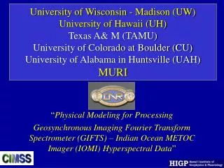
UW MURI Physical Modeling For Processing Hyperspectral Data – Non-UWCo-Is’Progress Allen Huang, PI Co-Is: Paul L. HIGP, Univ. of Hawaii Ping Y., Univ. of Texas A&M Gary J. & Sundar C., Univ. of Alabama-Huntsville Irina S., Univ. of Colorado at Boulder 4th Workshop on Hyperspectral Science of UW-Madison MURI, GIFTS, and GOES-R The Pyle Center Univ. of Wisconsin-Madison 702 Langdon Street, Madison 27-28 April 2004
GIFTS MURI Tasks (2001-2006) • 1 Mathematical Quantification of Useful Hyperspectral Information • 2 Radiative Transfer Modeling • Clear and cloudy Sky Emission/Absorption • Atmospheric Particulate (both dust & aerosol) Emission/Absorption • Surface Emission/Absorption • Ajoint & Linear Tangent • 3 Mathematical Retrieval Algorithm Development • Atmospheric Parameters • Suspended Particulate Detection and Quantification • Sea Surface Temperature • Surface Material Identification • 4 Product Research • Ocean and land Surface Characterization • Lower Tropospheric Temperature, Moisture and Winds • Surface Material Products • Aerosols • Derived (Second Order) Products • Visibility New Additions
Surface Characterization • Co-Investigator: Dr. Paul Lucey (UH-HIGP) • Tasks and Goals: • Modeling of surface emissivity • Apply UH analysis models to GIFTS simulations and • GIFTS-MURI data sets • Collect moderate resolution airborne hyperspectral data in support of MURI software development • Demonstrate GIFTS surface characterization of naval environment to support battle-space activities
UH Operates Airborne, Field and Laboratory Hyperspectral Data Collection Systems All systems are available for GIFTS MURI AHI Airborne LWIR Hyperspectral Imager Nicolet LWIR Laboratory FTIR Designs and Prototypes LWIR Field FTIR
Surface Characterization Progress • FY03 Task: • Produce global surface hyperspectral emissivity map for GIFTS simulation boundary condition • Progress reviewed at subcontractor site November 21, 2003 • Status: • Acquired global MODIS 5 km surface multispectral emissivity data for 4 seasons derived from 2002 and 2003 • Delivered Emissivity Map for MURI, April 2004
MODIS Based Land Surface Emissivity Modeling December, 2002 August, 2003 MOD11 C3 Dec. 2002monthly average, 5 km scale October, 2003
MODIS Based Land Surface Emissivity Modeling Spectral_emissivity = (1.0 – lib_entry_lat_long/100) x gain_lat_long + offset_lat_long offset_lat_long gain_lat_long
Suspended Matter (Aerosol and Dust) • Co-Investigator: Dr. Steve Ackerman (Director UW-CIMSS) • & Irina Sokolik (Uinv. Of Colorado at Boulder) • Tasks and Goals: • Improve existing algorithms for use with GIFTS hyperspectral • data for the detection and characterization of atmospheric • S.M.(aerosols). • Improve existing algorithms to demonstrate ship-based (i.e. carrier • deck) horizontal and slantwise visibility estimates.
Hyperspectral Dust Observations Desert Red Sea
Hyperspectral Dust/Aerosol Modeling Aerosol Material Ensemble Optical Properties
Hyperspectral Dust/Aerosol Modeling Negative Slope – The Dust Signature Green – Clear Spectrum Effect of Dust Layer Location Effect of Dust Particle Sizes Negative slope kCARTA+DISORT, spectral resolution = 0.0025 cm-1
Dust/Aerosol Modeling/Detection/Retrieval Progress • Aerosol Microphysical Properties • Parameterizations of single scattering properties • Varying aerosol chemistry & composition • Simulations of Radiances • Different approaches to full modeling • Fast model approach (coupling with PLOD) seems appropriate
Cloud & Aerosol Modeling • Co-Investigator: Prof. Ping Yang (UT-A&M) • Tasks and Goals: • Develop State of the Art Cloud Model for GIFTS/HES • 1. Water Cloud Radiative Property Modeling • 2. Ice Cloud Radiative Property Modeling • 3. Full Fast Physical Cloudy Radiative Transfer Modeling • Develop Aerosol Model for GIFTS/HES • Aerosol Radiative Property Modeling • Aerosol Radiative Transfer Modeling
The state-of-the-art techniques for modeling the ice crystal property, forward calculation and sensitivity and retrieval studies Sensitivity study • Effective particle size • Visible optical thickness Simultaneous retrieval of the optical thickness and effective particle size of cirrus clouds • Computing techniques: • FDTD: the finite-difference time-domain method • IGOM: Improved geometric optics method • SSPM: Stretched scattering potential method • Composite method: A combination of FDTD or other method (such as the T-matrix) with the weighted summation of approximate solutions for obtaining the single-scattering properties for small size parameters to large size parameters. • Parameterization: • Based on the effective size of in-situ particle size distribution
Generation of a comprehensive database of the single-scattering properties of ice crystals in IR To create the database, the habits of ice crystal are assumed as aggregate, solid hexagonal column, sphere, bullet rosette, droxtal, hollow, plate, and spheroid with random orientations. We have computed the single-scattering properties at 49 wavelengths from 3.08 µm to 100 µm for 38 size bins ranging from 2 µm to 3100 µm in terms of the particle maximum dimension. The results can be interpolated to a higher spectral resolution (less than 1cm-1 in the wavenumber domain). It took about 6 months on 10 workstation computers to finish the computation.
Retrieval of Cirrus Properties from High Spectral Resolution Infrared Observations • Delivered a fast radiative transfer model under cloudy conditions. We have integrated the fast cloudy RT code with the AIRS clear-sky radiative transfer model. This package substantially reduce the CPU time required in the forward simulation. • Has investigated the sensitivity of the IR spectra to the properties of cirrus clouds (optical thickness and effective size). Based on the sensitivity study, an algorithm has been developed to retrieve cirrus optical thickness from high spectral resolution IR observations. As an illustration, the retrieval algorithm is applied to a granule of AIRS image. The results are compared with that of collocated and degraded MODIS 1.38 µm ice clouds optical thickness. The optical thickness retrieved from AIRS data coincides with the that of MODIS for thin to moderate thick cirrus clouds
Accomplishments So Far • Improvement on light scattering computation algorithms; • Development of a database of the single-scattering properties of nonspherical ice crystals in infrared wavelength region; and • Development of a retrieval algorithm for inferring the optical thickness of cirrus clouds, which is applied to the retrieval from AIRS data as a canonical problem. 3 Conference papers & 4 Journal Publications
Cloud Detection in High Spectral Resolution Data • Co-Investigator: Prof. Gary Jedlovec & Sundar Christopher • University of Alabama - Huntsville • Tasks and Goals: • Develop a cloud detection algorithm for AIRS (or GIFTS/HES) that exploits high spectral resolution measurements to differentiate clouds from underlying surface features
Cloud Detection Algorithms • GOES techniques: 11 m, and 11-3.9 m differences (day and night) • Spatial (coherence) and temporal thresholds determined • EOS approach with MODIS uses many spectral difference tests/thresholds • 11-3.9 m, 11-12 m, 8.6-11 m, 3-7-12 m, 11-6.7 m • AIRS Adapt few existing MODIS tests and incorporate slope information (3.7-4.0 m region) • 11 m – opaque high clouds, day and night • 11-3.9 m – low clouds over water/land, day and night • 3.93 –3.96 m slope – all clouds, day and night • 3.85-3.87 m slope – cirrus, day and night
Accomplishments So Far • Developed cloud detection strategy for AIRS which includes • Several MODIS spectral tests • Short- and long-wave IR window region slope thresholds • Evaluated dependent study days to determine best test thresholds • Selected case studies for cloud detection method validation • Implemented preliminary methodology • – more complete results at Satellite Conference (Nofrfolk – September 2004) • Conduct graduate student training