Download
1 / 8
80 likes | 86 Views
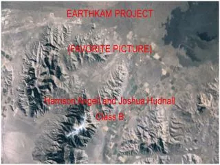
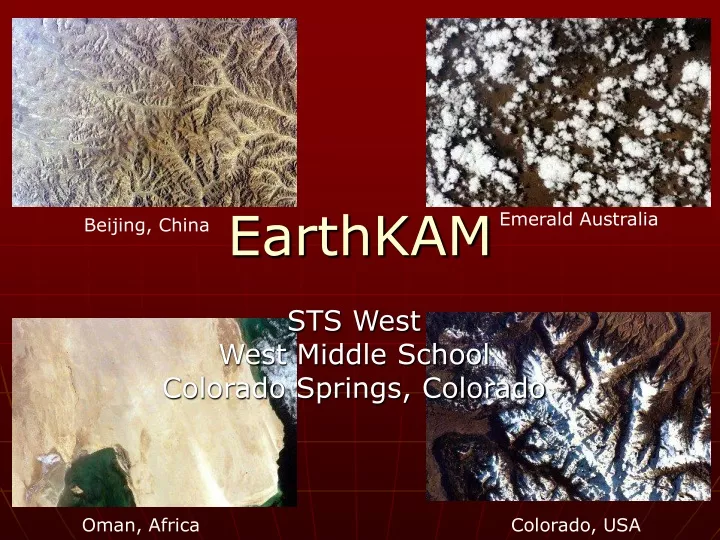
EarthKAM. Emerald Australia. Beijing, China. STS West West Middle School Colorado Springs, Colorado. Oman, Africa. Colorado, USA. China and the Yellow Sea Latitude: 37°N Longitude: 122°E Location: 7.4 km (4.6 miles) South of Songcun, Shandong, China Approx. Altitude: 5 m (16 ft)

E N D
EarthKAM Emerald Australia Beijing, China STS West West Middle School Colorado Springs, Colorado Oman, Africa Colorado, USA
China and the Yellow Sea Latitude: 37°N Longitude: 122°E Location: 7.4 km (4.6 miles) South of Songcun, Shandong, China Approx. Altitude: 5 m (16 ft) Antipode: 37 South 58 West Country (long form)People's Republic of China CapitalBeijing Total Area3,705,406.97 sq mi9,596,960.00 sq km(slightly smaller than the US) Population1,261,832,482 (July 2000 est.) Estimated Population in 20501,470,468,924 LanguagesStandard Chinese or Mandarin (Putonghua, based on the Beijing dialect), Yue (Cantonese), Wu (Shanghaiese), Minbei (Fuzhou), Minnan (Hokkien-Taiwanese), Xiang, Gan, Hakka dialects, minority languages Literacy81.5% total, 89.9% male, 72.7% female (1995 est.) ReligionsDaoist (Taoist), Buddhist, Muslim 2%-3%, Christian 1% (est.) note: officially atheist Life Expectancy69.6 male, 73.33 female (2000 est.) Government TypeCommunist state Photo Information
Population and Weather • Population- China-1,306,313,812 Shandong-91,250,000 • Weather-Mostly Clear
Industry: cotton wheat gold diamonds sorghum maize petroleum Economy Shandong is one of the richer provinces of China, and its economic development focuses on large enterprises with well-known brand names. Shandong has also benefited from South Korean and Japanese investment, due to its geographical proximity to those countries. The richest part of the province is the Shandong Peninsula, where the city of Qingdao is home to two of the most well-known brand names of China: Tsingtao Beer and Haier. In addition, Dongying's oil fields and petroleum industries form an important component of Shandong's economy. On the other hand, the extreme inland west of Shandong is much poorer than the rest of the province Economy and Industry
Tourism and Attractions • Penglai, a town on the north of the Shandong peninsula famed in Daoism. • Qingdao, beach resort city on the south of the peninsula famous for its Tsingtao beer • Laoshan, a scenic area and Daoist centre to the east of Qingdao. • Qingzhou, an ancient trading and administrative center with some famous archaeological discoveries. • Weihai, a former British port city important in the second Sino-Japanese War. • World Heritage Sites: • Temple and Cemetery of Confucius, and the Kong Family Mansion in Qufu • Tai Shan, sacred mountain, in Tai'an
Image Cloud Yellow Sea Pollution or Shallow Water Cloud Shadow Pollution Cliffs Unpopulated Hills or Mountains Docks Sea Wall River Inlet Highway City Of Shanghai Click Here For Enlarged Image
Bibliography • http://gutenberg.elib.com/gutenberg/etext04/world02.txt • http://www.confluence.org/search.php • http://www.confluence.org/confluence.php?lat=37&lon=122