Download

1 / 24
240 likes | 386 Views
Locating Health Services. Two main systems adopted by Federal government for identifying locations where barriers to obtaining primary health care exist. Health Professional Shortage Areas (HPSAs)

E N D
Two main systems adopted by Federal government for identifying locations where barriers to obtaining primary health care exist. • Health Professional Shortage Areas (HPSAs) • First used in 1978 to direct placements of National Health Service Corps employees to counties or facilities with a critical shortage of physicians. • Medically Underserved Areas (MUAs)system was developed in 1976 to identify areas for eligible for federally funded community health centers.
Analysts relying on these methods/approaches were not able to identify who was underserved and why. The data used to describe the number of available physicians in a place were often neither timely nor accurate. • Instead of identifying specific populations in need of care and the system resources available to meet that need, these approaches began with a place_ a geographic area like a county or a specific facility like a prison_ and characterized the place based on medical resource availability and population characteristics.
GIS provide the means to capture and verify health service capacity in locally defined areas using data that may not be available at the national level. • GIS functions can be used to display the components of health service systems, to investigate the distributions of specific client populations affected by different barriers to care, and to incorporate location models that assess how well the distribution of services fits the distribution of populations in need.
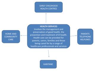
Service Delivery System • “ A cluster of diverse agencies within an organizational network that provides services to a common client population” • Components: • The client or patient population • The provider agencies • The relationships that connect clients or providers
Normative models of facility location and service delivery • Normative models and mathematical programming methods • They are designed to identify the facility locations or flows that maximize or minimize a mathematical function that expresses the objective of the decision maker.
Allocation models • Assume that facility locations are fixed_ as they are in the short term_ and identify the assignment of patients to facilities that maximizes or minimizes the objective function-for example, the assignment that minimizes total distance traveled to service sites.
Location models • Seek the set of locations from among a set of candidate sites that maximize or minimize the objective function.
Location-allocation models • Identify the optimal locations and assignments. • Location-allocation problems are solved through the application of mathematical programming techniques. • Mathematical programming is a set of numerical methods for solving optimization problems. These methods are not based in multivariate inferential statistics. These models have been used within medical geography since the 1960s when the algorithms for solving them could be run on mainframe computers.
The transportation problem • To assign demand associated with a set of demand points to facilities that can supply the needed service (supply sites) so that the total cost of the assignment (total distance or travel time) is minimized. • Bounded transportation problem is a variant of the transportation problem that places a lower bound or service population threshold on each supply site as well as an upper bound on each site’s capacity.
Facility Location • Minimizing travel effort • P-median problem • The objective of the p-median problem is to locate a given number of facilities among a set of candidate facility sites so that the total travel distance or time to serve the population assigned to the facilities is minimized, using the median as the measure of central tendency.
Unlike the transpiration problem, in which the number and locations of supply sites are known in advance, the p-median problem specifics only the number of facilities, p, to be located from a larger set of possible facility sites.
Maximizing coverage and emerging service location • Location set covering problem (LSCP) identifies the minimal number and the locations of facilities required to cover or provide service to all users, within a prespecified critical travel distance or time • The objective function of LSCP is to minimize the total number of facilities to be opened from a set of potential facility locations.
An obvious limitation of the LSCP is that the number of facilities required to cover 100% of the population may be beyond the budget available for providing the service. To address this problem, analysts developed the maximal covering problem, incorporating elements of both the • p-median problem and the LSCP.
Maximal covering problems are particularly appropriate for planning and evaluating the location of emergency service facilities. • Emergency Medical Service (EMS) delivery is the only effective if the response can be made within a critical time period.
Maximizing medical outcomes • Enhancing coverage by ensuring geographical accessibility and enhancing the level of care by centralizing services are two desirable objectives for the spatial organization of a health service system to improve patient outcomes.
Shortest Path Analysis • For services like EMS requiring service providers to travel to the person in need, the optimal route for the service provider to take from the dispatch site to the location where care will be delivered may also be an important issue.
In location analysis, shortest path algorithms are used to find the shortest distance (or least cost) path from one point in a transportation network to another point. • Shortest path algorithms, more than other types of normative models, have been incorporated into GIS software packages.
Routing Problems • Home-delivered care, like the services provided by visiting nurses, requires the service provider to make series of stops along a route. In rural areas, where travel times between stops are likely to be longer, less service can be delivered by a single provider because more time must be devoted to travel.
Finding the order in which the stops are made that minimizes the total distance traveled is an optimization problem known as the “Traveling Salesman Problem”
Incorporating normative models of facility location and service delivery into GIS • Representing demand for services and the implications of demand aggregation • Identify feasible sites for facility location • Modeling coverage areas based on the road network • Modeling service delivery routes • Finding solution methodologies that can be implemented in the GIS
b Potential Facility Site a 1 A e f c d Aggregated Clients location Actual Client location B g Potential Facility Site 2 h
b Potential Facility Site a 1 A e f c d Actual Client location g h Aggregated Clients location Potential Facility Site 2
Decision Maker Propose and evaluate alternative User Interface Analytical Models Spatial Database Management Systems Spatial Databases Components of a Spatial decision support system