Download
1 / 21
210 likes | 298 Views
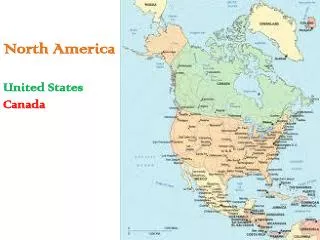
Extreme Waves at the Great Lakes: Performance of NCEP’s Operational Wave Models. Jose-Henrique Alves Research Scientist SRG@NOAA/NCEP/EMC. Outline. General Views Past numerical wave models Present Op models Description of op systems at NCEP Performance in typical condtions

E N D
Extreme Waves at the Great Lakes: Performance of NCEP’s Operational Wave Models Jose-Henrique Alves Research Scientist SRG@NOAA/NCEP/EMC
Outline • General Views • Past numerical wave models • Present Op models • Description of op systems at NCEP • Performance in typical condtions • Performance in severe storms • Improving model performance during storms • What future lies ahead?
General Views: Numerical Ancestry • 1974: First Automated NWS wave forecasts for Great Lakes • Pore (1979) based on Bretschneider (1970) fetch relations • Predictions at set of 64 point in five major lakes • Fetches radiating from points in 24 directions • Late 70’s: Two-dimensional grid using 2G wave model • Mark Donelan’s wave model from an unpublished 1977 report • Tweaked for Great Lakes by GLERL (Liu, Schwab et al) using obs • Made more accurate via wind analysis developed at GLERL • GLERL wave model is the main source of wave now/forecasts in the region today.
General Views: Modern Era • Early 2004: Pilot-test using WAVEWATCH III at Marquette WFO • Good results : proof of concept , 3G model could be beneficial • Motivation to WFOs request toward using WW3 in the region • Late 2004: Development o a WW3-based system starts • 2005: Testing and interaction with local WFOs • Defining best wave spectral resolutions • Assessing quality of available winds (ETA, then NAM model) • Gathering bathymetric data (NGDC and GLERL) => spatial grids
NCEP Op Implementations • 08/2006: Great Lakes Wave system (GLW)is made operational • 4 X daily forecasts at 00Z, 06Z, 12Z and 18Z • Initialization using 0h nowcast from previous run, with 6h hindcast forced with NDAS, then 84h forecasts • Output products made available via ftp://ftpprd.noaa.gov and non-operational NCEP website http://polar.ncep.noaa.gov
NCEP Op Implementations • 2008: Experimental GLW/NDFD (GLWN) wave system • Request from WFOs for a wave model forced with NDFD winds • 2009: Op implementation of the GLWN • Identical settings to GLW/NAM: shared spectral resolutions, spatial grids, ice coverage, air-sea temperature differences etc • Staggered operational schedule: 03Z, 09Z, 15Z and 21Z • Extended forecast horizon (up to 144h) • No hindcast: initialization with 6h forecasts of previous cycle
NCEP Op Implementations • GLW/GLWN system configuration: • WAVEWATCH III model • Wave evolution physics parameterizations following Tolman & Chalikov (1996), default WW3 package • Single, regular spatial grid covering all lakes • 0.05o x 0.035o resolution in longitude by latitude ~ 4km • Discrete wave spectrum resolved between 0.05Hz and 0.72Hz • Corresponds to the observed wave scales as per buoy data • Stability estimated internally using air-sea temperature differences • Products output every 3h, made available via NOAA’s operational ftp server and non-operational web site
Performance: Typical Conditions • Bulk validation: emphasizes performance in typical conditions • Wave model vs buoys: bias, RMS errors and correlation • Performance assessment made for years 2008 and 2009 • Only NDBC buoys used for bulk performance study • Lake Superior: 45001, 45004, 45006 • Lake Michigan: 45002, 45007 • Lake Huron: 45003, 45008 • Lake Erie: 45005 • Lake Ontario: 45012 • Assessment made relative to reference wave model for the region: GLERL wave model, Great Lakes Op Forecast System (GLOFS) • Forecast phase has same forcing winds as in the GLWN model
Performance: Typical Conditions 2009 Winds 24h 48h Waves
Performance: Typical Conditions • Bulk validation in 24h and 48h forecasts • NAM and NDFD winds are very similar, almost indistinguishable • GLW, GLWN and GLERL have similar biases • GLW and GLWN have slightly lower RMS errors than GLERL • GLW and GLWN have noticeably better correlations than GLERL • Typical conditions: GLW, GLWN, GLERL are statistically similar • Generally similar values of bias, RMS error and correlations • Standard deviations are very different • Normalized STD for GLERL is close to 1 relative to buoys • GLW is close to 0.80, GLWN is close to 0.75!
Performance: Severe Sea States • 99% wind speeds and wave heights (normalized by obs) • Emphasize more severe sea states, storms 2009 Winds 24h 48h Waves
Performance: Storm Wave Forecasts • Assessment included 95% (not shown) and 99% percentiles • Results reveal that: • NAM and NDFD provide a reasonable representation of stronger winds associated with storms • NAM slightly outperforms NDFD at upper wind-speed percentile • GLW, GLWN systematically underestimate upper Hs percentiles • GLW clearly outperforms GLWN • GLERL wave model provides a reasonably accurate representation of observed upper Hs percentiles • Both GLERL and GLWN use the same NDFD forecast winds • Default WAVEWATCH III physics are not doing a good job in reproducing wave growth in intense storms in areas with short/irregular fetches… nothing new.
Better Physics: Bridging the Gap • Recent WAVEWATCH III development focused on better parameterizations of wave evolution physics • ONR, USACE and NCEP joined forces in a NOPP • Scientists from USA, Canada, Netherlands, France, Australia etc • Collaboration that recently produced 1st improved wave physics package, in development version of WAVEWATCH III • Team spearheaded by FabriceArdhuin (Ifremer, France) • More realistic wave growth and dissipation source terms • Input based on Miles exponential growth • Negative input due to swells or mature waves • Dissipation based on recent empirical data
Better Physics: Bridging the Gap • Performance of WW3 + Ardhuin et al. (2010) physics [A+10] • Comparative assessment using GLERL wave model as a reference • To emphasize model skill, analysis winds were used • Wave hindcasts were generated with models forced by GLERL surface wind analyses for 2008 and 2009 • GLW system was run with the default WW3 physics (Tolman and Chalikov, 1996) and with the new A+10 package • GLERL wave model data and GLERL wind analyses were provided by Dave Schwab and Greg Lang from … GLERL!
Better Physics: Bridging the Gap 2009 • WW3 with A+10 Physics • Breakthrough-level improvement to GLW in term of Hs • Improved GLW’s already good bulk statistics (bias, RMS error, correlation) • Matched GLERL STD • Higher precision in tracking observations • Much improved wave periods relative to GLERL
Better Physics: Bridging the Gap 2009 • 99% normalized by obs • GLERL wind analyses have a superb quality: great accuracy in upper wind speeds at 99% • WW3 with A+10 Physics • Breakthrough-level improvement in predicting 99%wave heights
Example Cases: Severe Sea States • Buoy 45004, Northeast of Marquette, MI (Lake Superior) • Double whammy… • September 28 2009 • Maximum recorded wind speed: 18.25 m/s • Maximum recorded Hs: 5.15 m http://www.youtube.com/watch?v=2pKgF_QMT14 • October 10 2009 • Maximum recorded wind speed: 16.60 m/s • Maximum recorded Hs: 5.05 m http://www.youtube.com/watch?v=MRczx6Mr0gc
Future Work • Extend cases to include more severe wave events • Expand assessment relative to Environment Canada Buoys • Towards development of a Great Lakes wave test bed • Including also “swell” cases • Wave evolution in sudden wind drop cases • Nearshore wave evolution (further down the track) • Collaboration with NWS WFOs, POC Greg Mann
Future GLW/GLWN Systems • Great reaults, aren’t they?? • Implement A+10 physics in GLW/GLWN within 1 year • Include in the new system several other upgrades: • Hindcast phase in GLWN using new RTMA overlake analyses • RTMA will have internal adjustment over lakes using GLERL wind analysis algorithm • More accurate bathymetries (current not updated since 2004) • Possibly higher overall grid resolution (probably double) ~ 2km • Deployment of nearshore grids, two-way nested to coarser grid, possibly at ½ km resolution • New GLW development to be made in tight collaboration with NWS Great Lakes WFOs.
This is the last slide! QUESTIONS? If anything to say or ask later: Henrique.Alves@NOAA.gov