Download
1 / 36
360 likes | 507 Views
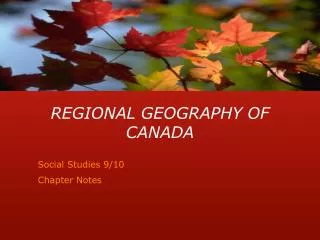
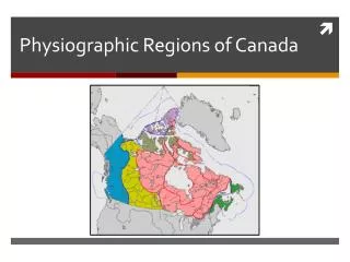
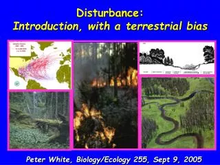
Canada’s 15 Terrestrial Ecozones. What is an Ecozone?. It is a geographic zone that can be defined by similar characteristics The characteristics can include: landforms, climate, soils, vegetation, wildlife, and human activity Canada has 15 ecozones. Arctic Cordillera. Bylot Island.

E N D
What is an Ecozone? • It is a geographic zone that can be defined by similar characteristics • The characteristics can include: landforms, climate, soils, vegetation, wildlife, and human activity • Canada has 15 ecozones
Arctic Cordillera Bylot Island Pond Inlet, Baffin Island Ice Tongue, Ellesmere Island
Arctic Cordillera • Northern Nunavut, including sections of Baffin Island and Ellesmere Island • Most inhospitable ecozone • Little to no vegetation • About 1,000 permanent residents, mostly Inuit • Too harsh for reptiles, amphibians or insects
Arctic Wolf Snowy Owl Walrus
Northern Arctic Polar Bear Pass, Bathurst Island Arctic Landscape during summer months Barren Land Caribou Snow Goose
Northern Arctic • Northern Nunavut and NWT • Coldest and driest ecozone • There is total permafrost, and this can extend to over 1km in thickness • Little vegetation
Southern Arctic Wetlands, Yukon Polar Bear Arctic Hare
Southern Arctic • Northern edge of continental NWT and northern Quebec • Landscape formed through glaciation • The tree line is at the very south edge of this ecozone • Population is around 10,000
Taiga Plain Beaver pond in Northern Alberta Keg River, Alberta Western Toad (found only in BC and the Yukon Moose
Taiga Plain • Centred around the Mackenzie River • Population is around 22,000, with most people making their income off the land – mining, forestry, etc.
Taiga Shield Osprey American Marten Lynx
Taiga Shield • Stretches eastward from NWT to Quebec • Part of the Canadian Shield, which has some of the world’s oldest rock deposits • Landforms include: wetlands, shrub lands and forests
Boreal Shield Saguenay Fjord, Quebec Lower Laurentians, Quebec Shawbridge, Quebec
Boreal Shield • Largest ecozone in Canada (reaches across Alberta, Saskatchewan, Manitoba, Ontario, Quebec and Newfoundland • Glaciers responsible for wetlands, lakes in the area • Many diverse landscapes
Beaver American Black Bear Great Blue Heron Eastern Red Cedar
Atlantic Maritime Harbour Seal (top and left) Gooseberry Bay, Nova Scotia
Atlantic Maritime • Comprises the Maritime provinces • Very high precipitation rates – this area is home to the most storms in all of Canada • New Brunswick is densely forested, and that industry is very large in this ecozone, in addition to fisheries
Mixedwood Plains Niagara Falls, Ontario Groundhog Killdeer Raccoon
Mixedwood Plains • Southern Ontario and Quebec • Most heavily populated ecozone • Major land use is agriculture • Smallest ecozone • Highly changeable weather patterns
Boreal Plain Buffalo Jump Prov. Park, Alberta Alberta landscape American Badger Great Horned Owl
Boreal Plain • Population around 750,000 scattered in small communities • Canada’s oil and gas industry • Located in the central to northern sections of the Prairie Provinces • Rocky Mountains create rainshadow effect
Prairie Plain Alberta Hay Field Canola Field Long-tailed Weasel The Bad Lands
Prairie Plain • Southern Alberta, Saskatchewan and Manitoba • Major land use is agriculture • 80 per cent of the population resides in cities • Glaciers formed landscape – the “Bread Basket” created when an inland lake dried up leaving fertile land
Taiga Cordillera Mountain Goat Gyrfalcon American Pika
Taiga Cordillera • The border between Yukon and NWT • This area represents the most northern section of the Rocky Mountains • Landforms consist of mountains and valleys
Boreal Cordillera Kluane Lake, Yukon Glacier in Yukon Kaskawalsh Glacier, Kluane
Boreal Cordillera • Southern Yukon and northern British Columbia • Mining is a primary industry (Klondike Gold Rush) • Landforms include: mountains, plateaus and valleys
Kluane Lake, Yukon Arctic Ground Squirrel Whitebark Pine
Pacific Maritime Mountain Lion (Cougar) California Sea Lion BC Rainforest Salmon Glacier, BC
Pacific Maritime • Comprises BC’s west coast • This ecozone has the wettest weather and tallest trees in Canada • Climate is dictated by Pacific Ocean • There are still glaciers found in high elevations
Montane Cordillera Burstall Pass Helmcken Falls (Wells Gray National Park, BC) Jasper Provicial Park California Big Horn Sheep Wolverine
Montane Cordillera • Southern BC and western Alberta • The most diverse ecozone because of its 2 mountain ranges • Susceptible to orographic (relief) precipitation • Many national parks (e.g., Banff, Jasper)
Hudson Plains Bearded Seal Balsam Poplar American Mink
Hudson Plains • Area surrounding Hudson Bay • This area represents the largest system of natural wetlands in the world • Large vegetation (trees) found only at higher and drier elevations
Source: Canadian Biodiversity Website. (2012). Retrieved from: http://canadianbiodiversity.mcgill.ca/english/index.htm