Download
1 / 53
530 likes | 851 Views
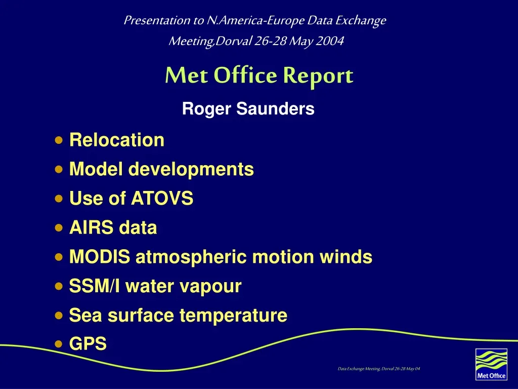
Presentation to N.America-Europe Data Exchange Meeting,Dorval 26-28 May 2004. Met Office Report. Roger Saunders. Relocation Model developments Use of ATOVS AIRS data MODIS atmospheric motion winds SSM/I water vapour Sea surface temperature GPS. Relocation.

E N D
Presentation to N.America-Europe Data Exchange Meeting,Dorval 26-28 May 2004 Met Office Report Roger Saunders • Relocation • Model developments • Use of ATOVS • AIRS data • MODIS atmospheric motion winds • SSM/I water vapour • Sea surface temperature • GPS
Relocation • Met Office HQ relocated ~200km from Bracknell to Exeter - biggest IT move in Europe! • Operational forecasts started in Exeter Sep 03 • New building completed in Dec 03 • More than 70% of the staff moved to Exeter • All open plan offices (including Director!) • New director will be Dave Rogers Bracknell Exeter
Presentation to N.America-Europe Data Exchange Meeting,Dorval 26-28 May 2004 Met Office Report Roger Saunders • Relocation • Model developments • Use of ATOVS • AIRS data • MODIS atmospheric motion winds • SSM/I water vapour • Sea surface temperature • GPS
Met Office NWP Models Data Assimilation: 3DVar, FGAT, 6 hr cycle 1hr 50min cut-off with 7hr update runs for next cycle Model formulation: Exact equations of motion in 3D, non-hydrostatic effects included, semi-Langrangian scheme, hybrid-eta in height.
Global Model • No major upgrades over the last year due to relocation ‘freeze’ • Successfully migrated to NEC SX-6 from Cray T3E’s on 27 April 04. • Satellite upgrade goes operational this week more later • 4DVar planned for late summer 04 implementation, conservative implementation but good impacts. • 70L model with top above 0.1hPa planned for 2005 along with increased horizontal resolution. • 16 member ensembles out to T+72 at half operational resolution planned for 2005.
European model Domain 548 Current UK mesoscale 320 New Euro Model 20km resolution
European Model (EUROLAM) • 20km grid model became operational on 23 Mar 04 • Run 4 times per day out to T+48hr • Data assimilation 3DVar • Observation usage similar to global model • Products planned to be available in late 2004 • Move to 12km grid in 2005
Observations used in Global, Euro and UK Mesoscale models (May 04)
Presentation to N.America-Europe Data Exchange Meeting,Dorval 26-28 May 2004 Met Office Report Roger Saunders • Relocation • Model developments • Use of ATOVS • AIRS data • MODIS atmospheric motion winds • SSM/I water vapour • Sea surface temperature • GPS
Met Office NOAA Data Acquisition West Freugh or Exeter Washington EUMETCAST Local HRPT EARS 1a data Global 1b data AAPP AAPP AAPP 1c data to European Met Centres METO NWP • 1a counts + housekeeping • 1b counts + navigation + cal info • 1c brightness temps • 1d brightness temps on HIRS Grid 1d data on HIRS grid
Use of ATOVS data • Global level 1b data from NESDIS • Converted to level 1d (all IFOVS mapped to HIRS) using AAPP software • Level 1d radiances pre-processed with 1D-Var • Level 1d radiances assimilated in 3D-Var • HIRS/AMSU in Global and AMSU only in Euro and mesoscale models • Main global model run (cut-off 1:50) • Update model run (cut-off ~7:00)
Use of EARS ATOVS data • Receiving ATOVS 1A data from up to 8 stations • Routinely compare level 1B global (from NESDIS) with EARS level 1B (using AAPP to convert from 1A to 1B) • Comparisons of: • Earth location • Brightness temperatures HIRS, AMSU • AMSU data show good agreement but HIRS shows large differences due to calibration • To reduce the delay in the ATOVS ‘blind’ orbits the EUMETSAT EARS AMSU data are now being assimilated in our global forecast model
EARS data coverage STATIONS Black: Current Red: Proposed future upgrade
Arrival Times of Data • North Atlantic Region • six-hour window 09/09/2003 09:00-15:00 Main Run NESDIS 25% EARS 75% Update Run both 100% First Overpass window
Experiment to assess impact of early cut-off on forecasts • Period 12 May – 4 June 2003 • NOAA level 1b radiances used: • NOAA-15 AMSU-A/AMSU-B • NOAA-16 HIRS/AMSU-A/AMSU-B • NOAA-17 HIRS/AMSU-A/AMSU-B • Control: All data received before 1:50 (Ops) for main run and all late ATOVS used in update run • Experiment: All data received before 1:50 + all late ATOVS received (up to 50% more data) used in main model run
1:50 cut-off Forecast impactsN. Hem500hPa Improved bust?
1:50 cut-off Forecast impactsS. Hem500hPa Consistent improvement
Example 985 hPa low in control 975 hPa low including late ATOVS 976 hPa low in analysis
AMSU ‘precip’ imagery increasing cloud liquid water incr. scattering Imagery Application Other applications outside of NWP can also exploit the timeliness of EARS data. This plot shows an example of a now-casting product that is disseminated in near real time to forecasters. The areas coloured green, red, yellow denote increasing cloud liquid water, identified using AMSUA radiances. Blue denotes the scattering signal in the AMSUB radiances, produced either by ice particles in the cloud, which can infer precipitation, or sea-ice. The product is overlaid on a coincident Meteosat IR image.
Summary of recent OSEs at the Met Office • Remove AMSU, HIRS, AMSU+HIRS radiances • Remove radiosonde temperature and humidity • Remove 1, 2, 3 x ATOVS • CHAMP Radio Occultation
Percentage change in RMS fit of radiosonde Z & RH, and ship/buoy/synop pmsl to T+6
Schematic AMSU and HIRS ~ 0% No HIRS AMSU only ~4% ~6% ~6% No AMSU so HIRS only ~2% No AMSU and no HIRS So HIRS >> nothing. So assimilating only in cloud-free areas does improve forecasts. So AIRS should give a benefit in data sparse areas? Worth using HIRS if AMSU-A fails (as on NOAA-17)?
Percentage change in RMS fit of radiosonde Z & RH, and ship/buoy/synop pmsl to background
Conclusions • Late ATOVS missing main f/c run degrades forecasts. • EUMETSAT EARS can help alleviate this. • First and second AMSU are very important to NWP. • Third AMSU still positive overall, but main role is robustness. • HIRS impact much less than AMSU but still an impact on low level moisture (NB SSM/I low level moisture not used). In absence of AMSU, HIRS impact is still very significant so important for robustness. • AIRS initial impacts much larger than HIRS, smaller than sonde temperatures and much smaller than AMSU.
Presentation to N.America-Europe Data Exchange Meeting,Dorval 26-28 May 2004 Met Office Report Roger Saunders • Relocation • Model developments • Use of ATOVS • AIRS data • MODIS atmospheric motion winds • SSM/I water vapour • Sea surface temperature • GPS
Monitoring web page Available via password protected page on Met Office site. Userid:airspage Passwd: &Graces
Change in Forecast Errors:500hPa Height at 24 hours -0.2% -0.6% -1.8% Red/green reduced errors due to AIRS
Satellite Spring UpgradeAndrew Collard, Nigel Atkinson, Brett Candy, Fiona Hilton, James Cameron, Roger Saunders and Stephen English • AIRS radiances: cloud-free, ocean fovs only (~5% of fovs, ~3% of channels) • Aqua AMSU-A radiances • EUMETSAT ATOVS Retransmission Service Radiances for Tromso, Maspalomas and Edmonton (3 out of 8 stations). • RTTOV-7 radiative transfer model replaces RTTOV-5 • New bias correction scheme using 850-300hPa and 200-50hPa thicknesses as predictors rather than AMSU channels 5 and 9. • Use of ATOVS radiances over all land areas (previously restricted to elevations < 1000m)
Presentation to N.America-Europe Data Exchange Meeting,Dorval 26-28 May 2004 Met Office Report Roger Saunders • Relocation • Model developments • Use of ATOVS • AIRS data • MODIS atmospheric motion winds • SSM/I water vapour • Sea surface temperature • GPS
MODIS polar winds • MODIS imagery from Terra and Aqua used to generate winds. • IR(11mm) and WV (6.7mm) channels • 100 min between overlapping images. • Time delay of 5-6 hours after valid time before winds are available. • Still experimental. MetOffice obtains them via ECMWF. Now using winds from Washington. Picture courtesy of CIMSS
MODIS winds impact • New results using NESDIS-NCEP MODIS winds • Better results than earlier winds from CIMSS
Presentation to N.America-Europe Data Exchange Meeting,Dorval 26-28 May 2004 Met Office Report Roger Saunders • Relocation • Model developments • Use of ATOVS • AIRS data • MODIS atmospheric motion winds • SSM/I water vapour • Sea surface temperature • GPS
II. SSMI TPW used to validate model performance O - B 22GHz model ‘wet’ model ‘dry’ ‘normal’ regime
Presentation to N.America-Europe Data Exchange Meeting,Dorval 26-28 May 2004 Met Office Report Roger Saunders • Relocation • Model developments • Use of ATOVS • AIRS data • MODIS atmospheric motion winds • SSM/I water vapour • Sea surface temperature • GPS
(A)ATSR SST anomalies ATSR-2 ATSR ERS-2 gyro failure AATSR Climate Model SST anomalies
Presentation to N.America-Europe Data Exchange Meeting,Dorval 26-28 May 2004 Met Office Report Roger Saunders • Relocation • Model developments • Use of ATOVS • AIRS data • MODIS atmospheric motion winds • SSM/I water vapour • Sea surface temperature • GPS
GPS Stations for TCWV • Current GPS network shown over Europe • TCWV data put on GTS in real time • Plans to assimilate in Euro model
Ozonesondes from Lerwick • The Met Office started launching weekly ozonesonde ascents from Lerwick in Feb 04 • Normally ~11Z on a Wednesday • Ascents put on GTS in real time in WMO BUFR format • Data also sent to NILU • To ensure continuity an email/letter of interest to Met Office would help