Download
1 / 51

E N D
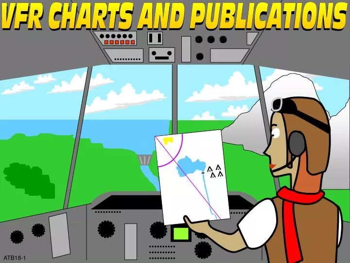
OBJECTIVE(S) • Given aeronautical charts and an airport facility directory, on an End-of-Lesson Test, and in accordance with the AIM, FAA Order 7110.65, and chart/directory legends, you will identify the purpose, contents, and specific items and information (e.g., NAVAIDs, airport elevation, etc.) of: • 1. Sectional Aeronautical Charts. • 2. VFR Terminal Area Charts. • 3. World Aeronautical Charts. • 4. Airport/Facility Directory. ATB18-2
SECTIONAL CHARTS ATB18-3
PUBLICATION INFORMATION • DALLAS-FT WORTH • SECTIONAL AERONAUTICAL CHART • SCALE 1:500,000 • Lambert Conformal Conic Projection Standard parallels 33°20’ and 38°40’ • Horizontal Datum: North American Datum of 1983 (World Geodetic System 1984) • TH EDITION March 26, 1998 • Includes airspace amendments effective February 26, 1998 • and other aeronautical data received by January 29, 1998 • Information on this chart will change; consolidated updates of chart changes are available every • 56 days in the AIRPORT / FACILITY DIRECTORY (A/FD). Also consult appropriate NOTICES TO • AIRMEN (NOTAMs) and other FLIGHT INFORMATION PUBLICATIONS (FLIPs) for the latest changes. • This chart will become OBSOLETE FOR USE IN NAVIGATION upon publication of the next edition scheduled for October 8, 1998 • PUBLISHED IN ACCORDANCE WITH INTERAGENCY AIR CARTOGRAPHIC COMMITTEE • SPECIFICATION AND AGREEMENTS, APPROVED BY • DEPARTMENT OF DEFENSE * FEDERAL AVIATION ADMINISTRATION * DEPARTMENT OF COMMERCE SOUTH NORTH 60 ATB18-4
GEOGRAPHICAL AREA PRESENTATION ATB18-5
MAXIMUM ELEVATION FIGURES ATTENTION THIS CHART CONTAINS MAXIMUM ELEVATION FIGURES (MEF). The Maximum Elevation Figures shown in quadrangles bounded by ticked lines of latitude and longitude are represented in THOUSANDS and HUNDREDS of feet above mean sea level. The MEF is based on information available concerning the highest known feature in each quadrangle, including terrain and obstructions (trees, towers, antennas, etc.). Example: 12,500 feet……... 125 ATB18-6
3818 3000 2000 1000 Sea Level HIGHEST TERRAIN AND CONTOUR INFORMATION CONTOUR INTERVAL 500 feet 500 HIGHEST TERRAIN elevation is 3818 feet located at 34°52’N - 101°59’W Critical Elevation ------------------ · 4254 Approximate Elevation ------------ X 3200 Doubtful locations are indicated by omission of the point locator (dot or ”x”) ATB18-7
RESPONSE ITEM • MEFs depict the elevation of the highest • A. topographical feature on the chart. • B. known feature within each section of the chart. • C. elevation rounded up to the next 1,000 feet. B. known feature within each section of the chart. B. known feature within each section of the chart. B. known feature within each section of the chart. ATB18-8
CHART LEGEND ATB18-9
AIRPORTS Airports having ControlTowers are shown in Blue, all others in Magenta. Consult Airport/Facility Directory (A/FD) for details involving airport lighting, navigation aids, and services. For additional symbol information refer to the Chart User’s Guide. Other than hard-surfaced runways Seaplane Base Hard-surfaced runways 1500 ft. to 8069 ft. in length Hard-surfaced runways greater than 8069 ft. or some multiple runways less than 8069 ft. Open dot within hard-surfaced runway configuration indicates approximate VOR, VOR-DME, or VORTAC location All recognizable hard-surfaced runways, including those closed, are shown for visual identification. Airports may be public or private. ATB18-10A
R U F ADDITIONAL AIRPORT INFORMATION Private “(Pvt)” - Non-public use having emergency or landmark value. Military - Other than hard-surfaced. All military airports are identified by abbreviations AFB, NAS, AAF, etc. For complete airport information consult DOD FLIP. H Heliport- Selected Public Unverified Abandoned - paved, having landmark value, 3000 ft. or greater Ultralight Flight Park Selected Services - fuel available and field tended during normal working hours depicted by use of ticks around basic airport symbol. (Normal working hours are Mon thru Fri 10:00 A.M. to 4:00 P.M. local time). Consult A/FD for service availability at airports with hard-surfaced runways greater than 8069 ft. Rotating airport beacon in operation Sunset to Sunrise. ATB18-10B
- Lighting in operation Sunset to Sunrise - Lighting limitations exist, refer to Airport/Facility Directory - Length of longest runway in hundreds of feet; usable length may be less When facility or information is lacking, the respective character is replaced by a dash. All lighting codes refer to runway lights. Lighted runway may not be the longest or lighted full length. All times are local. FSS - Flight Service Station NO SVFR - Fixed-wing special VFR flight is prohibited. CT - 118.3 - Control Tower (CT) - primary frequency NFCT - Non-Federal Control Tower « - Star indicates operation part-time (see tower frequencies tabulation for hours of operation). - Indicates Common Traffic Advisory Frequencies (CTAF) L *L 72 AIRPORT DATA F.A.R. 91 Box indicates F.A.R. 93 Special Air Traffic Rules & Airport Traffic Patterns FSS NO SVFR NAME (NAM) CT - 118.3« ATIS 123.8 285L 72122.95 VFR Advsy 125.0 Airport of Entry Location Identifier Airport Surveillance Radar UNICOM ATIS 123.8 - Automatic Terminal Information Service ASOS/AWOS 135.42 - Automated Surface Weather Observing Systems. NDBs broadcasting ASOS/AWOS data may not be located at the airport. UNICOM - Aeronautical advisory station VFR Advsy - VFR Advisory Service shown where ATIS not available and frequency is other than primary CT frequency 285 - Elevation in feet ATB18-11
RESPONSE ITEM • Airports with control towers are always depicted • A. in the color blue. • B. by a circle with runway configurations shown. • C. with the letter “T” next to the airport. A. in the color blue. A. in the color blue. A. in the color blue. ATB18-12
RESPONSE ITEM • In the airport data “450 L 51 122.7,” the letter “L” indicates • A. the category of NAVAID located at the airport. • B. a left-hand traffic pattern is standard at that airport. • C. the airport has runway lighting. C. the airport has runway lighting. C. the airport has runway lighting. C. the airport has runway lighting. ATB18-13
RESPONSE ITEM • In the airport data “4500 L 72 122.95,” “4500” is the • A. airport elevation above sea level. • B. length of the longest runway. • C. height above sea level of the tallest obstruction within 5nm. A. airport elevation above sea level. A. airport elevation above sea level. A. airport elevation above sea level. ATB18-14
RADIO AIDS VHF OMNI RANGE (VOR) VORTAC VOR DME Non-Directional Radiobeacon (NDB) NDB-DME Other facilities, i.e., Commercial Broadcast Stations, FSS Outlets- RCO, etc. ATB18-15
COMMUNICATION BOXES 122.1R 122.1R 122.6 123.6 OAKDALE 362«116.8 OAK CHICAGO CHI Heavy line box indicates Flight Service Station (FSS). Freqs. 121.5, 122.2, 243.0, and 255.4 (Canada - 121.5, 126.7 and 243.0) are normally available at all FSSs and are not shown above boxes. All other freqs. are shown. For Local Airport Advisory use FSS freq. 123.6. Frequencies above thin line box are remoted to NAVAID site. Other freqs. at controlling FSS may be available as determined by altitude and terrain. Consult Airport/Facility Directory for complete information. • Underline indicates no voice on this freq • Operates less than continuous or On-Request. • TWEB - HIWAS • Receive only « R 122.1R MIAMI Controlling FSS ATB18-16
AIRPORT TRAFFIC SERVICE AND AIRSPACE INFORMATION Only the controlled and reserved airspace effective below 18,000 ft. MSL are shown on this chart. All times are local. Class B Airspace Class C Airspace (Mode C See F.A.R. 91.215/Aim). Class D Airspace Ceiling of Class D Airspace in hundreds of feet. (A minus ceiling value indicates surface up to but not including that value). Class E Airspace Class E Airspace with floor 700 ft above surface. Class E Airspace with floor 1200 ft or greater above surface that abuts Class G Airspace. Differentiates floors of Class E Airspace greater than 700 ft. above surface. Class E Airspace low altitude Federal Airways are indicated by center line. 40 2400 MSL 4500 MSL ATB18-17A
AIRPORT TRAFFIC SERVICE AND AIRSPACE INFORMATION Intersection - Arrows are directed towards facilities which establish intersection. Total mileage between NAVAIDs on direct Airways. Prohibited, Restricted, Warning and Alert Areas Canadian Advisory and Restricted Areas MOA - Military Operations Area Special Airport Traffic Areas (See F.A.R. Part 93 for details). MODE C (See F.A.R. 91.215/AIM). National Security Area Terminal Radar Service Area (TRSA) MTR - Military Training Routes V 69 132° 169 ¬IR211 ATB18-17B
OBSTRUCTIONS 1000 ft. and higher AGL Below 1000 ft. AGL Group Obstruction Obstruction with high-intensity lights May operate part-time Elevation of the top above mean sea level Height above ground Under construction or reported: position and elevation unverified NOTICE: Guy wires may extend outward from structures. or or 2049 (1149) UC ATB18-18
U H G MISCELLANEOUS 1°E Isogonic Line (1995 VALUE) Ultralight Fl Flashing Activity Light HangGlider Marine Activity Light Glider Operations NAME (Magenta, Blue, or Black) Visual Check Point Parachute Jumping Area (See Airport/Facility Directory). ATB18-19
CG TOPOGRAPHIC INFORMATION Roads Road Markers Railroad Bridges and Viaducts Power Transmission Lines Aerial Cable Landmark Feature - stadium, factory, school, golf course, etc. Outdoor Theater Lookout Tower P-17 (Site Number) 618 (Elevation Base of Tower) Coast Guard Station 40 95 ATB18-20A
TOPOGRAPHIC INFORMATION Race Track Tank Water, oil or gas Oil Well Water Well Mines and Quarries Mountain Pass 11823 (Elevation of Pass) Rocks Dams Pier Perennial Lake Non-Perennial Lake ATB18-20B
RESPONSE ITEM • A pilot can receive Hazardous Inflight Weather Advisory Service (HIWAS) broadcasts via the voice portion of a navigational aid if its communications box has a(n) • A. frequency written above the box. • B. asterisk preceding the NAVAID frequency. • C. filled-in square in the corner. C. filled-in square in the corner. C. filled-in square in the corner. C. filled-in square in the corner. ATB18-21
RESPONSE ITEM • The boundary of Class B Airspace is always depicted in what color? • A. Magenta • B. Blue • C. Dark gray B. Blue B. Blue B. Blue ATB18-22
RESPONSE ITEM • The height of an obstruction is indicated on the chart in feet above • A. ground level (AGL). • B. Mean Sea Level (MSL). • C. both ground level and sea level. C. both ground level and sea level. C. both ground level and sea level. C. both ground level and sea level. ATB18-23
40 V 69 132° 169 SYMBOL SEARCH 4 1 2 6 8 3 5 7 9 10 12 11 13 15 14 16 ATB18-24
CONTROL TOWER FREQUENCIES CONTROL TOWER FREQUENCIES ON DALLAS-FT. WORTH SECTIONAL CHART Airports which have control towers are indicated on this chart by the letters CT followed by the primary VHF local control frequency. Selected transmitting frequencies for each control tower are tabulated in the adjoining spaces, the low or medium transmitting frequency is listed first followed by a VHF local control frequency, and the primary VHF and UHF military frequencies, when these frequencies are available. An asterisk (*) follows the part-time tower frequency remoted to the collocated full-time FSS for use as Local Airport Advisory (LAA) during hours tower is closed. Hours shown are local time. Ground control frequencies listed are the primary ground control frequencies. Automatic Terminal Information Service (ATIS) frequencies, shown on the face of the chart are primary arrival VHF/UHF frequencies. All ATIS frequencies are listed below. ATIS operational hours may differ from control tower operational hours. ASR and/or PAR indicates Radar Instrument Approach available. “MON-FRI” indicates Monday thru Friday. ATB18-25A
CONTROL TOWER FREQUENCIES CONTROL TOWER OPERATES TWR FREQ GND CON ATIS ASR/PAR ABILENE REGIONAL CONTINUOUS 120.1 257.8 121.7 348.6 118.25 ASR ADDISON 0600-2400 MAY 1-OCT 31 126.0 239.0 121.6 133.4 0600-2200 NOV 1-APR 30 ALTUS AFB CONTINUOUS 119.65 255.6 121.85 275.8 273.5 ASR/PAR AMARILLO INTL 0600-2400 118.3 121.9 348.6 118.85 350.3 ASR ARDMORE NF 0700-2300 MON-FRI 118.5 257.7 121.8 0700-1700 SAT-SUN CLINTON-SHERMAN 0800-2100 MON-FRI 119.6 256.9 121.7 239.0 EXC HOL DALLAS-FT CONTINUOUS 124.15 134.9 (W) 121.65 121.8 (E) 123.775 ARR WORTH INTL 126.55 127.5 (E) 121.85 (W) 135.925 DEP NAS DALLAS/HENSLEY 0700-2300 126.2 336.4 143.6 382.8 278.0 ASR/PAR DALLAS LOVE CONTINUOUS 123.7 239.3 121.75 348.6 120.15 ASR DYESS AFB CONTINUOUS 133.0 295.7 119.35 275.8 385.7 ASR NAS FT WORTH/ 0700-2200 120.95 237.9 126.4 264.5 271.6 ASR/PAR CARSWELL FT WORTH CONTINUOUS 135.15 288.15 132.65 387.15 126.925 ALLIANCE FT WORTH CONTINUOUS 118.3 257.8 121.9 120.7 MEACHAM INTL GRAND PRARIE NF 0700-2100 DALGT 128.55 121.15 0800-1800 STD ATB18-25B
CLASS B, CLASS C, TRSA, AND SELECTED RADAR APPROACH CONTROL FREQUENCIES FACILITY FREQUENCIES ** SERVICE AVAILABILITY DALLAS-FT WORTH 118.1 306.95 (NORTHWEST) CONTINUOUS CLASS B 120.5 379.9 (SOUTHWEST) 124.3 282.35 (NORTHEAST) 125.2 343.65 (SOUTHEAST) ABILENE CLASS C 125.0 338.3 (EAST) CONTINUOUS 127.2 239.05 (WEST) AMARILLO CLASS C 119.5 307.0 (161°-339°) 0600-2400 124.8 319.15 (340°-160°) O/T Class E O/T 127.85 351.7 ZAB CNTR LUBBOCK CLASS C 119.2 351.8 (EAST OF LBB VORTAC 015°-165°) CONTINUOUS 119.9 335.6 (WEST OF LBB VORTAC 165°-015°) OKLAHOMA CITY CLASS C 120.45 385.5 (081°-170°) CONTINUOUS 124.2 336.4 (001°-080°) 124.6 395.0 (171°-360°) TULSA CLASS C 119.1 351.8 (355°-174°) CONTINUOUS 120.7 338.3 (175°-354°) ALTUS TRSA 125.1 348.3 CONTINUOUS HENRY POST AAF 120.55 233.2 (S) CONTINUOUS RADAR 127.3 227.3 (N) SHEPPARD AFB/ 118.2 308.6 0600-2100 WICHITA FALLS RADAR O/T 133.5 350.35 ZFW CNTR **ZAB - Albuquerque, ZFW - Fort Worth O/T - indicates Other Times ATB18-26
SPECIAL USE AIRSPACE (SUA) SPECIAL USE AIRSPACE ON DALLAS-FT. WORTH SECTIONAL CHART Unless otherwise noted altitudes are The word “TO” an altitude means “To and including.” MSL and in feet; time is local. “MON-FRI” indicates “Monday thru Friday” Contact nearest FSS for information. FL - Flight Level † Other time by NOTAM contact FSS NO A/G - No air to ground communications U.S. P-PROHIBITED, R-RESTRICTED, A-ALERT, W-WARNING, MOA-MILITARY OPERATIONS AREA NUMBER LOCATION ALTITUDE TIME OF USE CONTROLLING AGENCY** P-47 AMARILLO, TX TO 4800 CONTINUOUS NO A/G R-5601 A FORT SILL, OK TO 40,000 CONTINUOUS ZFW CNTR R-5601 B FORT SILL, OK TO 40,000 CONTINUOUS ZFW CNTR R-5601 C FORT SILL, OK TO 40,000 CONTINUOUS ZFW CNTR R-5601 D FORT SILL, OK 500 AGL TO 16,500 SR-SS TUE-SAT† ZFW CNTR R-5601 E FORT SILL, OK 500 AGL TO 6000 SR-SS TUE-SAT† ZFW CNTR A-561 FREDERICK, OK TO 4000 SR-SS MON-FRI NO A/G A-562 A ENID, OK TO 10,000 SR TO 3 HRS AFTER NO A/G SS MON-FRI A-636 WICHITA FALLS, TX TO 4000 1 HR BEFORE SR- NO A/G 1 HR AFTER SS MON-FRI A-637 LUBBOCK, TX TO 6000 SR TO 3 HRS AFTER SS NO A/G MON-FRI, WEEKENDS BY NOTAM ** ZFW - Fort Worth ATB18-27
MILITARY OPERATIONS AREAS (MOAs) MOA NAME ALTITUDE OF USE* TIME OF USE† CONTROLLING AGENCY** BROWNWOOD 1 EAST, 7000 0700-2200 ZFW CNTR 1 WEST BROWNWOOD 3 13,000 0700-2200 ZFW CNTR HOLLIS 11,000 1 HR BEFORE SR- ZFW CNTR 1 HR AFTER SS MON-FRI REESE 4 10,000 SR-SS MON-FRI LUBBOCK ATCT REESE 5 12,000 SR-SS MON-FRI ZFW CNTR RIVERS 8000 SR-2100 MON-SAT ZFW CNTR ROBY 12,000 SR-SS MON-FRI ZFW CNTR SHEPPARD 1,2 8000 1 HR BEFORE SR- ZFW CNTR 1 HR AFTER SS MON-FRI VANCE 1 A 10,000 1 HR BEFORE SR- ZKC CNTR 1 HR AFTER SS MON-FRI VANCE 1 B 7000 1 HR BEFORE SR- ZKC CNTR 1 HR AFTER SS MON-FRI WASHITA 8000 1 HR BEFORE SR- ZFW CNTR 1 HR AFTER SS MON-FRI WESTOVER 1 9000 1 HR BEFORE SR- ZFW CNTR 1 HR AFTER SS MON-FRI WESTOVER 2 10,000 1 HR BEFORE SR- ZFW CNTR 1 HR AFTER SS MON-FRI *Altitudes indicate floor of MOA. All MOAs extend to but do not include FL180 unless otherwise indicated in tabulation or on chart.†Other time by NOTAM contact FSS ** ZFW - Fort Worth, ZKC - Kansas City ATB18-28
MOA NAME ALTITUDE OF USE* TIME OF USE† CONTROLLING AGENCY** VANCE 1 B 7000 1 HR BEFORE SR- ZKC CNTR 1 HR AFTER SS MON-FRI WASHITA 8000 1 HR BEFORE SR- ZFW CNTR 1 HR AFTER SS MON-FRI WESTOVER 1 9000 1 HR BEFORE SR- ZFW CNTR 1 HR AFTER SS MON-FRI CONTROL TOWER OPERATES TWR FREQ GND CON ATIS ASR/PAR ABILENE REGIONAL CONTINUOUS 120.1 257.8 121.7 348.6 118.25 ASR ADDISON 0600-2400 MAY 1-OCT 31 126.0 239.0 121.6 133.4 0600-2200 NOV 1-APR 30 ALTUS AFB CONTINUOUS 119.65 255.6 121.85 275.8 273.5 ASR/PAR FACILITY FREQUENCIES ** SERVICE AVAILABILITY OKLAHOMA CITY CLASS C 120.45 385.5 (081°-170°) CONTINUOUS 124.2 336.4 (001°-080°) 124.6 395.0 (171°-360°) TULSA CLASS C 119.1 351.8 (355°-174°) CONTINUOUS 120.7 338.3 (175°-354°) ALTUS TRSA 125.1 348.3 CONTINUOUS NUMBER LOCATION ALTITUDE TIME OF USE CONTROLLING AGENCY** R-5601 E FORT SILL, OK 500 AGL TO 6000 SR-SS TUE-SAT† ZFW CNTR A-561 FREDERICK, OK TO 4000 SR-SS MON-FRI NO A/G A-562 A ENID, OK TO 10,000 SR TO 3 HRS AFTER NO A/G SS MON-FRI ATB18-29a
CLASS B OPERATING RULES OPERATING RULES AND PILOT/EQUIPMENT REQUIREMENTS. Regardless of weather conditions, an ATC authorization is required prior to operating within the Class B Airspace. Pilots should not request an authorization to operate within the Class B Airspace unless the requirements of FAR 91.215 and FAR 91.131 are met. Included among those requirements are: 1. Unless otherwise authorized by ATC, an operable two-way radio capable of communicating with ATC on appropriate frequencies for that Class B Airspace. 2. No person may take off or land a civil aircraft at the Dallas-Ft Worth International Airport unless the pilot in commands holds at least a private pilot certificate. 3. No person may take off or land a civil aircraft at an airport within the Class B Airspace or operate a civil aircraft within the Class B Airspace unless: (a) The pilot in command holds at least a private pilot certificate or: (b) The aircraft is operated by a student pilot who has met the requirements of FAR 61.95 4. Unless otherwise authorized by ATC, each person operating a large turbine engine-powered aircraft to or from a primary airport shall operate at or above the designated floors while within the lateral limits of the Class B airspace. 5. An operable VOR or TACAN receiver for IFR operations. 6. A transponder with automatic altitude reporting equipment. NOTE: ATC may, upon notification, immediately authorize a deviation from the altitude reporting equipment requirement or for a transponder failure; however, other request for deviations from the transponder equipment requirement must be submitted to the controlling ATC facility at least one hour before the proposed operation. ATB18-31A
CLASS B OPERATING RULES FLIGHT PROCEDURES: IFR FLIGHTS - Aircraft operating within the Dallas-Ft Worth Class B Airspace must be operated in accordance with ATC clearances and instructions. VFR FLIGHTS - 1. Arriving aircraft should contact the appropriate approach control on specified frequencies and in relation to geographic fixes shown on the accompanying chart. Although arriving aircraft may be operating beneath the floor of the Class B Airspace on initial contact, communications should be established with approach control in relation to the points indicated for sequencing and spacing purposes. 2. Aircraft departing the primary airports are requested to advise clearance delivery prior to taxiing of their intended altitude and direction of flight to depart the Class B Airspace. Aircraft departing from other than the primary airports whose route of flight would penetrate the Class B Airspace should give this information to ATC on the appropriate frequencies. 3. Aircraft desiring to transit the Class B Airspace must obtain an ATC clearance to enter the Class B Airspace and will be handled on an ATC workload permitting basis. ATC PROCEDURES: All aircraft will be controlled and separated while operating within the Class B Airspace, except helicopters need not be separated from other helicopters. Although radar separation will be the primary standard used, approved visual and other nonradar procedures will be applied as required or deemed appropriate. Traffic information on observed but unidentified radar targets will be provided on a workload permitting basis to aircraft operating outside the Class B Airspace. NOTE: Assignment of radar headings and/or altitudes is based on the provision that a pilot operating in accordance with visual flight rules is expected to advise ATC if compliance with an assigned route, radar heading or altitude will cause the pilot to violate such rules. ATB18-31B
VFR FLYWAY PLANNING CHART LEGEND DALLAS-FT WORTH CHARTED VFR FLYWAY PLANNING CHART Scale: 1:250,000 NOT TO BE USED FOR NAVIGATION LEGEND AIRPORTS Paved Runways Unpaved Runways NAME (NAM) NAME (NAM) NAME (NAM) NAVIGATIONAL AIDS VOR VORTAC VOR/DME DLG 138.8 PPS 121.8 KIP 110.7 NDB NDB/DME DCW 262 RMW 320 ATB18-32
EXAMPLES OF CLASS B AIRSPACE ALTITUDES ------ CEILING IN HUNDREDS OF FEET MSL ------ FLOOR IN HUNDREDS OF FEET MSL ------ MODE C (SEE F.A.R. 91.215/AIM) 70 30 40 VFR FLYWAY PLANNING CHART LEGEND AIRSPACE INFORMATION CLASS B AIRSPACE CLASS B SURFACE AREA CLASS C AIRSPACE CLASS C SURFACE AREA MODE C (SEE F.A.R. 91.215/AIM.) Class D Airspace Ceiling of Class D Airspace in hundreds of feet. (A minus ceiling value indicates surface Class E Airspace up to but not including that value.) ATB18-33
VFR FLYWAY PLANNING CHART LEGEND SPECIAL USE AIRSPACE Prohibited, Restricted, Warning and Alert Areas, Canadian Advisory and Restricted Areas SUGGESTED VFR FLYWAY AND ALTITUDE IFR DEPARTURE ROUTES IFR ARRIVAL ROUTES Military Operations Areas (MOA) 2600 6700 OBSTRUCTIONS (Selected) NAVIGATION REFERENCE POINT MOUNTAIN TOP OR PEAK AND SPOT ELEVATION N 38°56.32’ W 76° 36.91’ 12256 2049 ATB18-34
RESPONSE ITEM • A major difference between a Sectional Chart and a Terminal Area Chart is that the Terminal Area Chart • A. provides greater detail and a larger scale. • B. is used primarily for IFR flight in the terminal area. • C. uses a different set of symbols for manmade as well as topographical features. A. provides greater detail and a larger scale. A. provides greater detail and a larger scale. ATB18-35
WORLD AERONAUTICAL CHART ATB18-37
IFR/VFR PLANNING CHART CANADA UNITED STATES IFR/VFR WALL PLANNING CHART DOMINICAN REPUBLIC CUBA MEXICO PUERTO RICO GULF OF MEXICO AND CARIBBEAN PLANNING CHART VENEZUELA COLUMBIA COSTA RICA PANAMA BRAZIL ATB18-39
AIRPORT FACILITY DIRECTORIES ATB18-40
18 19 20 21 DIRECTORY LEGEND 1 3 4 5 6 7 CITY NAME AIRPORT NAME (ORL) 4 E UTC-5(-4DT) N28°32.72’ W81°21.17’ JACKSONVILLE 200 B S4 FUEL 100, JET A OX 1, 2, 3 TPA-1000(800) AOE ARFF Index A Not insp. COPTER H-4G, L-19C IAP RWY 07-25: H6000X150 (ASPH-PFC) S-90, D-160, DT-300-PCN 80 R/B/W/T HIRL CL 0.4% up E RWY 07: ALSF1. Trees RWY 25: REIL. Rgt tfc. RWY 13-31: H4620X100 (ASPH) HIRL RWY 13: SAVASI(S2L)-GA 3.3° TCH 89’. Pole RWY 31: PAPI(P2L)-GA 3.1° TCH 36’. Tree. Rgt tfc. RUNWAY DECLARED DISTANCE INFORMATION RWY 07: TORA-6000 TODA-6700 ASDA-5700 LDA-5500 RWY 25: TORA-6000 TODA-6000 ASDA-6000 LDA-5700 AIRPORT REMARKS: Special Air Traffic Rules - Part 93, see Regulatory Notices. Attend 1200-0300Z‡. Parachute Jumping. CAUTION cattle and deer on arpt. Acft 100,000 lbs or over ctc Director of Aviation for approval 305-894-9831. Fee for all airline charters, travel clubs and certain revenue producing acft. Flight Notification Service (ADCUS) available. WEATHER DATA SOURCES: AWOS-1 120.3 (202) 426-8000. LLWAS. COMMUNICATIONS: ATIS 127.25 UNICOM 122.95 NAME FSS (ORL) on arpt. 123.65 122.65 122.2. TF 1-800-WX-BRIEF. NOTAM FILE ORL NAME APP/DEP CON 128.35 (1200-0400Z‡) TOWER 118.7 GND CON 121.7 CLNC DEL 125.55 PRE TAXI CLNC 125.5 9 10 11 12 13 14 15 16 17 8 2 R ATB18-41A
DIRECTORY LEGEND 22 AIRSPACE: CLASS B See VFR Terminal Area Chart. RADIO AIDS TO NAVIGATION: NOTAM FILE MCO. VHF/DF ctc FSS. (H) ABVORTAC 112.2 MCO Chan 59 N28°32.55’ W81°20.12’ at fld, 1110/8E TWEB avbl 1300-0100Z‡. VOR unusable 050°-060° beyond 15 NM below 5000’. HENRY NDB (LOM) 221 OR N28°30.40’ W81° 26.05’ 067° 5.4 NM to fld. ILS 109.9 I-ORL Rwy 07. LOM HENRY NDB. ASR/PAR (1200-0400Z‡) COMM/NAVAID REMARKS: Emerg frequency 121.5 not available at tower. HELIPAD H1: H100X75 (ASPH) HELIPAD H2: H60X60 (ASPH) HELIPORT REMARKS: Helipad H1 lctd on general aviation side and H2 lctd on air carrier side of arpt. 187 TPA1000(813) WATERWAY 13-31: 5000X300 (WATER) SEAPLANE REMARKS: Birds roosting and feeding areas along river banks. Seaplanes operating adjacent to NE side of arpt not visible from twr and are required to ctc twr. 23 24 1 ATB18-41B
OKLAHOMA CITY WILEY POST (PWA) 7 NW UTC-6(-5DT) N35°32.07’ W97°38.83’ DALLAS- FT WORTH 1299 B S4 FUEL 100LL, JET A OX 1, 2, 3, 4 H-2E, 4F, L-6G, 13C RWY 17L-35R: H7198X150 (CONC) S-35, D-50, DT-90 HIRL IAP RWY 17L: MALSR. RWY 35R: VASI(V4L)-GA 3.0° TCH 31’. RWY 13-31: H4213X100 (CONC) S-35, D-50, DT-90 MIRL RWY 13: Road. Rght tfc. RWY 31: Tree. RWY 17R-35L: H4001X75 (ASPH-CONC) S-26 MIRL RWY 17R: VASI(V2L)-GA 3.5°TCH31’. Rgt tfc. RWY 35L: VASI(V2L)-GA 3.5°TCH31’. RWY 03-21: H3409X75 (ASPH-CONC) S-26 MIRL RWY 03: Trees. RWY 21: Rgt tfc. AIRPORT REMARKS: Attended continuously. Rwy 13-31 CLOSED 0400-1300Z‡. Rwy 13-31 CLOSED to jets. Rwy 13 CLOSED to tkf and Rwy 31 CLOSED to ldg for acft over 12,500 lbs gross weight. PPR for acft over 54,000 pounds ramp weight, phone 405-789-4061 during normal business hours. Rwy 03-21 and Rwy 13-31 and Rwy 17R-35L unlighted 0400-1300Z‡. Rwy 17R-35L S 1000’ conc. Touch & go or stop & go ldgs not authorized Rwy 13-31. Twy C1 north of Rwy 31 thld and Twy C from 100’ east of Twy A eastbound designated nonmovement area. ACTIVATE HIRL Rwy 17L-35R and MALSR Rwy 17L- CTAF. WEATHER DATA SOURCES: ASOS (405) 495-7192. COMMUNICATIONS: CTAF 126.9 ATIS 128.725 (405) 495-4063 UNICOM 122.95 MC ALESTER FSS (MLC) TF 1-800-WX-BRIEF. NOTAM FILE PWA. RCO 122.4 122.65 (MC ALESTER FSS) OKE CITY APP/DEP CON 126.65 (171°-260°) 124.6 (261°-360°) 120.45 (081°-170°) 124.2 (001°-080°) TOWER 126.9 FCT (1300-0400Z‡) GND CON 121.7 AIRSPACE: CLASS D svc 1300-0400Z‡ other times CLASS E. RADIO AIDS TO NAVIGATION: NOTAM FILE PWA. (T) VORW/DME 113.4 PWA Chan 81 N35°31.98’ W97°38.83’ at fld. 1270/08E ILS 108.7 I-PWA Rwy 17L. Unmonitored when twr clsd. ASR R ATB18-42
VFR CROSS COUNTRY FLYING This video is not available. VIDEO CLIP