Download
1 / 64
1.01k likes | 2.06k Views
Coastal Navigation . Jack Dale ISPA Yachtmaster Offshore Instructor CYA Advanced Cruising Instructor . Plotters Dividers Hand Bearing Compass Ship’s Compass TSD Computer Calculator Pencils / Erasers. Binoculars Knotmeter Depth Sounder / Lead Line Watch Barometer GPS VHF Radio.

E N D
Coastal Navigation Jack Dale ISPA Yachtmaster Offshore Instructor CYA Advanced Cruising Instructor
Plotters Dividers Hand Bearing Compass Ship’s Compass TSD Computer Calculator Pencils / Erasers Binoculars Knotmeter Depth Sounder / Lead Line Watch Barometer GPS VHF Radio Navigational Equipment
Plotter • Portland Plotter • Douglas Protractor • Parallel Rules • Course Arm Plotter
One handed Straight Dividers • Used for • Measuring distance • Determining Latitude and Longitude
Hand Bearing Compass • Used to take bearings • Lines of position • Danger bearings
Binnacle Compass Bulkhead Compass Ship’s Compass
Fluxgate Compass • Digital compass • Sensor
Time speed distance calculations Nautical Slide Rule
Time speed distance calculations Can be used for celestial navigation Calculator
O.9 mm pencil Soft lead White erasers Pencils / Erasers
7 X 50 May have built-in compass Binoculars
Measures speed through the water. Usually includes a trip log Distance covered Knotmeter
Depth Sounder / Lead Line • Used to measure depths • Be aware of offset • May not work at extreme depths
Ship’s clock is official time Clock / Watch
Used to make weather forecasts Rapidly falling barometer indicates severe weather Barometer
Position finding Speed over ground Velocity made good ETA Horizontal datum should match chart GPS
VHF Radio • Marine weather forecasts • Notices to Shipping • GMDSS • Communication with other vessels, marinas
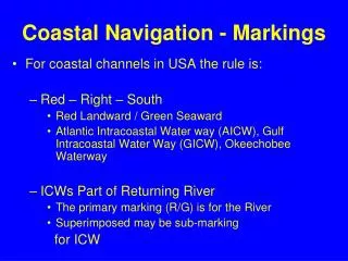
Notices to Mariners Chart 1 - Symbols and Abbreviations Catalogue of Nautical Charts and Related Publications Sailing Directions Current Atlas Canadian Aids to Navigation System Tide and Current Tables List of Lights, Buoys and Fog Signals Radio Aids to Marine Navigation Navigational Publications
Other Publications • International Regulations for the Prevention of Collisions at Sea (ColRegs) • Safe Boating Guide
Charts • a graphic representation of a maritime area and adjacent coastal regions.
Chart Information • Charts show • depths of water and heights of land, • natural features of the seabed, • details of the coastline, • navigational hazards, • locations of natural and man-made aids to navigation, • information on tides and currents, • local details of the Earth'smagnetic field, • man-made structures such as harbours and bridges
Chart Classification • Sailing Charts • Offshore passages • 1:600,000 • Very little detail • General Charts • Making landfalls • 1:150,000 to 1:600,000
Chart Classification • Coastal Charts • Inshore navigation • 1:50,000 to 1:150,000 • Harbour Charts • Navigating harbours and waterways • Larger than 1:50,000 • Large scale = lots of detail
Care of Charts • Use soft pencils only • Use white erasers only • Level, flat surface • Keep them updated • Keep them dry • Use below decks • Stow flat / folded
Reading Charts • Title Block • Chart Symbols and Abbreviations
Title Block • Region Identification • Main Title • Scale Identification • Projection Identification
Title Block • Depths Notes • Elevation Notes • Horizontal Datum • Source Classification • Symbol Reference Notes (Chart 1)
Title Block • Tides and Current Notes • Aids to Navigation Notes • Cautionary Notes • Conversion Table • Metres, Feet, Fathoms
Compass Rose • Variation • May be as many as four per chart • May vary • Use the closest one
Transferring Charts • Determine position • Determine range and bearing to object on both charts • Verify with latitude and longitude
Coordinates • Latitude (L) • Parallels run east and west • Denote location north or south of the Equator • Poles are 90º North and 90º South • Longitude (λ) • Meridians run north and south • Denote location east or west of Prime Meriden • Greenwich • Converge at poles
Graticule • This latitude/longitude "webbing" is known as the common graticule. • Location can be specified by both latitude and longitude.
Deception Pass L 48 24.4’N 122 40.2W
Degrees Minutes Seconds • 360 degrees in a circle • Symbol º • 60 minutes in a degree • Symbol ' • 60 seconds in a minute • Symbol "
Formats • Latitude – Longitude • DM Degree:Minute • L 49º 30.0’ N λ123º 30.0’W • DMS Degree:Minute:Second • L49 º 30’ 00”N λ123º 30’ 00”W • DD Decimal Degree • L49.5000ºN λ123.5000ºW • generally with 4 decimal numbers.
Chart Projections • Mercator • “Normal” projection for charts • Polyconic • May be used in the Great Lakes
The Ships Compass and North • Cardinal Points • North • East • South • West • North is usually at the top
North • True North • No variation or deviation • Magnetic North • Accounts for variation only • Compass North • Accounts for variation and deviation
Variation • Difference between true north and magnetic north • North pole and magnetic pole differ • Annual change • Found on compass rose • Varies globally
Compass Rose • 004 1/2°W 1985 (8' E) • 4.5º West variation in 1985 • 8’ annual change • Current variation 3ºW • 8 X 19/60 = 1.424º change • 4.5 – 1.5 = 3 • Subtract when annual change and variation directions differ • Add when same