Download

1 / 28
280 likes | 439 Views
YUKON Wildland Fire Preparedness Planning 2006-2008. August 04, 2008. Preparedness Planning CIFFC ‘Prep’ LEVELS. Agency Preparedness Planning Yukon ‘Prep’ LEVELS. Agency Preparedness Planning Yukon ‘Prep’ LEVELS. Agency Preparedness Planning Yukon ‘Prep’ LEVELS.

E N D
YUKON Wildland Fire Preparedness Planning2006-2008 August 04, 2008
Agency Preparedness Planning Yukon ‘Prep’ LEVELS
Agency Preparedness Planning Yukon ‘Prep’ LEVELS
Agency Preparedness Planning Yukon ‘Prep’ LEVELS
Agency Preparedness Planning Yukon ‘Prep’ LEVELS
Agency Preparedness Planning Yukon ‘Prep’ LEVELS
Temperature Wind Speed Relative Humidity 24 hour Rainfall Wind Speed Temperature Relative Humidity 24 hour Rainfall Temperature 24 hour Rainfall Weather Observations Duff Moisture Code (DMC) Drought Code (DC) Fine Fuel Moisture Code (FFMC) Fuel Moisture Codes Initial Spread Index (ISI) Build Up Index (BUI) Fire Behaviour Indicies FWI System Fire Weather Index (FWI)
Canadian Forest Fire Behaviour Prediction (FBP) System Elapsed time, point or line ignition FFMC, ISI, BUI, wind speed and direction Elevation, latitude/longitude, date FBP System fuel type Percent slope, upslope direction Type and duration of prediction Foliar Moisture Content Topography Fuels Weather INPUTS OUTPUTS Primary Outputs Secondary Outputs • Head, Flank and Back Fire Spread Distances • Flank and Back Fire Rates of Spread • Flank and Back Fire Intensities • Elliptical Fire Area and Perimeter • Rate of Perimeter Growth • Rate of Spread • Head Fire Intensity • Total Fuel Consumption • Crown Fraction Burned • Fire Type
Preparedness Guidelines Wildfire Ignition Probability Predictor (System) POI = Probability of Ignition
Response ALERTS • set for each zone daily. • determined through an average wx station value. • average wx station value determined from ~ 5 stations per zone.
35% days level 3to5 49% days level 3to5 2006 2007 65% days level 3to5 PREP Levels May 1st to July 15th Level 1 Level 2 Dawson Level 3 Level 4 Level 5 2008
71% days level 3to5 56% days level 3to5 2007 2006 64% days level 3to5 PREP Levels May 1st to July 15th Level 1 Level 2 Stewart Crossing Level 3 Level 4 Level 5 2008
74% days level 3to5 46% days level 3to5 Mayo 2006 2007 46% days level 3to5 PREP Levels May 1st to July 15th Level 1 Level 2 Level 3 Haines Junction Level 4 Level 5 2008
18% days level 3to5 30% days level 3to5 2007 2006 24% days level 3to5 PREP Levels May 1st to July 15th Level 1 Level 2 Whitehorse Level 3 Level 4 Level 5 2008
Carmacks Mayo PREP Overtime by ALERT 2006 to 2008 Dawson
Haines Junction Watson Lake PREP Overtime by ALERT 2006 to 2008 Whitehorse
Fire Growth Modeling MacLean Lake Road Fuel Treatment Effectiveness May 17, 1994 Ignition: 2:00 pm Warm and windy spring day.
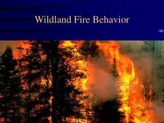
Fire Cause • Lightning Fires: • more remote • larger • lower priority Human-caused Fires: • near communities • or transportation corridors • highest priority