Download
1 / 17
170 likes | 178 Views
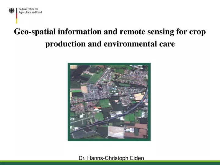
Geo-spatial information and remote sensing for crop production and environmental care. Dr. Hanns-Christoph Eiden. German Federal Office for Agriculture and Food. www.ble.de. 15/05/2013 Dr. Hanns-Christoph Eiden 1.

E N D
Geo-spatial information and remote sensing for crop production and environmental care Dr. Hanns-Christoph Eiden
German Federal Office for Agriculture and Food www.ble.de 15/05/2013 Dr. Hanns-Christoph Eiden 1
Introduction: Geo-information in Agriculture • Most of the agricultural activities are area related and have a spatial reference • Use of geo-information in the European agriculture is quite common • Requirement of R&D for a wider use of geospatial data still exists 15/05/2013 Dr. Hanns-Christoph Eiden 2
Content Construction and equipment Companies Farmers and Associations, Agricultural Industry International Organizations EU and National Authorities Fertilizer and Plant protection Industry Farmers & Associations Agricultural enterprises Provision of equipment, fertilizer and plant protection Products, seeds, irrigation systems Food production • CAP • INSPIRE • COPERNICUS • GEO-GLAM • Precision and Smart Farming • Subsidies • Environmental commitments Consumers Precision farming Trading Companies & Retailer Food Sec. & price stability Nature & Climate Protection CAP International Organizations Administration EU Nat. GOV. 15/05/2013 Dr. Hanns-Christoph Eiden 3
Precision Farming • Precise management of heterogeneous agricultural areas • Measurement and evaluation of intra-field variations of crop and soil parameter • Adjustment of agricultural measures according to the different needs of field sectors: precise inputs at the right time and place • Several benefits • Protection of environment based on precise targeting of agrochemicals • Improvement of efficiency of farming, increase of yield, saving of time, labor and costs 15/05/2013 Dr. Hanns-Christoph Eiden 4
Precision Farming • German studies: • Precision farming leads to significant saving of fertilizers and pesticides • Higher acceptance by farmers in eastern parts of Germany, probably due to bigger farming companies • Due to additional equipment costs precision farming is only feasible for farms with 300 -400 ha of acreage • For management of complex data and techniques training and competence of farmers is required • Further technical development: Smart Farming 15/05/2013 Dr. Hanns-Christoph Eiden 5
Control of the EU agricultural aid payments • Long history of using geo-information and remote sensing for the control of agricultural aid payments • Determination of area size (perimeter measurement) • GNSS devices (validated or certified accuracy ≤ 1.5 m) • Since 1993: remote sensing, i.e. 20 years of controls with remote sensing in Germany • satellite imagery (about 0.5 – 5 m resolution) • aerial imagery (about 0.2 m resolution) • Since 2005: mandatory introduction of GIS as managing tool for administration 15/05/2013 Dr. Hanns-Christoph Eiden 6
Control of the EU agricultural aid payments • Capabilities of remote sensing • Determination of size, land cover, location of areas and relevant changes • Advantagesof remote sensing: • quick • staff saving • cost-efficient • reliable and accurate • Limits of remote sensing: • weather • sun zenith angle • crown cover • undergrowth 15/05/2013 Dr. Hanns-Christoph Eiden 7
Control of the EU agricultural aid payments • Further needs - new requirements - new challenges • Greening • Cross Compliance • Agri-environment-climate measures 15/05/2013 Dr. Hanns-Christoph Eiden 8
INSPIRE • aimed at the establishment of an INfrastructure for SPatialInfoRmation in Europe • leads to interoperability of spatial data sets and services throughout the EU • supports the formulation and implementation of the EU environmental policy • data accessible in principle to any citizen • Directive 2007/2/EC (implemented by EU member states) • Implementing EU regulations 15/05/2013 Dr. Hanns-Christoph Eiden 9
INSPIRE • Examples for INSPIRE spatial data themes (34 themes in total) • Land cover • Land use • Habitats and biotopes • Species distribution • Step-by-step implementation is scheduled and will be completed in 2020 15/05/2013 Dr. Hanns-Christoph Eiden 10
INSPIRE INSPIRE Geo-Portal metadata discovery services view services download services transformation services Geo-Portals of the German Federal States German Geo-Portal GDI-DE Spatial data infrastructures of all European Member States 15/05/2013 Dr. Hanns-Christoph Eiden 11
Copernicus • aimed at the establishment of a European capacity for earth observation • supports the development of environmental policies • collection of data from multiple sources: • Earth observation satellites (5 specially developed Sentinel missions and about 30 contributing missions) • In situ sensors, e.g. ground stations • data accessible in principle to any citizen 15/05/2013 Dr. Hanns-Christoph Eiden 12
Copernicus • Monitoring services: • Land, climate change, weather, atmosphere, marine, emergency/security • Opportunity to develop value added services based on these so called “core services” • German projects DeCOVER, DeSECURE and DeMARINE concerning value added land, security and marine services. • Monitoring services: • Land, climate change, weather, atmosphere, marine, emergency/security • Opportunity to develop value added services based on these so called “core services” • German projects DeCOVER, DeSECURE and DeMARINE concerning value added land, security and marine services. 15/05/2013 Dr. Hanns-Christoph Eiden 13
GEO-GLAM • International initiative for global agricultural monitoring with Earth observation and GIS technologies, agricultural and meteorological expertise and information • Support of G 20’s Agricultural Market Information System (AMIS) • Objective: enhance international capacity to produce and disseminate relevant, accurate and timely forecast of agricultural production 15/05/2013 Dr. Hanns-Christoph Eiden 14
Conclusion • Eradication of malnutrition and starvation are huge challenges, food production has to be increased due to rapid growth of population • Sustainable agriculture such as precision farming is required to preserve the environment • Use of geo-information systems and Earth observation techniques help to • monitor real-time changes of agricultural production, • predict crop requirements, • estimate yield and support early-warning-systems for harvest losses • Great effort is undertaken within the EU and worldwide to enhance agricultural monitoring with Earth observation • Development of common international standards for data exchange is needed 15/05/2013 Dr. Hanns-Christoph Eiden 15
Geospatial information and remote sensing for crop production and environmental care Thank you for your attention! Dr. Hanns-Christoph Eiden