Download
1 / 17
170 likes | 305 Views
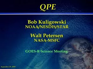
QPE Bob Kuligowski NOAA/NESDIS/STAR Walt Petersen NASA-MSFC. GOES-R Science Meeting. Outline. SCaMPR Overview (Bob) SCaMPR and Lightning: Previous Work (Bob) SCaMPR and Lightning: Ongoing and proposed Work (Walt) Questions / Discussion (all). SCaMPR Overview.

E N D
QPEBob KuligowskiNOAA/NESDIS/STARWalt PetersenNASA-MSFC GOES-R Science Meeting
Outline • SCaMPR Overview (Bob) • SCaMPR and Lightning: Previous Work (Bob) • SCaMPR and Lightning: Ongoing and proposed Work (Walt) • Questions / Discussion (all)
SCaMPR Overview • Self-Calibrating Multivariate Precipitation Retrieval • Calibrates IR predictors to MW rain rates • Updates calibration whenever new target data (MW rain rates) become available • Selects both best predictors and calibration coefficients; thus, predictors used can change in time or space • Flexible; can use any inputs or target data
SCaMPR Overview (cont.) • Two calibration steps: • Rain / no-rain discrimination using discriminant analysis • Rain rate using stepwise multiple linear regression • Classification scheme based on BTD’s (ABI only): • Type 1 (water cloud): T7.34<T11.2 and T8.5-T11.2<-0.3 • Type 2 (ice cloud): T7.34<T11.2 and T8.5-T11.2>-0.3 • Type 3 (cold-top convective cloud): T7.34>T11.2
START Predictors from ABI / GLM Aggregate to spatial resolution of target data Target rain rates Matched non-raining predictors and targets Match non-raining raining target pixels with corresponding predictors in space and time Assemble training data set Match raining target pixels with corresponding predictors in space and time Matched raining predictors and targets Calibrate rain detection algorithm using discriminant analysis Calibrate rain rate retrieval Create nonlinear transforms of predictor values Calibrate rain intensity algorithm using regression Subsequent ABI / GLM data Apply calibration coefficients to independent data Output END
SCaMPR and Lightning: Previous Work • Back in 2005, performed some experiments using National Lightning Detection Network (NLDN) data as predictors to SCaMPR • Basic predictor was number of lightning flashes in a GOES pixel in previous 15 min • Two uses of the predictor: • Classification: separate convective (lightning present) and stratiform (no lightning) calibrations • Lightning flash rate as a predictor for the convective class • Positive impact; hoping to incorporate into the real-time version of SCaMPR by year’s end
GLM Information Content for SCaMPR • Rain Presence • Rain Class/Type (C/S/Other) • Rain Rate (Gross PDF constraints) • IWP (not a requirement) Prediction_SEVIRI_000 Rain_type Determine pixel latitude band (1-4) Loop through pixels Yes Compute solar zenith angle [POSSOL] Determine pixel longitude band (1-4) Assign inputs SUB Initial Class=3 (cold-top convective) T7.34 < T11.2? No Adjust reflectances for solar zenith angle No Yes Determine rain class [Rain_type] T8.5 - T11.2<-0.3? Initial Class=2 (ice cloud) No Derive output from inputs and coefficients [gforecast] Yes Initial Class=1 (water cloud) SUB gforecast Combine pixel latitude and longitude bands with initial class to get final rain class Loop through predictors Construct predictor from input variables and coefficients Rain rate predictor? No No End Rain_type Yes Use to build rain / no rain discriminator Use to build rain rate Rain / no rain discriminator >= threshold? Rain rate=0 No Yes
GOES-R GLM QPE ALGORITHM: Conceptual……………. GLM, TBD DATA (Boldi, SCaMPR SCaMPR No Lightning Yes Lightning-Producing Entity/Weather Type Location, Cluster, Extent, Characteristics (Flash Rate [FR], D(FR)/Dt, location etc. Convective Fraction Growing Mature Decaying Stratiform Fraction Growing Mature Decaying Volume Rain CharacterIce Volume Rain CharacterIce SCaMPR Rain Type SCaMPR GForecast Petersen, 9/29/2008
Convective and Stratiform (C/S) Precipitation • Recognized in the precipitation community as a fundamental characteristic of convective system rainfall process since the 70’s-80s • Implemented in most state of the art ground-based radar estimation algorithms (historically problematic for satellite algorithms Vis/IR and MW alike (both fundamental to SCaMPR) • For satellite QPE- this application of lightning information is “low-hanging fruit”: Lightning occurs predominantly in precipitating convection and when lightning does occur, it identifies/pin points convective areas of precipitation. • When combined with other observations- can enhance the classic “presence or absence” problem and facilitate better C/S partitioning (e.g., Grecu and Anagnostou; convective/stratiform fractions and revised rain volume calculation). • Relative to applications in C/S partitioning we can ask (and suspect): • Fundamentally, between raining convective systems of similar area coverage does the presence/absence/amount of lightning identify a systematic difference (e.g., constraint) in system-wide C/S precipitation behavior?
Turn to TRMM and Testbeds: Feature C/S behavior as f(lightning)Establishing broad constraints in behavior PR LIS • For each TRMM Orbit and precipitation feature: • 2A25/2A12 Convective/Stratiform rain fractions (within 1Z99) • C/S partitioned Avg./Max rain rate, volume rate, IWP, LWP, Scattering Index • Lightning flash count • Evaluate over TN Valley (first) • C/S feature fractions as f(flash, no flash) • C/S feature area fain volume rates f(flash, no flash) • C/S Rain volume ratios f(flash, no flash) • Feature C/S Avg. rain rates f(flash, no flash) • C/S IWP/LWP f(flash, no flash)
7-Year TN Valley Feature Sample number and C/S Fraction With lightning present there is a clear increase in convective fraction regardless of feature area This is most pronounced for smallest features (PR/TMI partitioning artifact?) • 21,788 Total Features (20 dBZ / 250 K 85 GHz) • Feature area > 500 km2 • 82 % Had convection • 33 % Had lightning • All features (including area <500 km2 ) • 33% were “convective” (artifacts present) • Only 5% Had lightning
Average Feature Rain Rate (C/S) • Average convective RR ~ 10%-larger for features with lightning regardless of feature area. • No difference for stratiform. Asymptotic 2 mm/hr stratiform rain rate is similar to Adler and Negri (1988) value. Convective Stratiform
C/S Rain Volume Volume rain rate behavior (e.g., slope of line) different for convective feature areas with and without lightning About the same for stratiform Total Convective rain volume for features w/lightning is markedly larger regardless of area
Future/Ongoing Work Bias = -10% (-0.99 mm) Error = 12% TRMM Features/C-S/LIS N. Alabama Testbed • Process ASCII features and C/S file for the globe (almost done). Freely available to those who abhor…hate…HDF. • Extend TRMM features C/S study to global domain including African SEVIRI and other SCaMPR/GLM testbeds. • Add C/S partition/identifier to Boldi cell ID/tracking algorithm. • ISOLATE BEST SCaMPR APPLICATION • Calibrated/QC’d dual-pol rain map C/S partitioning with LMA for TN Valley (Proxy dataset?) • Relate statistics of C/S and flash behavior over lifecycles, compared to TRMM “snapshots”. • IWP retrieval validation (Not requirement, yet…….).