Download
1 / 43
440 likes | 589 Views
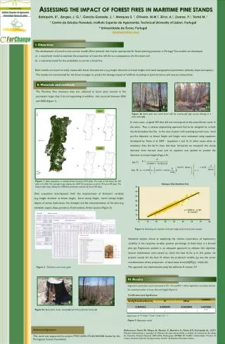
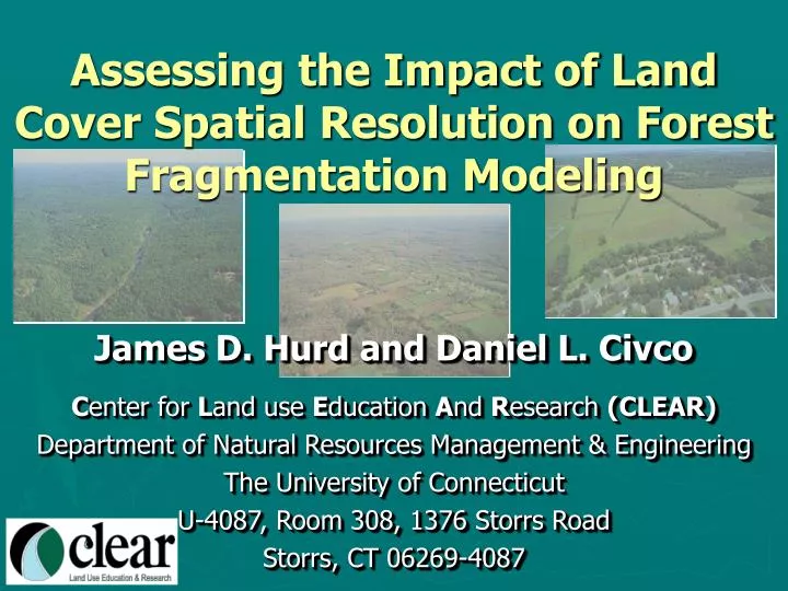
Assessing the Impact of Land Cover Spatial Resolution on Forest Fragmentation Modeling. James D. Hurd and Daniel L. Civco C enter for L and use E ducation A nd R esearch (CLEAR) Department of Natural Resources Management & Engineering The University of Connecticut

E N D
Assessing the Impact of Land Cover Spatial Resolution on Forest Fragmentation Modeling James D. Hurd and Daniel L. Civco Center for Land use Education And Research (CLEAR) Department of Natural Resources Management & Engineering The University of Connecticut U-4087, Room 308, 1376 Storrs Road Storrs, CT 06269-4087
Outline • The Forest Fragmentation Model • Application to land cover of different spatial resolutions • Concluding remarks
Forest Fragmentation Model Background Developed by Riitters et al. (2000) to assess global forest fragmentation from 1 km land cover data. Adapted for use on Landsat derived land cover information (30-meter spatial resolution). • Categorizes forest pixels into 6 types: • Core forest • Perforated forest • Edge forest • Transition forest • Patch forest • Undetermined forest
Forest Fragmentation Model How It Works Based on Image Convolution. Uses a roving analysis window of fixed size to determine vales of Pf (amount) and Pff (adjacency). 9x9 Analysis Window Forest Pixel Non-Forest Pixel
Forest Fragmentation Model 57 forest pixels Pf = = 0.70 81 total pixels How It Works 9x9 Analysis Window Forest Pixel Non-Forest Pixel Pf = proportion of forest pixels in analysis window.
Forest Fragmentation Model 57 forest pixels Pf = = 0.70 81 total pixels 86 pixel pairs, both forest Pff = = 0.72 119 pixel pairs, at least one forest How It Works 9x9 Analysis Window Forest Pixel 144 pixel pairs in a 9x9 window (72 vertical, 72 horizontal) Non-Forest Pixel Pff = how connected are those forest pixels.
Forest Fragmentation Model How It Works • Core forest, Pf = 1.0 • Perforated forest, Pf > 0.6 andPf – Pff > 0 • Edge forest, Pf > 0.6 and Pf – Pff < 0 • Transition forest, Pf < 0.6 and >0.4 • Patch forest, Pf < 0.4 • Undetermined forest, Pf > 0.6 • andPf = Pff (Riitters et al., 2000)
Forest Fragmentation Model Definitions • Core Forest - all surrounding grid cells are forest. • Perforated Forest - the interior edge of a forest tract such as would occur around a small clearing or house lot. • Edge Forest - the exterior edge of a forest tract such as would occur along a large agricultural field or urban area. • Transitional Forest - about half of the surrounding grid cells are forest. • Patch Forest - less than 40% of surrounding grid cells are forest.
Forest Fragmentation Model How It Works Pf = 0.70 Forest Pixel Non-Forest Pixel
Forest Fragmentation Model How It Works Pf - Pff = 0.70-0.72 = -0.02 Pf = 0.70 Forest Pixel Non-Forest Pixel EDGE FOREST
Forest Fragmentation Model Analysis Window Sizes Analysis windows of different sizes can be applied. 9x9 27x27 81x81 As analysis window size increases, the amount of core forest decreases. 27x27 analysis window 9x9 analysis window 81x81 analysis window
Forest Fragmentation Model Three Related Items to Consider 1. Spatial resolution of input land cover. 2. Width of desired edge (i.e. how far from a non-forested feature do you need to be before you are in core forest?). 3. What analysis window size will you use?
Core Forest to Non-forest n x n pixel analysis window, where n is odd minimum pixel distance = 1 + [(n – 1) / 2] Minimum distance = minimum pixel distance * pixel resolution A core forest pixel will be at least the minimum distance from a non-forest pixel (pixel center to pixel center).
Core Forest to Non-forest 5 pixels (150 m) No longer core forest (120 m) 9x9 analysis window = 1 + [(9 - 1) / 2] = 5 pixels For 30 m pixels = 5 x 30 = 150 m (pixel centers) (5 x 30) – 30 = 120m (pixel edges)
Forest Fragmentation Model Three Related Items to Consider 1. Spatial resolution of input land cover. 2. Width of desired edge (i.e. how far from a non-forested feature do you need to be before you are in core forest?). 3. What analysis window size will you use?
Application to Land Cover of Different Spatial Resolutions Using Analysis Windows of Same Pixel Dimensions
Land Cover 1 - meter 5 - meter 10 - meter 30 - meter Larger spatial resolution created by degrading the 1-meter spatial resolution land cover
Forest Fragmentation Result 5 x 5 Analysis Window 1 - meter 5 - meter 10 - meter 30 - meter
Forest Fragmentation Result 15 x 15 Analysis Window 1 - meter 5 - meter 10 - meter 30 - meter
Forest Fragmentation Result 27 x 27 Analysis Window 1 - meter 5 - meter 10 - meter 30 - meter
Forest Fragmentation Result 81 x 81 Analysis Window 1 - meter 5 - meter 10 - meter 30 - meter
Application to Land Cover of Different Spatial Resolutions Using Analysis Windows of Same Areal Extent
Land Cover 1 - meter 5 - meter 10 - meter 30 - meter Larger spatial resolution created by degrading the 1-meter spatial resolution land cover
Forest Fragmentation Result 1 - meter 5 - meter 10 - meter 30 - meter 271x271 55x55 27x27 9x9 Analysis Window Area = approx. 7.3 hectares
1 – meter, 271x271 5 – meter, 55x55 10 – meter, 27x27 30 – meter, 9x9
30 – meter Land Cover9x9 Analysis Window 9x9 Analysis Window Pf = 0.765 Pff = 0.744 Pf - Pff = 0.021 PERFORATED FOREST
10 – meter Land Cover27x27 Analysis Window 27x27 Analysis Window Pf = 0.844 Pff = 0.916 Pf - Pff = -0.072 EDGE FOREST
5 – meter Land Cover55x55 Analysis Window 55x55 Analysis Window Pf = 0.848 Pff = 0.966 Pf - Pff = -0.118 EDGE FOREST
1 – meter Land Cover271x271 Analysis Window 271x271 Analysis Window Pf = 0.847 Pff = 0.983 Pf - Pff = -0.136 EDGE FOREST
Edge/Perforated Definition • Core forest, Pf = 1.0 • Perforated forest, Pf > 0.6 andPf – Pff > 0 • Edge forest, Pf > 0.6 and Pf – Pff < 0 • Transition forest, Pf < 0.6 and >0.4 • Patch forest, Pf < 0.4 • Undetermined forest, Pf > 0.6 • andPf = Pff
Altering Definition of Edge/Perforated 9x9 Analysis Window applied to 30-meter spatial resolution land cover Land Cover 9x9 Analysis Window
Altering Definition of Edge/Perforated Results of Forest Frag. Model using a 27x27 Analysis Window on 10m Land Cover Riitters Original Definitions Perforated Pf – Pff > 0 Edge Pf – Pff < 0 Altered Definitions Perforated Pf – Pff > -0.05 Edge Pf – Pff < -0.05 Altered Definitions Perforated Pf – Pff > -0.1 Edge Pf – Pff < -0.1 MORE LIKE 30m 9x9 FF RESULTS NOT SO GOOD BETTER
Altering Definition of Edge/Perforated Results of Forest Frag. Model using a 55x55 Analysis Window on 5m Land Cover Riitters Original Definitions Perforated Pf – Pff > 0 Edge Pf – Pff < 0 Altered Definitions Perforated Pf – Pff > -0.05 Edge Pf – Pff < -0.05 Altered Definitions Perforated Pf – Pff > -0.11 Edge Pf – Pff < -0.11 MORE LIKE 30m 9x9 FF RESULTS NOT SO GOOD BETTER
Altering Definition of Edge/Perforated Results of Forest Frag. Model using a 271x271 Analysis Window on 1m Land Cover Riitters Original Definitions Perforated Pf – Pff > 0 Edge Pf – Pff < 0 Altered Definitions Perforated Pf – Pff > -0.1 Edge Pf – Pff < -0.1 Altered Definitions Perforated Pf – Pff > -0.15 Edge Pf – Pff < -0.15 MORE LIKE 30m 9x9 FF RESULTS NOT SO GOOD BETTER
5 – meter, Pf – Pff threshold = -0.11 1 – meter, Pf – Pff threshold = -0.16 10- meter 31x31 (Pf-Pff > OR < -0.1) 10 – meter, Pf – Pff threshold = -0.05 30- meter 9x9 (original definitions) 30 – meter, Pf – Pff threshold = 0.0
Class Edge Bias Curve Class Edge Bias = 0.0488 * ln(r) - 0.1601 where r = land cover spatial resolution
CLEAR Website clear.uconn.edu
CLEAR Website http://clear.uconn.edu/projects/landscape/forestfrag/ff_tool.htm
Concluding Remarks When applying Forest Fragmentation model, three items to consider: - land cover spatial resolution - desired width of edge/perforation - analysis window size The spatial resolution (and landscape pattern) of the land cover impacts the result of the model: - it may be desirable to alter the definition of edge and perforated. Ultimately the results are only an approximation, but: - provide a powerful visual impact - allow for the quantification of forest fragmentation.
Thank You Assessing the Impact of Land Cover Spatial Resolution on Forest Fragmentation Modeling james.hurd_jr@uconn.edu Center for Land use Education And Research (CLEAR) Department of Natural Resources Management & Engineering The University of Connecticut U-4087, Room 308, 1376 Storrs Road Storrs, CT 06269-4087