Download
1 / 8
80 likes | 157 Views
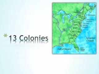
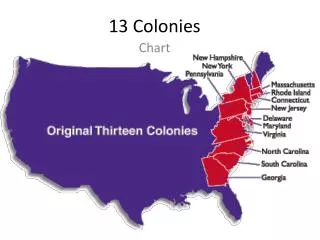
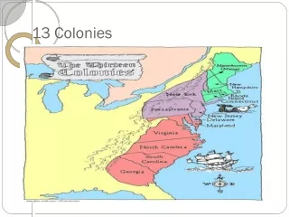
13 Colonies Mapping. Get out your ISN, colored pencils, scissors, and a glue stick and open to page 24 in your ISN. Add LABELS…. 13 Colonies NH - New Hampshire MA - Massachusetts RI - Rhode Island CT - Connecticut NY - New York PA - Pennsylvania NJ - New Jersey DE - Delaware

E N D
13 Colonies Mapping Get out your ISN, colored pencils, scissors, and a glue stick and open to page 24 in your ISN.
Add LABELS… 13 Colonies • NH - New Hampshire • MA - Massachusetts • RI - Rhode Island • CT - Connecticut • NY - New York • PA - Pennsylvania • NJ - New Jersey • DE - Delaware • MD - Maryland • VA - Virginia • NC - North Carolina • SC - South Carolina • GA - Georgia Other Territories • New France (N of Great Lakes) • Louisiana (W of Appalachian Mts) • New Spain (S of Georgia)
Add PHYSICAL FEATURES… • Label the Great Lakes: • Superior • Michigan • Huron • Erie • Ontario • Label the Appalachian Mountains • Label the Atlantic Ocean
Add COLOR… • Color Code the Three Regions of the 13 Colonies • New England Colonies • Middle Colonies • Southern Colonies
Add a KEY… • USE COLORED PENCILS: Using different colors, make a key for the map & color in the following regions based on that key New England Colonies Middle Colonies Southern Colonies