Download
1 / 20
200 likes | 348 Views
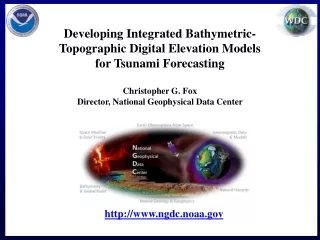
U.S. Department of Commerce National Oceanic & Atmospheric Administration National Geophysical Data Center (NGDC) Marine Geology and Geophysics Division & Collocated World Data Center for GMG. http://www.ngdc.noaa.gov/mgg/. International data exchange through the collocated World Data Center

E N D
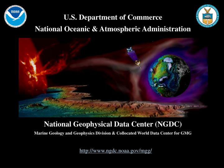
U.S. Department of CommerceNational Oceanic & Atmospheric AdministrationNational Geophysical Data Center (NGDC)Marine Geology and Geophysics Division & Collocated World Data Center for GMG http://www.ngdc.noaa.gov/mgg/
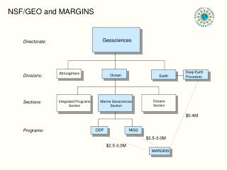
International data exchange through the collocatedWorld Data Center Geophysics & Marine Geology US National Long-term Archivefor marine geological & geophysical data NSF Division of Ocean Sciences Data & Sample Policyhttp://www.nsf.gov/pubs/2004/nsf04004/
NGDC provides scientific stewardship for data from the ocean floor and lakebeds Permanent Archive We’re in it for the Long Haul, Preserving data for your great-grandchildren Data Rescue & Digitizing Rescuing data from scientists’ desks and file cabinets. Data Access Making data freely and publicly available.
Permanent Archive We’re in it for the Long Haul, Preserving data for your great-grandchildren • 2.86 terabytes of sediment/rock data & images archived • Archived in software-independent form, to NARA standards using Open Archive Information System (OAIS) guidelines • Documentation in FGDC form, moving to ISO 19115 • Archive periodically migrated to new media • moving from LTO-3 to LTO-4 this summer
Data Rescue & Digitizing Rescuing data from scientists’ desks and file cabinets. NOAA’s Climate Database Modernization Program (CDMP) is a partnership with private industry to image and key paper & film records and make them available on the Web.
Data Access Making data freely and publicly available. • Geospatially-enabled relational databases • Web services (Feature & Map) & browse tools • ArcIMS viewers (in migration to ArcGIS Server) • Metadata access via Geospatial One-Stop/GCMD • Collaboration with MGDS/R2R/UNEP-GRID/SESAR • Links to Related Data (reciprocal links encouraged) • Working on near-line access to entire 190+ tb archive
Why add your data to the long-term archive? • NOAA/NGDC’s mandate includes a commitment to provide access to, and long-term archival for data pertaining to sea floor and lakebed samples. • NGDC data archives are maintained to NARA standards with offsite backups, storage on approved media, and periodic migration to new media and technologies. • Funded projects end, scientists retire, and institutional resources for maintaining scientific data and records can change – place a copy in the archive to ensure its continued accessibility to the scientific community We’re in it for the Long Haul, Preserving data for your great-grandchildren Carla Moore NOAA/National Geophysical Data Center E/GC3 325 Broadway Boulder, CO USA 80303-3328 Phone: 1+ 303 497 6339 Fax: 1+ 303 497 6513 Email: carla.j.moore@noaa.gov Web: http://www.ngdc.noaa.gov/mgg/
Index to Marine & Lacustrine Geological Samples May 2009 “State of the Database” http://www.ngdc.noaa.gov/mgg/curator/
Index to Marine & Lacustrine Geological Samples Database Ways to Access the Database • JSP Text Interface • Web Feature Service • Web Map Service • ArcIMS Web Interface(migrating to ArcGIS Server) The Database provides access to: Information about samples + related data and images available from NGDC, participating repositories, & other sources
Index to Marine & Lacustrine Geological Samples Database Web Access to the Database 12-month period May 2008-April 2009 ~ 937 requests/day (331,484 total) after robots removed ~ 246 megabytes/day downloaded 14,632 distinct hosts served over the year > 56,000 searches of the JSP interface > 8,870 accesses of the web services (WMS, WFS) > 2,100 accesses of the ArcIMS map
INSTITUTION #SAMPLES USGSWH 16,822* OSU 107 LaCore 1,220 USGSMP 451 SIO 392 URI 195 TOTAL 19,187 *complete sample replacement, 5,492 new INSTITUTION #SAMPLES ARF/FSU 2,627 BOSCORF 328 LDEO 7,089 OSU 63 SIO 355 WHOI 929 TOTAL 11,746 Index to Marine & Lacustrine Geological Samples Database Samples AddedOct 2007 – Apr 2009 Samples in ProcessingMay 2009 http://www.ngdc.noaa.gov/mgg/curator/updates.HTML
SESAR Widget(<iframe FRAMEBORDER="0" WIDTH="128" HEIGHT="256" id="test" SCROLLING="no" MARGINWIDTH="0" MARGINHEIGHT="0" SRC=“http://www.ngdc.noaa.gov/geosamples/igsnlookup.jsp?inst=ARFFSU"></iframe>) Index to Marine & Lacustrine Geological Samples Database Other Database Additions/Modifications • 34,137 Links to SESAR (all available IGSNs: ARF/FSU, DSDP/ODP, URI, WHOI, LDEO, SIO) • Access by IGSN added(showsample.jsp?igsn=xxx)
Index to Marine & Lacustrine Geological Samples Database Other Database Additions/Modifications • 26,281 Cruise/leg cross-correlationsMGDS/SIO Explorer Standard Ids were found for samples in the Index database and added as a new parameter. Existing cruise identifiers were kept in their original form. This is an ongoing effort for historic samples. Most new samples, at least from UNOLS ships are expected to use the more standard cruise/legs.
Index to Marine & Lacustrine Geological Samples Database Cruise/leg Options • Search by old cruise • Search by new cruise/leg • Search results display both for each sample selected
Index to Marine & Lacustrine Geological Samples Database New External Links using the New Cruise/Leg Ids
Index to Marine & Lacustrine Geological Samples Database Database Interface Additions • Single-Repository Search: • Shows only Samples, ships, cruises, devices from that Institution • OpenLayers lat/lon entry: • ETOPO1 or boundaries background • sample locations • variable grid • zoom and pan Alphabetical Cruise list
Index to Marine & Lacustrine Geological Samples Database New Collaboration: United Nations Environmental Programme UNEP GRID-Arendal ArcIMS/KMZ Inventories include/harvest/link to the Index http://maps.continentalshelf.org/
Index to Marine & Lacustrine Geological Samples Database NOAA CDMP Project L-19 Progress (2005 – 4/2009) • 8,937 core X-rays scanned • 9,060 pages of core logs, descriptions, & sampling logs key-entered • 23,462 pages of coring data sheets & cruise reports scanned • 25,540 sea floor photos scanned (slides, film, and prints) • 33,758 core photos (film & prints) Project L-19: Digitization of Marine & Lacustrine Records of Climate Change
Index to Marine & Lacustrine Geological Samples Database Requests to the Curators’ Consortium • Please check your contact information & send us corrections • Help keep the Index up to date, send data for new samples in your collection • Please help add standardized leg information for your older samples • Make use of the Index on your web sites via links and web services, we will be happy to assist you • Please take advantage of NOAA’s CDMP to scan/enter remaining materials related to your collections. There is room in the 2009 budget for additional digitization. 2009 may be the final year.