Download
1 / 62
620 likes | 743 Views
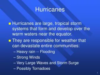
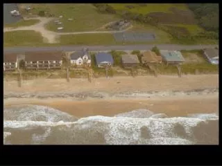
Topic 13 Hurricanes. GEOL 2503 Introduction to Oceanography. Garden City, South Carolina after Hurricane Hugo (1989). North coast of Puerto Rico after Hurricane Hugo (1989). US Hurricanes. Galveston 1900 deadliest 6000 dead

E N D
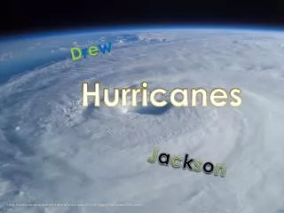
Topic 13Hurricanes GEOL 2503 Introduction to Oceanography
US Hurricanes • Galveston 1900 deadliest • 6000 dead • Strongest hurricanes-1935 Florida Keys-1969 Camille (Gulf coast, MS)
Years of maximum and minimum tropical storm, hurricane, and major hurricane activity in the Atlantic basin 1851-2006.
Years of maximum United States hurricane and major hurricane strikes 1851-2006
Hurricanes • Rotating air • Winds exceed 64 knots (74 mi/hr) • Rotate counter-clockwise in the Northern Hemisphere (clockwise in the Southern Hemisphere). • Visit the National Hurricane Center web page at http://www.nhc.noaa.gov/
What is a cyclone? • In meteorology, a cyclone refers to an area of closed, circular fluid motion rotating in the same direction as the Earth • Usually characterized by inward spiraling winds • Rotate counter clockwise in the Northern Hemisphere and clockwise in the Southern Hemisphere of the Earth.
Cyclones • Tropical cyclones—generated in the tropics • Extratropical cyclones—generated outside of the tropics
Hurricane Formation • Formed from thunderstorms • Ocean water itself must be warmer than 26.5 degrees Celsius (81°F) • Hurricanes weaken rapidly when they travel over land or colder ocean waters
Tropical cyclones • Tropical depression • Winds less than 38 mph • Tropical storm • Winds 39-73 mph • Hurricane • Winds 74 + mph
The warm water is one of the most important keys as it is water that powers the tropical cyclone. As water vapor rises, it cools. This cooling causes the water vapor to condense into a liquid we see as clouds. Condensation releases heat, which warms the atmosphere, making the air lighter still which then continues to rise into the atmosphere. As it does, more air moves in near the surface to take its place which is the strong wind we feel from these storms.
The main parts of a tropical cyclone are the rainbands, the eye, and the eyewall. Air spirals in toward the center in a counter-clockwise pattern in the northern hemisphere (clockwise in the southern hemisphere), and out the top in the opposite direction. In the very center of the storm, air sinks, forming an "eye" that is mostly cloud-free.
Hurricane Hurricane Typhoon Cyclone Cyclone Given that sea surface temperatures need to be at least 80°F (27°C) for tropical cyclones form, it is natural that they form near the equator. However, with only the rarest of occasions, these storms do not form within 5° latitude of the equator. This is due to the lack of sufficient Coriolis Force.
Classic “Cape Verde” hurricane track Progression of Tropical Systems
Tropical Disturbance • A discrete tropical weather system of apparently organized convection originating in the tropics or subtropics, maintaining its identity for 24 hours or more.
Tropical Depression • A tropical cyclone in which the maximum sustained wind speed is 33 kt (38 mph, 17 m/s). • Depressions have a closed circulation.
Tropical Storm • A tropical cyclone in which the maximum sustained surface wind speed ranges from 34 kt (39 mph,17.5 m/s) to 63 kt (73 mph, 32.5 m/s). • The convection in tropical storms is usually more concentrated near the center with outer rainfall organizing into distinct bands. • Tropical storms receive a name
Hurricanes • A tropical cyclone with winds equal to or exceeding 64 kt (74 mph, 33 m/s) • Hurricanes are further designated by categories on the Saffir-Simpson scale. • Hurricanes in categories 3, 4, 5 are known as Major Hurricanes or Intense Hurricanes. • Known as typhoons or cyclones in some ocean basins
Tracks of systems that became major hurricanes after forming in Tropical Atlantic or Caribbean Sea Active 24-Year Period 1955-1970, 1995-2002 Inactive 24-Year Period 1971-1994 27 Major Hurricanes 67 Major Hurricanes
Storm Surge • Local rise in sea level caused by storm processes • Wind • Waves • Low air pressure • Not “STORM TIDE”
High water level (+17 feet) Normal high tide here is 2 feet above sea level. The storm surge is an additional 15 feet. Giving a total water level of 17 feet.
Observed (high water level) - Predicted (tides) = Storm Surge high water level storm surge tide level Storm-surge levels along South Carolina coast (from FEMA).
What would the wind history be at cities A, B, and C as the hurricane makes landfall?
Floyd vs Andrew Andrew was much stronger, but Floyd was much larger Photo courtesy of the National Climate Data Center
Lake Pontchartrain New Orleans
Katrina pushed water into Lake Pontchartrain Water broke through flood walls into New Orleans
B(4) warm water vapor C(1) cool dry air A(2) eye of the hurricane D(3) spiral rain bands
GPS Dropsondes • Deployed from aircraft to measure temperature, humidity, pressure, and winds between flight level and the surface • As the sonde falls at 10 m/s (2000 ft/min) it is also pushed by the wind • The wind can be determined from the Doppler shifts of the GPS signals. • Readings are relayed to the airplane at half second intervals. • Vertical resolution for all measurements is 5 m
3 major hurricanes struck GA coast in the 1890’s