Download
1 / 23
230 likes | 366 Views
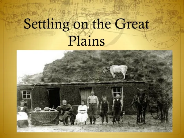
The Latitudinal Distribution of Putative Periglacial Sites on the Northern Martian Plains. Alex Barrett. Matt Balme, Manish Patel, Axel Hagermann. A Periglacial landscape. Common in cold climate environments on Earth.

E N D
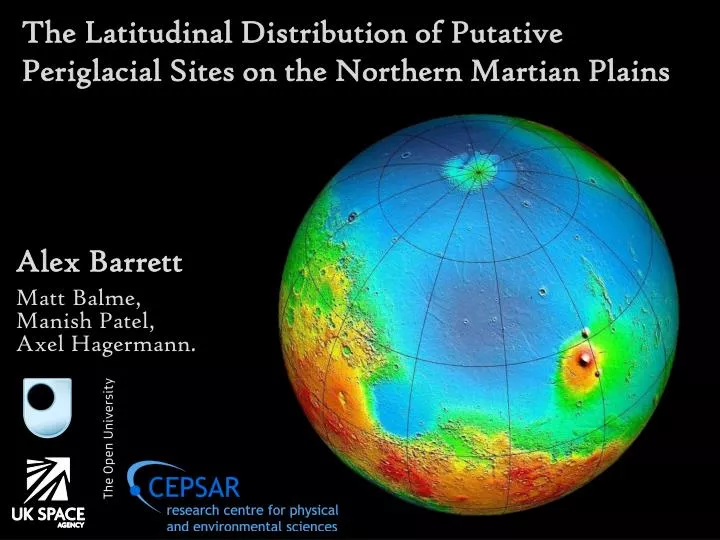
The Latitudinal Distribution of Putative Periglacial Sites on the Northern Martian Plains Alex Barrett Matt Balme, Manish Patel, Axel Hagermann.
A Periglacial landscape Common in cold climate environments on Earth. The seasonal freezing and thawing of the permafrost active layer creates a variety of distinctive landforms Periglacial landforms suggest the thawing of ground ice in geologically recent times. Frost Mounds Thermokarst Lakes Solifluction Lobes (figs: Geological Survey of Canada, US army corps of engineers Cold Regions Research and Engineering Laboratory) Alex Barrett 01-2013
Sorted forms Repeated freezing and thawing of the ground produces circles of clasts enclosing domains of finer material. Circles and Polygons Stripes Alex Barrett 01-2013 NERC ARSF aerial photograph, EUFAR.
Periglacial features on Mars? It has been proposed that periglacial features could be present at high latitudes on Mars. For example in Gallagher et al 2011 where clastic stripes and stone banked lobes were observed. Periglacial processes would have been possible in eras when the climate was warmer and wetter. Or in the present day if the presence of cryobrines allows freezing and thawing at ambient martian temperatures. Gallagher et al (2011). Sorted clastic stripes, lobes and associated gullies in high-latitude craters on Mars: Landforms indicative of very recent, polycyclic ground-ice thaw and liquid flows. Icarus. Alex Barrett 01-2013
Study Areas: A survey of the interiors of craters with HiRISE coverage is under way. 285 images across three study areas have so far been examined.
Study Areas: Acidalia Planitia: 0o-30o East by 30o-80o North. Utopia Planitia: 80-140o East by 30-70 o North. Arcadia Planitia: by 160-220o East 30-80o North. (ongoing)
HiRISE: High Resolution Imaging Science Experiment. 6 km wide, 10 or more km long, 25 cm / pixel 100 m Highest resolution images of Mars
Sorted Nets / Circles N 74.88 oN – 13.48 oE: Acidalia 100 m (figs: HiRISE Frame: ESP_015931_2550 NASA/JPL/University of Arizona)
Organisation in stone fields on Mars could be due to the same processes that form patterned ground on earth, albeit on a much larger scale.
Rubble Piles / Sorted Islands N 72.98 oN - 21.83 oE: Acidalia 100 m (figs: HiRISE Frame: PSP_007597_2530 NASA/JPL/University of Arizona)
Sorted Stripes N 73.039 oN – 21.75 oE: Acidalia 100 m (figs: HiRISE Frame: PSP_007597_2530 NASA/JPL/University of Arizona)
Possible Polygons N 67oN –132oE: Utopia 40 m (figs: HiRISE Frame: PSP_007738_2480, NASA/JPL/University of Arizona)
Lobate structures N 32.6 oN -7.4 oE: Acidalia 60 m (figs: HiRISE Frame: ESP_016828_2120 NASA/JPL/university of Arizona)
If lobate structures on crater walls formed through solifluction it would suggest the thawing of water in geologically recent times.
Lobate structures N 45oN -135oE: Utopia 50 m (figs: HiRISE Frame: ESP_016810_2260, NASA/JPL/university of Arizona)
Lobate structures N 67 oN - 120oE: Acidalia 70 m (figs: HiRISE Frame: ESP_016573_2475, NASA/JPL/university of Arizona)
Sorting and Lobes In Utopia Planitia possible areas of sorting can be found as far south as 40oN and as far north as 70oN. Most occur between 45-65oN. In Acidalia Planitia they occur at mid to high latitudes north of 40oN.Sorted nets are found more frequently than stripes and rubble piles. Lobes are found across a wide range of latitudes with no apparent pattern, although this may be due to the lack of sites with lobate features in general. Rubble Piles Polygons Stripes Lobes Alex Barrett 01-2013
Scalloped Depressions N 42oN –90oE: Utopia 100 m (figs: HiRISE Frame:PSP_002782_2230, NASA/JPL/university of Arizona)
Scalloped depressions are common in Utopia Planitia. They could form through melting or sublimation of ground ice.
Scalloped Depressions N 49.2 oN – 25.3 oE: Acidalia 200 m (figs: HiRISE Frame: PSP_002692_2295, NASA/JPL/university of Arizona)
Scallops and Gullies In Utopia scalloped depressions occur over a much wider range of latitudes than in Acidalia where they are confined to the area below 55oN. In Acidalia gullies and scalloped depressions occur over the same range of latitudes, 30-55oN, however in Utopia more gullies occur at lower latitudes, while scalloped depressions are not as common below 40oN. Preliminary results from Arcadia show scalloped depressions at high latitudes, low latitudes have yet to be surveyed. Gullies Scalloped Depressions Pitted Ground Alex Barrett 01-2013
Conclusions: Possible sorted polygons are found at mid to high latitudes in both Acidalia Planitia and Utopia Planitia. Different sorted forms do not appear to occur preferentially at different latitudes. Scalloped depressions are only found at low latitudes in Acidalia Planitia, but over a much wider range of latitudes in Utopia Planitia. Lobes are found in a few isolated locations across the study areas, but are not found frequently enough to infer any patterns from their distribution. Alex Barrett 01-2013
Conclusions: Mounds and hummocks are common across the areas surveyed, but are not especially indicative of a periglacial environment as they could have a wide range of formation mechanisms. These features are hard to identify with any degree of certainty. In the absence of ground truth it is impossible to be certain whether these features are the result of periglacial processes. A periglacial environment on the northern plains of Mars is possible, but uncertain. Putative periglacial landforms are present at lower latitudes than previously thought. Alex Barrett 01-2013