Download
1 / 31
320 likes | 491 Views
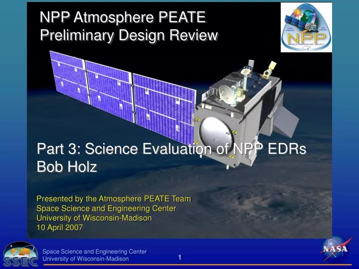
NPP Atmosphere PEATE Preliminary Design Review. Part 3: Science Evaluation of NPP EDRs Bob Holz. Presented by the Atmosphere PEATE Team Space Science and Engineering Center University of Wisconsin-Madison 10 April 2007. Science Evaluation of NPP EDRs. Goals and Requirements Evaluation Plan

E N D
NPP Atmosphere PEATEPreliminary Design Review Part 3: Science Evaluation of NPP EDRsBob Holz Presented by the Atmosphere PEATE TeamSpace Science and Engineering CenterUniversity of Wisconsin-Madison10 April 2007
Science Evaluation of NPP EDRs • Goals and Requirements • Evaluation Plan • Evaluation Demonstration • Summary
Evaluation • Primary purpose of the PEATE is for evaluation of official NGST global cloud products: • Suspended Matter • Cloud Cover/Layers • Cloud Effective Particle Size • Cloud Top Height • Cloud Top Pressure • Cloud Top Temperature • Cloud Base Height • Cloud Optical Thickness • Cloud Mask • Create global cloud products for evaluation • note that NGST algorithms have not yet processed global data • Choose a path for determining how reasonable the results are for each of the cloud parameters
Evaluation Goals • The PEATE will be designed to identify algorithm/instrument issues from the physical sensitivity differences between the evaluation and VIIRS products • The VIIRS science team will be enlisted to establish protocols so that cloud product inter-comparisons are performed similarly for all algorithms • The goal is to automate the product inter-comparison process • The evaluation results will be compiled for each VIIRS processing run using established protocols • Graphics (figures) and comparison statistics will be automatically generated for review allowing for instantaneous feedback on changes to the VIIRS algorithms • When new evaluation measurements/retrievals become available they can be easily integrated into the evaluation system • Well-documented evaluation protocols for each VIIRS product will be created
Evaluation Requirements To meet the goals of the Atmosphere PEATE the system will need to: • Have high quality evaluation measurements (ground, aircraft, and satellite) • Store the evaluation measurements • Produce evaluation products that can be compared directly to VIIRS • Collocate (in space and time) the evaluation products with VIIRS • Produce comparison results for the VIIRS science team • This includes: • Graphics • Collocated data products • Quantitative results
Evaluation: Satellite and Ground Measurements • Evaluate the effectiveness of proposed cloud algorithms and the resulting global cloud products generated from MODIS (proxy for VIIRS), AIRS (proxy for CrIS), Cloudsat, and CALIPSO • A subsequent test of algorithm robustness will be to apply the cloud algorithms to METOP data (AVHRR, HIRS, and IASI) for concurrent time period as A-Train data analyses • Build the capability to assess instrument issues, such as out-of-band response, channels that perform out of spec, detector striping, etc • When VIIRS is launched, it is unlikely that a space-based lidar/radar will be in operation and there will not be continuous coincident lidar/radar measurements with VIIRS • A combined satellite and ground measurement plan provides a comprehensive evaluation capability to assess the VIIRS products
Evaluation Measurement Plan • The NASA A-Train measurement platform using MODIS as a proxy for VIIRS will provide: • a platform to compare the VIIRS algorithms directly with MODIS, CALIPSO and CloudSat cloud retrievals (global) • a “baseline” for our global performance expectations for VIIRS • The assessment using ground measurements will provide well-calibrated point measurements that will be available at VIIRS launch • The combined ground/satellite evaluation using MODIS will provide a measure of how representative the ground evaluation will be in determining the global performance of the VIIRS retrievals at launch
Evaluation Measurements • Ground • ARM (Atmospheric Radiation Measurements) • NOAA SEARCH • Satellite • CALIPSO (Space Lidar) • CloudSat (Space Radar) • Aircraft • SHIS, CPL ….
Evaluation Ground Measurements • Lidar/Radar (Ramen, HSRL, MPL, MMCR) • Cloud geometric boundaries (ARSCL product) • Cloud optical depth and phase (Ramen/HSRL) until signal attenuation • Effective Radius (lidar/radar) • AERI • Up-looking high spectral resolution IR measurements • Vertical profiles of temperature and water vapor • IR Cloud Properties • IR effective radius • IR cloud optical depth • Radiosonde • Vertical profiles of atmospheric temperature and water vapor • Infrared Radiation Thermometer (IRT) • Surface skin temperature
Evaluation Satellite Measurements Lidar/Radar (CALIPSO/CloudSat) • Cloud mask (CALIPSO) • Aerosol/cloud discrimination (CALIPSO) • Aerosol layer height (CALIPSO) • Cloud layering (CALIPSO/CloudSat) • Cloud top height (CALIPSO/CloudSat) • Cloud base (CALIPSO/CloudSat) • Cloud thermodynamic phase (CALIPSO) • Cloud optical thickness (for < ~3 from CALIPSO; for higher from CloudSat) • Cloud particle radius (ongoing research: CALIPSO/CloudSat)
EDR Evaluation Demonstration • Goal: To demonstrate the workflow necessary to evaluate a VIIRS atmosphere EDR for climate product quality • Proxy Data: Aqua MODIS is the best available spectral simulation of VIIRS • Products to be Compared: • VIIRS OPS Cloud Mask (versions 1.3 and 1.4) • MODIS operational cloud mask (collection 5) • MODIS operation cloud top pressure (collection 5) • MODIS cloud phase (collection 5) • MODIS operational cloud mask with VIIRS bands only • Components of Demonstration • Obtain Products (from archive, or regenerate from RDR) • Run Quality Control process on each product • Intercompare products (internally) • Validate products (using external data)
EDR Evaluation Demonstration • The evaluation illuminated the components of the PEATE that will be necessary to evaluate the VIIRS/CrIS products • This has allowed for prototyping and testing of the evaluation measurements and evaluation products • The evaluation demonstration has two components: • Global evaluation using MODIS as a proxy for VIIRS compared to CALIPSO and CloudSat • 2. Ground evaluation using the AHSRL (lidar)
CALIPSO CALIPSO MODIS CALIPSO MODIS CALIPSO Evaluation: Satellite
Evaluation: One month (August 2006) Cloud Mask Evaluation Pre NPP Launch Processing Run MODISL1DB algorithms for geolocation and calibration Run DAAC operational algorithm for Level 1B destriping Run cloud mask algorithms Run collocation algorithm (CALIPSO/MODIS) Generate the evaluation products Generate collocated data files (1 per day) Generate figures and statistics
Evaluation: Satellite Collocation Algorithms Collocation • The comparison of CALIPSO and CloudSat with global MODIS cloud retrievals (as proxy for VIIRS) require an accurate collocation package • The collocation has been developed as part of the PEATE • For each MODIS granule, a collocation file is produced that contains the indices of the collocated measurements in the MODIS and CALIPSO/CloudSat granules
Evaluation: Satellite Collocation Algorithms CALIPSO MODIS FOV The collocation returns a hdf file with the MODIS and CALlPSO/CloudSat indices into the granule files
= Cloudy Shot = Clear Shot Evaluation: Cloud Mask Evaluation Product Development CALIPSO/MODIS products using the collocation MODIS Cloud Fraction determined by CALIPSO CF = 0 is clear CF >0.7 is cloudy Cloud Fraction (CF) CF = 0 CF = 0.5 CF = 1.0
CALIPSO Clear Cloudy Clear 0.83 0.09 MODIS Cloudy 0.17 0.91 Evaluation: Cloud Mask Results One month of global comparisons 1.498 x 10 7 collocated MODIS/CALIPSO FOV
CALIPSO MODIS Evaluation: Granule Investigation
Evaluation Demonstration: Ground Measurements AHSRL Run MODISL1DB algorithms for geolocation and calibration Run DAAC operational algorithm for Level 1B destriping Run Cloud Mask algorithms Extract satellite field of view over ground site Generate the evaluation products from ground measurements Generate figures and statistics
Evaluation: MODIS Cloud Mask and Height AHSRL evaluation products
Evaluation: MODIS Cloud Mask AHSRL OD for MODIS missed clouds (SSEC 2004)
Evaluation: MODIS Cloud Height HSRL (Geometric) - MODIS HSRL (Ext Weighted) - MODIS
Evaluation: Post NPP Launch Evaluation Flow Diagram Post NPP Launch
Atmosphere EDR Evaluation Summary At VIIRS launch, the Atmosphere PEATE EDR evaluation system will have the capability to: • Ingest and store global VIIRS RDRs, SDRs and atmosphere EDRs • Regenerate self-consistent SDR and EDR long-term datasets for evaluating climate quality of atmosphere EDRs • Ingest, process, and store the evaluation measurements (ground and satellite) • Collocate (space and time) the VIIRS SDRs and EDRs with the evaluation measurements (ground and satellite) • Produce quantitative comparisons between the VIIRS SDR/EDRs and the evaluation products (global, long-term) • Produce quick-look images of the VIIRS SDR/EDRs, evaluation, and collocated products • Distribute results to NPP Science Team