Download
1 / 19
200 likes | 387 Views
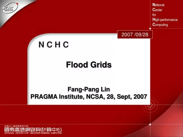
2007 /09/28. N C H C. Flood Grids. Fang-Pang Lin PRAGMA Institute, NCSA, 28, Sept, 2007. Typhoon and Flood invade Taiwan. NCHC Using Grid to Support Water Resource Agency for Flood Mitigation. Flood Mitigation Grid-Implementation. Water Resource Agency 4 years Project.

E N D
2007 /09/28 N C H C Flood Grids Fang-Pang Lin PRAGMA Institute, NCSA, 28, Sept, 2007
Typhoon and Flood invade Taiwan NCHC Using Grid to Support Water Resource Agency for Flood Mitigation
Flood Mitigation Grid-Implementation Water Resource Agency 4 years Project Weather Information Remote Sensing Satellite Reservoir Local Government Flood and Inundation Forecast Central Weather Bureau Radar Flood Warning & Mitigation Rain Gauge VR VR Sensor Network Software & Data Base Estuary Broadband TWAREN River Gauging Station Central Emergency Mitigation Center Data Storage Supercomputer Flood Control Gate River Bureau Access Grid Communication PumpingStation Ministry of Economics Water Resources Agency
Flood Mitigation Grid: Infrastructure Application WRA Applications: Flood Forecast, Warning, Response, Mitigation NTU Application Information Service: Web service III Grid Platform Interface Definition、Protocol、Flow Resource-oriented Real-time/Communication-oriented Computing Grid Data Grid Sensor network Access Grid Sharing Middleware Customization NCHC Instrument Resource Planning Sensor Video Audio Computer Storage Visualization Network
Water Resource Agency NCHC Water Resource Bureau Water Management Office (WMO) Redundant Networks
Front End Message Exchange Computational Grid
Flood Mitigation Grid: Video-CameraSensors for Flood Monitoring • Real-time Monitoring River and Reservoir Stage~110 cameras TWAREN • Remote Operation • Data Recording and Searching
Broadcasting System User User User User User User User User NCHC WRA Middleware Middleware TWAREN Source Source Source Source Source Source Source Source
CLEANER Poster Exhibition Frequent flooding in Keelung River across urban area of Taipei City; recorded by a Flood Monitoring System of the Hazard Mitigation Grid of NCHC. The system consists of more than 100 video cameras to monitor the major rivers and reservoirs of Taiwan. Overflow
Networks in Developing WMO 1 WMO 2 WMO 3
Taipei Taichung Tainan Hsinchu PRAGMA Toward Geo-Grid: Grid of Grids Typhoon Research COSMIC Grid Flood Mitigation Grid NSC CREON NSC GLEON Source Chi - Yu Chiu and Chin Lin NSF GENI/CLD GEO/GEON CLEANER CUAHSI NSF
4D Geo-based Multi-Scale and Multi-Physics Virtual Reality Large scale geometry handling and synthesis with numerical simulation results Walk through Navigation for better understanding of environment