Download
1 / 23
230 likes | 410 Views
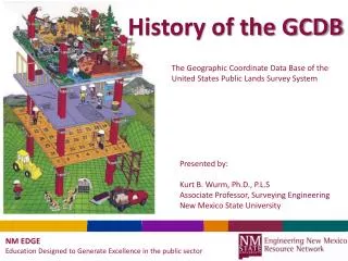
The Geographic Coordinate Data Base of the United States Public Lands Survey System. History of the GCDB. Presented by: Kurt B. Wurm, Ph.D., P.L.S Associate Professor, Surveying Engineering New Mexico State University. NM EDGE Education Designed to Generate Excellence in the public sector.

E N D
The Geographic Coordinate Data Base of the United States Public Lands Survey System History of the GCDB Presented by: Kurt B. Wurm, Ph.D., P.L.S Associate Professor, Surveying Engineering New Mexico State University NM EDGE Education Designed to Generate Excellence in the public sector
Associate Professor: New Mexico State University, ETSE, College of Engineering Classes include: GPS and Spatial Data, Plane Surveying, Construction Surveying, Least squares, Boundary Surveying, Satellite Geodesy Licensed Professional Surveyor: New Mexico, Montana Board of Directors: New Mexico Geographic Information Council, Inc. (NMGIC) About me Background: B.S. Surveying Engineering, Ferris State University, Big Rapids, MI MS – Spatial Information Science and Engineering, University of Maine Ph.D. – Spatial Information Science and Engineering, University of Maine. Former Cadastral Surveyor in the USDI – Bureau of Land Management; Professional Consultant
Upon completion of this class, the student shall gain an understanding of: • The need for the Geographic Coordinate Data Base (GCDB) • The scope of GCDB for federal land management • The methodology employed in the creation of GCDB • The variations in GCDB data nationwide • The accuracies that can be expected Course Objectives
GIS are systems designed to input, store, edit, retrieve, analyze and output geographic data and information. Geographic Information Systems Components: Hardware Software Clients Data Vendors Institutions
The National Research Council report, “Need for a multipurpose cadastre” 1980 Early studies • NRC – “Procedures and Standards for a multipurpose cadastre” 1983
People • Politics • Policy • Program The “P’s” Western Governors Association endorsement, “GCDB is the best hope of standardizing the PLSS in western states and its use is strongly endorsed by the WGA” Presentation at the ESRI Users Conference – 2003. Steve Hope – “PLSS as a Spatial Framework: History of the GCDB”
And integration with published coordinates. A weighted least squares approach Record Data as Measurements Presented by: Kurt B. Wurm, Ph.D., P.L.S Associate Professor, Surveying Engineering New Mexico State University NM EDGE Education Designed to Generate Excellence in the public sector
Upon completion of this class, the student shall gain an understanding of: • The appropriate interpretation of published data • The impact of updating positions • The hope of continued support for maintenance Course Objectives
Record data as measurements? • Use of Source Identifiers • GMM: an Operational Measurement- • Based Land Information System
Automatic Subdivision and parcel creation Presented by: Kurt B. Wurm, Ph.D., P.L.S Associate Professor, Surveying Engineering New Mexico State University NM EDGE Education Designed to Generate Excellence in the public sector
Upon completion of this class, the student shall gain an understanding of: • The concept of post-adjustment computations • The encoding of specialized section subdivision • Concepts for the use of derived information Course Objectives
Integration of updated Positions into GCDB Presented by: Kurt B. Wurm, Ph.D., P.L.S Associate Professor, Surveying Engineering New Mexico State University NM EDGE Education Designed to Generate Excellence in the public sector
Upon completion of this class, the student shall gain an understanding of: • How newly recovered positions can benefit the GCDB • How newly recovered positions can benefit YOU! Course Objectives
New Twist to Corner Recovery • An Assessment of the updatable spatial • Accuracies • GCDB Accuracy Enhancement • GIS issues with integration of Data Case Studies
Regional Analysis of Multiple Townships Presented by: Kurt B. Wurm, Ph.D., P.L.S Associate Professor, Surveying Engineering New Mexico State University NM EDGE Education Designed to Generate Excellence in the public sector
Upon completion of this class, the student shall gain an understanding of: • The importance of “edge-matching” • The concept of regional analysis • The impact of fixed and buffered boundaries • Post-regional updates Course Objectives
Use of Source • Regional Analysis • Post-regional updates